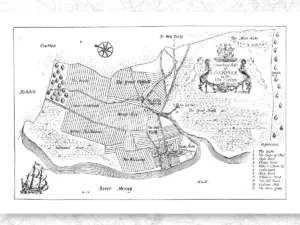
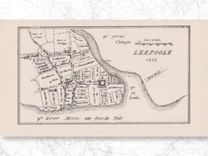
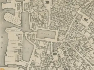
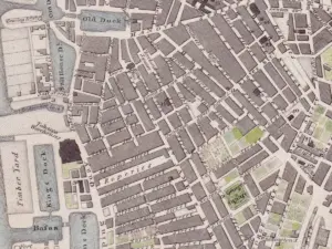
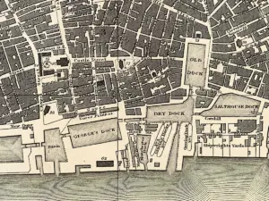
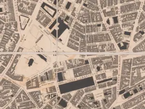
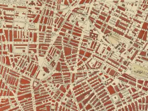
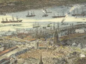
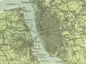
As a large city, Liverpool has seen a great many maps and plans made of it. Some of these maps show the wider area around the city. They may include areas as far afield as North Wales or Manchester, Lancaster or Chester.
Old maps are a great way to research the history of a place. They record changes in the landscape, like long-gone roads or new areas of houses for a growing population. Some show a familiar Liverpool, but look closer and you’ll see all kinds of details that you may have missed. I recommend looking at some places you know well, such as the parks and streets you knew as a child. See if you can spot your old haunts!
Don’t forget to check out the Interactive Maps page. It has modern maps with historic features laying out tthe things you can see in the landscape today. There’s also the History Map which shows the locations of many of the posts on this very site.
There are other maps dotted around the Internet, usually on national archives websites:
- A Plan of Liverpool, with the environs, Bibliothèque Nationale de France, accessed 16th October 2025.
- Map of Liverpool and its Environs (Southampton, 1874-1893), British History Online, accessed 16 October 2025. An excellent, very detailed map.
- ‘Sheet 106‘, in Map of Lancashire (Southampton, 1846-1873), British History Online, accessed October 16, 2025. Not as detailed as the above map, and not as nicely scanned, but still of interest.
- Lancashire Old Maps, Cartophilia, accessed 16th October 2025. A huge list of Lancashire maps, though some of the links are now broken since they went through a redesign a few years back.
You can buy many of these old maps of Liverpool as high quality prints from the Liverpool History Book and Map shop. At the shop you can also buy notebooks, postcards and canvas style prints of some of the old maps.
Paul O'Donnell
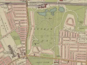
It is hard to believe that there is only 4 years between the top and bottom maps. It looks like several decades of development around Edge Hill. The whole shape of Sefton Park was undefined in 1895, but by 1898, the familiar kidney shape is there, and all the rows of housing are in place down Smithdown Road. Which is strange, as I know my road was not built until 1903, yet it appears to be on the 1898 map. I have a 1765 map, and one that appears to even older, as it has the Castle on it.
Martin Greaney
Hi Paul,
Thanks for your comments. Yes, the ingenuity, not to mention the work rate, of the Victorians never ceases to amaze me. I think the fact that Edge Hill is around a station just spurred them on even more at the height of the Industrial Revolution, when Liverpool wanted to be the transport hub of Britain.
As to the discrepancy between the date when your road was built, this could either be because my publication date is slightly out, or that the mapmaker knew what was being built in that area, and/or that the record for when your road was built counts the date at which all buildings were complete, increasing the chances that the mapmaker could see the new road plans several years before, perhaps when they’re being laid out.
I’ve seen some history books from the period which take great pleasure in detailing all the soon-to-be-built roads, and mapmakers were keen to be at the cutting edge, sometimes risking looking foolish if building projects didn’t come to fruition.
Hope you enjoy the site!
Regards,
Martin
jim
Hi Martin
I have been looking at your site and trying to find out when the street ( Reading St Liverpool 5 ) was first built we left there in the late 1950,s as the street was being demolished many friends and neighbours were moved out to kirkby skelmersdale speke and some stayed local i have saw maps of the area 1885 but would like to know when it was built it was infamous for some trouble makers and the police so it was said walked down the street in twos i am now in my late 60,s but to us growing up there it was the best around
regards
jim byrne
Martin Greaney
Hi Jim,
The map you have of 1885 is one of the first maps which shows the road in existence. On the OS map of 1882 the area is still fields (brick fields) but a couple of roads nearby have been built, south of Lambeth Road, so it’s easy to say that the area was being built up at that time. So Reading Street was built between 1882 and 1885.
Martin
joseph Farley
Jim do you remember the Simpson family who lived next to the post office in commercial road.
Paul and Annie Simpson where my grand ma and grandad.
Robert
My grandad and his family lived at and ran the reading pub (reading hotel I think it was called) as far as I know they were there for many years until it was demolished in the 70s. Unfortunately, I don’t have any photos of the place. I’ve been told they had a parrot at the bar that knew a few choice words and would shout “ma!” If anyone came in and there was nobody behind the bar. Just hoping it jogs someone’s memory. I’d love to see what it looked like.
Paul O'Donnell
My mistake, 14 years, but still, hard to imagine the engineering project to transform Edge Hill in that Time.
wilson
hi are you the brother of Christy o’donnell re: the feather’s
please contact 07407358633
this is along shot as I see the old place is gone
Kevin Davies
I have been looking for some old pictures of Heath street Liverpool 7/8, ran parallel to Bedford street south and across Myrtle street. My dads family lived in around the area pre post war Amy, Bill, les, Cath, Gladys. On the side side running up to Cypress street. Have Some old pictures of house steps but not of the whole street. My mum said only one side had houses on it. The other had the walls of the big gardens from the Georgian terrace on Bedford street south. Demolished to make way for that hideous Rathbone building .
Many thanks
Kevin.
Martin Greaney
Hi Kevin,
I haven’t seen any photos of the street itself, but there’s a great map that shows that your Mum was right in saying that one side of the north half had the walls of the Bedford Street South houses on it. If I come across any photos I’ll post them here.
The map: https://maps.nls.uk/geo/explore/side-by-side/#zoom=17.408816872525154&lat=53.40096&lon=-2.96541&layers=168&right=ESRIWorld
Regards,
Martin
Kevin Davies
Thank you for your reply Martin, the is bound to be a photograph of Heath street somewhere. Maybe in the University archive or the Chambers Hardman archive Rodney street, or it is starring us right in the face mislabeled. The is a view of Myrtle street from heath street, so why not Heath street as well.
It all just fascinates me over a span of ten/ fifteen years how Myrtle street could change from a thriving high street, to a scene of pure devastation.
I do understand about failed schemes but to abandon such an area of so many fine elegant Georgian terraces and you come to realise the are less than a quarter of what was still there in the early fifties is truly heartbreaking.
One of the worst examples of this is the vandalism shown to Bedford street south/north . The beautiful Georgian terrace chopped in half by that hideous Rathbone building.
How much we had and how much we lost!!!!!!!!!!!!!!!!!!
Tracy Reppion
Hi Martin, this site is fascinating! I’m currently researching my family tree and have received my dads birth certificate. He was born at 104 Rice Lane, liverpool. The address for his parents is 1 Tetlow Street, liverpool. My dad was adopted – he’s not the first adopted child I’ve seen born at 104 Rice Lane – was this an unmarried mothers home I wonder?
Thanks in advance for any information you can give me.
Tracy
Martin Greaney
Hi Tracy,
Looking up that address on the current Google map brings up the large junction with an Aldi, and looking up that site on the old maps shows the West Derby Union Workhouse. I don’t know if the addresses are the same, but considering your ancestor’s adoption then perhaps he was born to someone in the workhouse.
There’s loads of information online, one source of which is Historic England: https://historicengland.org.uk/images-books/photos/volume/BF102391
Make sure not to confuse this workhouse with the one which was once on the site of the Catholic Cathedral. 🙂
Regards,
Martin
David Hojman
Hi Martin,
Many thanks for that side-by-side map. As you say, it is really great. Incredibly helpful. Would you happen to know which of those houses which sadly disappeared (I do not know if a result of the blitz or the University planners) was number 74? That is, 74 Bedford Street. That is the address where, according to Wikipedia, the actress Mary Lawson and her husband were staying at the beginning of May 1941, when they were both killed in the bombing. I think it is very sad that there is not even a small sign or notice remembering her.
Many thanks
David
Lynn
Hi Kevin,
Just found out my nan and granddad , James and May Henry lived in number 23 Heath street, with my mum and her siblings, Bessie, James, Peggy, Gladys, and Agnes . I wonder if your mum remembers them. They later moved to 154 Chatham street so not to far.
Gaye Schultz
Hi Martin,
I am researching my family history. I was wondering if you may be able to help me. My Great Grandparents, Samuel and Mary Anne Dickinson, lived at 109 Medlock Street, Kirkdale. They lived there for a number of years before moving to Wallasey.
can you tell me anything about Medlock Street?
Any information that you may be able to provide will be greatly appreciated.
Kind Regards, Gaye
Martin Greaney
Hi Gaye,
Medlock Street is just a tiny stump of road now, leading north west from Westminster Road, but it once ran right through to Rumsey Street before the park was created.
There are two really good pictures looking down the road on the Kirkdale Online website. You can see in the second picture the curved building which still sits on the corner with Westminster Road. The Kirkdale Gaol was the biggest landmark in the area, sitting on land between Garnet Avenue and North Dingle.
The houses on Medlock were slightly bigger than many of the tiny terraces which characterised Kirkdale and Everton in the 19th and early 20th centuries, having bay windows for example. It’s quite a shame these were demolished, as they were not at all slum housing, but large areas were given over to the wrecking ball in this part of town without much selectivity on the part of the council.
Do you know what kind of jobs your great grandparents did? These houses were often inhabited by those who worked in city centre offices, or the docks, but were slightly higher than the bottom rung of casual labourers – such as clerks, messengers and the like.
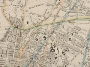
Here’s an old map of Kirkdale showing Medlock Street and the Gaol.
Gaye Schultz
Hi Martin, thank you for taking the time to reply 🙂 my great grandfather Samuel Dickinson was a ship’s steward, he was married to Mary Anne Bryant who would have been at home caring for their children. Thanks also for the link to Kirkdale Online and the Map, thankfully there are still a couple of photos remaining so that we can see what it once looked like. Strange that so many good homes were demolished, the house that my grandparents lived in, 40 Grosvenor Road, New Brighton, is still standing. My grandmother was Eveline Dickinson, from what I have been able to find out so far, she lived in Medlock Street during the 1901 Census, but has moved to New Brighton some time between 1901 and the next Census in 1911. She married my grandfather William Charles Hunt in 1919. He was also a ships steward and from what I can ascertain, he came from Liverpool. Interestingly, I remember my late mother telling me that my grandfather was a steward on the Lancastria when it was torpedoed off the coast of France… having difficulty confirming that though..
Great to hear from you, and I really appreciate the time that you have taken.
Kind regards, Gaye
Martin Greaney
No problem, glad I could help. It seems like a lot of families have a story passed down from previous generations. Sometimes they’re hard to verify, sometimes they turn out to be true. Good luck with your research.
Regards,
Martin
Jennifer
Hi Martin,
I am in the process of researching my family history and have discovered that my maternal great grandparents lived for several generations in Liverpool. Based on the 1881 and 1891 census they lived on Jackson Street and Vaughan Street. I can’t seem to find either on the maps. Can you point me in the right direction?
Many thanks!
Jennifer
Martin Greaney
Hi Jennifer,
I’ve not been able to find the exact place, but the censuses suggest that Vaughan Street is in south west Toxteth. I’ll have a look though my maps of the area, but even if I can’t find the street at least maybe you have a general idea of the place they were in!
I’ll post here if I find anything.
Regards,
Martin
Anthon A
Hi Jennifer, Vaughan Street was in Toxteth. It was next to Tamworth St which was off Park Street. Park Street runs down to the docks from Park Road. I now this because I discovered that my great grandparents lived in number 28 n the 1911 census. Good luck with your research.
David Lindley
There is (or was) a Jackson Street running between Mill Street and Hyslop Street (formerly Heath Street), pretty much exactly here: 53.390969, -2.973213 (use Googlemaps). I found it on the 1823 map in Liverpool Library. My Maylor relatives lived on the adjacent parallel Dover Street.
Dave Wood
Hi Jennifer,
Vaughan St was between Grafton St and Beaufort St and Jackson St was between Upper Warwick St and Upper Hill St. You can view both streets in these cropped images of a 1906 map and I’ve included the link to the full size map in the “Website” box. Great site Martin.
http://liverpoolpictorial.co.uk/jackson_street.gif
http://liverpoolpictorial.co.uk/jackson_street.gif
Dave Wood
Sorry. In my previous post, I posted Jackson St twice. The Vaughan St image is at http://liverpoolpictorial.co.uk/vaughan_street.gif
Martin
Thanks Dave, and thanks for adding those images!
Martin
Carol
Hi Martin
Do you know the name of the pub which used to be on the corner of Netherfield rd and Kirkdale road in the war times?This would solve a longstanding search for my uncle who`s asked everybody already.
Thanks
Carol.
Martin Greaney
Hi Carol,
I did a bit of research and replied to your previous comment here: http://historic-liverpool.co.uk/kirkdale/#comment-11917. Hope one of the two pubs I mentioned is the one you’re looking for, but if not it might start you in the right direction!
Martin
reginal pearson rostock
My father and his wife in the 1911 census had a (fish bar)in penton street .His father had lived in the sandhills hotel.I wonder if there are any pictures of either ,it would be great to see them.
Martin Greaney
There’s a picture of a Sandhills Hotel on the Liverpool Picturebook website’s North page. The photo’s from 1966 – is this the one you’re thinking of?
Martin
chris moore
Hi wondering if you can tell me anything about the houses in 5 Pleasant street liverpool I’ve traced my family tree back as far as 1860 and they lived in pleasant street up to at least 1891 I’ve also traced the family to 19 Cubbin Street in 1911 Liverpool do you know anything about this strret
Martin Greaney
Hi Chris,
Pleasant Street was very much exactly that on the first Ordnance Survey map (1850). Although there was a large timber yard at the western end (on the northern side) the rest of the street was residential. There were two chapels and a school, but the rest were houses with large gardens. The largest houses were actually on Clarence Street, with their side (and back garden) running along Pleasant Street. Some of the gardens are shown in great detail on the map, with paths and flower beds in dotted lines.
The houses that actually fronted onto Pleasant Street were smaller, with yards behind. Your own knowledge of your ancestors’ lives may shed more light on what the houses actually looked like.
Cubbin Street is no longer with us, but the name lives on in Cubbin Crescent, which sits on the same site in Kirkdale. The street wasn’t built by the time of the first few OS maps, and only appears in 1890. The houses on this street were small terraced houses, slightly smaller than those on Pleasant Street. There are some pictures of Cubbin Street rooms on Liverpool Pictorial. Those photos were taken in 1957, and show the rooms in a shocking state. However, a lot can change in 40 years, so I wouldn’t go assuming those are the conditions your ancestors lived in. However, you do get a very rough impression of the room size.
chris moore
H I Martin thanks for your help
mike woods
just seen your address 19 cubbin st dated at time of cencus in 1911,my ancsestors lived at 17 cubbin st at the time of that 1911 cencus,they were called the langgards
chris moore
Hi Mike
My dads family where called Moore lived in Cubbin Streeet there was a gang of them ha ha my dad was the youngest they must of known your ancestors ,as they liuved next door to each other .
Gloria woodman
Hi Martin
I’m researching my family who lived in the Toxteth area of Liverpool. I am told that my Mother and I lived in a pub called the Alhambra in that area during the war. The landlady, Bessie Hatfield, was my Aunt. I actually remember going to this pub in about 1946/47. Although I have been looking for it via the internet for several years I can now find no trace of it at all. Can you help please?
Many thanks.
Gloria
Martin Greaney
Hi Gloria,
I’ve found information about the Royal Alhambra pub on the corner of Esk Street and Derby Road, which is in Kirkdale rather than Toxteth (though similarly near the river). Unfortunately it’s no longer there, but was on the vacant plot here at the end of Esk Street. The old 1:2500 maps show it marked ‘PH’ (public house).
Regards,
Martin
cathy iles
Hi Gloria, I have also been trying to find details and photos of this pub and was lucky to receive a scanned copy of a photo taken in the 70’s. The building was no longer a pub but it gives a fair idea about the size of the building etc. would be happy to email you a copy.
Rob S.
Hi Cathy,
I saw your post. Would it be possible to send me via email the scan of the building that had been the Alhambra pub on Derby Road? I know a lady who lived there in the late 1930s and she would be thrilled to see it. Thanks
Kevin Davies
Thank you for your reply Martin, the is bound to be a photograph of Heath street somewhere. Maybe in the University archive or the Chambers Hardman archive Rodney street, or it is starring us right in the face mislabeled. The is a view of Myrtle street from heath street, so why not Heath street as well.
It all just fascinates me over a span of ten/ fifteen years how Myrtle street could change from a thriving high street, to a scene of pure devastation.
I do understand about failed schemes but to abandon such an area of so many fine elegant Georgian terraces and you come to realise the are less than a quarter of what was still there in the early fifties is truly heartbreaking.
One of the worst examples of this is the vandalism shown to Bedford street south/north . The beautiful Georgian terrace chopped in half by that hideous Rathbone building.
How much we had and how much we lost!!!!!!!!!!!!!!!!!!
Patricia Clerkin
I would like some guidance as the name of pub house on the corner of Compton Street Everton. My grandfather ran the pub we beieve in the late 1920s we have a picture of him outisde. the only thing that is written on the pub is Robinsons Liverpool Mild and Burton Bitter Ales (this brand I believe is now owned by Marstons) The pub I believe was demolished many years ago. Is there a register of pub landlords that I can browse for that time? Your help would be much appreciated. My Mother and her family came from Liverpool and I find it such a fascinating place, but shocked at the amount of deprivation my own Grandmothers family went throughat the beginning of the 1900’s.
Martin Greaney
Hi Patricia,
The 1891 Ordnance Survey map shows a Victoria Hotel at the top of Compton Road, at the junction with Whitefield Road. It could have changed names before the 1920s, especially if your grandfather took it over from someone else, but that’s the most certain evidence about the pub I can find. Hope this helps!
Ad you’re right – the amount of deprivation in this part of Liverpool was shocking. Some of the conditions right into the 1960s and beyond still surprise me. Makes me appreciative of how a lot of us live today!
Regards,
Martin
john
Hi my great grandad owned a timber yard on the dock road in the 50s and 60s called edwards can you please let me know if there any websites were i may find any pictures.
Please
Thank you
Martin Greaney
Hi John,
I’ve not been able to find any photos yet, but if you know any more details about where the timber yard was I might be able to have another search.
Martin
James
What was the name of your great Grandad?
Joseph Davison
Hi Martin, I was wondering if you could point me intend righ direction to discover more of my local area, Tuebrook/Clubmoor area. In particular the history of Lakhill Gardens? Any help would be greatly appreciated
Lindsay
Hi Martin,
I wonder if you could help-I’m trying to find old maps of the Halewood area.
Do you know where I could obtain a copy of Lancashire Sheet 114 1890-1 and also 1849 printing. They are on display at the Rangers Hut at Pickerings Pasture but a request for a copy fell on deaf ears!
I have some old tythe maps of the area but they are very poor-copied from worn out maps at Central Library.Do you know of any maps that might be better? I was told that one can go to the Lancashire Record Office but that you have to actually photograph them.
Any help would be appreciated!
Lindsay.
June 22, 2013
Lindsay.
Martin Greaney
Hi Lindsay,
A great source for old maps is (appropriately) Old-Maps.co.uk. You can search for Halewood on their home page, and it then gives a selection of old editions on the right. You can see a fair bit on the site, but to get big high quality copies it costs about £16. They have the 1849 edition at 1:10,560 and 1893 at 1:2500 (very high detail, but small areas covered per sheet).
When you ask whether I know of any maps which would be ‘better’ than the tithe maps, what is it you’d like to find out? Or are you just after some better copies of the same thing? Lancashire is probably the closest place, as the main other one will be the National Archives in London!
Hope this helps a bit, but do let me know more detail if you have some specific queries and I’ll see what I can do.
Regards,
Martin
Mike Keyton
Hi Martin,
I used to attend Liverpool City Institute of Further Education 1967. It may have been an annexe but the GCE courses were taught in a pale blue building on the corner of Duke St facing the Anglican Cathedral. This building has now been demolished along with the road and replaced by the Cathedral Gate development. Have you any maps that show the name of this now extinct road?
With no photos and no as yet found record of this building that literally changed my life, I feel a part of me has been amputated. I can feel the ghost limb twitching.
Cheers,
Mike.
HILDA BRESLIN
CAN ANYONE PLEASE HELP AS I AM LOOKING FOR THE BIRTHPLACE OF MY FATHER, IT IS 13 LEITH TERRACE KIRKDALE LIVERPOOL
Thomas shone
Hello hilda
I was born in 9 leith terrace in 1951 and lived there until the compulsory purchase slum clearance in I think 1969 when they were demolished. They were a row of Seven two up two down terraced houses which do not appear to show up on any early maps I have seen it was situated off forth st situated between Clyde st an Esk st. These last two streets named led on. to a main rd called Dearby rd which was the next main rd up from the Dock Road at Canada Dock
Hello Hilda
I was born in 1951 in Leith terrace and lived there until the compulsory purchase slum clearance in I think 1969 . It was a row of seven , -two up -two down terraced houses with a dead end.. It does not appear to show up on any early maps I have seen.It was off forth st and situated between Clyde st and Esk st both of the last named streets led onto a main rd called Dearby rd which was the next main rd up by about 200 yards parallel to the dock rd at Canada Dock.
hope this helps Tom
Niki Timpson
My Grandfather’s family, the Weston’s lived at 6 Leith Terrace.
My Great Grandad was John Weston, married to Elizabeth, and they had 7 children; 6 boys and 1 girl (Ethel)
Don’t suppose you remember them? Would have lived opposite you I think?
Niki
Margaret Cooper
Hi,
Can any one help please?
My Gt, Gt, Gt. Grandfather was Living in Gascoigne St (i3 onNorth map) in 1852 and was married from this street. He was married in “St Davids Church” . I have found Gascoigne St on this wonderful map but unable to find a St Davids church in the area! does any one know if their was a Church of that name in the area of Gascoigne St?
Margaret
Ann Khan
Hi Margaret
St David’s Church was at the bottom of Brownlow Hill (South Map). My Great Great grandparents were married there. It was known as the Welsh Church I believe. It is the last entry on this web page. http://www.lan-opc.org.uk/Liverpool/Liverpool-Central/home.html
Mike Keyton
Hi Martin,
I used to attend Liverpool City Institute of Further Education 1967. It may have been an annexe but the GCE courses were taught in a pale blue building on the corner of Duke St facing the Anglican Cathedral. This building has now been demolished along with the road and replaced by the Cathedral Gate development. Have you any maps that show the name of this now extinct road?
With no photos and no as yet found record of this building that literally changed my life, I feel a part of me has been amputated. I can feel the ghost limb twitching.
Cheers,
Mike.
July 31, 2013
Reply
Martin Greaney
Hi Mike,
Could you be thinking of Rathbone Street (and Back Rathbone Street)? They were on the site of the current Cathedral Gate, east of Great George Street. I’ve found a map of the area from the period you’re talking about, but can’t see the Institute on it. Perhaps you’ll be able to spot it! http://www.old-maps.co.uk/maptiles/m100955_335319_389554.png
Mike Keyton
Hi Martin,
And thank you. My building was on the corner of Upper Duke St. and St James street (which has now been built over by the cathedral gate development. I found the map really useful because now I have a street name with which to approach Liverpool library/archives – unless I can find something online.
Thanks again
Mike.
pauline
i am trying to find an old map of strawberryfields, little woolton. i want to find the layout of the house and grounds
Martin Greaney
Hi Pauline,
Here’s a map of the Strawberry Fields estate. It’s not a detailed look at the house, but hopefully it’s what you’re after.
Regards,
Martin
nancy smith
my great grandfather was a draper at 3 tillotson st, e. do you think that would have been a place of business and a residence together? his name was samuel carpel..that is the only address i can find for him.
thanks,
nancy
Martin Greaney
Hi Nancy,
While it’s certainly possible that a residence was in the same building as a small business like a drapers (just like today a grocer’s or newsagent’s might have a flat above or a house behind and above) by the look of the maps of the streets in the area the houses look like standard terraces. It might be that your ancestor worked at home, but there was likely not a shop at that address. If he was not the business owner, then perhaps his place of work address was not associated with his name.
Regards,
Martin
Paul Lynch
I have been looking for information or early photos of buildings my great grandfather lived and worked in. He was Peter Lynch the Licencee of ‘The Scotland’ public house in 1881 and the ‘Masons’ public house, 22 Richmond Row in 1887 and then a Provisions merchant in 2 Pownall square in 1911 but for many years in between as he is listed in early telephone books.
I have seen photos near these locations but never the actual buildings.
Regards
Paul
neil spruce
interested in history of old custom house in canning place. i know it was built around 1825 when the old dock was filled in and demolished after the war. i would like to know what occupied the site after it was demolished? was coronation gardens built on the site or was site levelled and landscaped?? would like to see any pics of the site prior and during demolition and any Liverpool A-Z street maps showing the site before and after demolition
Martin Greaney
Hi Neil,
The website Old-Maps.co.uk is your best bet for these maps. They have one from 1955 which marks the Customs House as ‘Ruin’. It also names the streets around that area, although they’re a little hard to see without buying the map. As far as I know, the landscaping of Chevasse Park, which was removed in the last few years to be replaced with Liverpool One, was that landscaping which was put down in place of the Customs House, though if anyone else knows better I’d be glad to hear from them! Coronation Park was further to the East, at the top of Lord Street.
Regards,
Martin
James Edwards
I am currently researching the architecture around Upper Parliament St, and the area surrounding the empty lot opposite the old site of the Racquet Club in particular. Do you know if the previous buildings on this site were also demolished as a result of the riots? Would you also happen to know the approximate dates the buildings around this area were first constructed?
Kind Regards
James
Jessica Nutt
I researching my family tree I am trying to locate Baptist Street, Islington, Liverpool. Can you help?
Thanks
Derek
Hello Jess
one of my ancestors was born in 5 Baptist street , and i am too desperate for information but cannot find it .
did you find anything at all .
Paddy Mahon
I lived at 2 Hawthorne Avenue Bootle at my grandmothers home in 1956 before migrating to Australia. It’s no longer listed as a Avenue only Hawthorne Road. Does anyone know if Hawthorne Avenue’s name has been changed or what has happened to it.
Thank you, Paddy Mahon Sydney Australia
Lynne Lay
I have looked in a book of street names of Bootle and Hawthorne Avenue is not listed , sorry. Are you a relative of Simon and Peter? They were important in political life of Bootle. I will ask on a Bootle forum to see if any one else knows.
Lynne Lay
Apparently the houses in Hawthorne Avenue were prefabs. They were built just after the was and demolished about 1970, so the avenue appears on very few maps. I will put a link to the site that found the map. Thank you Jan.
http://www.bootlehistory.co.uk/forum/viewtopic.php?f=3&t=30197&p=384634#p384634
It was off Balliol Road just by its junction with Breeze Hill just opposite where Balliol Secondary school used to be. Hope the link works and that you find this answer.
regards Lynne
Pat Collins
I have tried without success to find any information regarding father’s family. He was William George; had and older sister Lily (possible Lillian) and older brother Robert and two younger brothers George Davison and John Davison. The lived in Mann Street and my Nanna was Caherine nee Calderbank. My Father was born in May 1910. I particularlyld like to know about his Father who I believe was a seafarer called Lionel.
Paul Robinson
Great maps and website!
I am trying to find an image of Cadmus street, Everton. I have tried the Liverpool Records Office but without any success. Any thoughts/help would be most appreciated.
Martin Greaney
Hi Paul,
Glad you like the site! Have you got access to the original handwritten census return? I’ve found that when having trouble locating streets from census records the original is poorly written or transcribed, or the census writer misheard someone else naming the street. Try looking at this list of Liverpool streets beginning with C, and comparing it to what is written on the form, to see if the error is of this type.
Regards,
Martin
Paul Robinson
Martin,
Thank you for your speedy reply and helpful comments/suggestions.
I do not have access to the original census return but have seen the name Cadmus Street (adjacent to Dido Street) in an old (~1900) map of the area.
I looked at the Liverpool Streets site but without success.
Many thanks again and may the site go from strength to strength.
Paul
Lynne Lay
I am trying to find out when the housing in Gascoyne St Liverpool was demolished. My mother and grandmother were there on 1911 census and were moved to Rushmere Rd, but I do not know when. Any help or photos please.
Lynne Lay
Getting closer to when they were compulsorily purchased. My mum got married from there in 1935.
Kath O'Brien Briggs
I HAVE BEEN RESEARCHING MY MOTHER’S FAMILY (WILKINSON / FORSYTH WHO HAD SEVERAL PUBS AND A BREWERY IN THE VICINITY OF GREAT NEWTON STREET/DANSIE STREET AND EDGE HILL. I WOULD BE PLEASED IF ANY ONE HAS INFORMATION ABOUT THESE BUSINESSES. THE DATES WOULD BE UP TO APPROXIMATELY 1901 (THE SUN INN IN BIRKENHEAD)
Peter Murphy
Hi Martin
I’ve worked at Buckels garden centre in Fazakerley for 20 years it’s on the corner of Field lane and Copplehouse lane. We know it’s been there a while but we are curious what was there before it or when then Buckels family moved there. Its not owned by the Buckels family now so any information would be appreciated. My boss says they got land off the Molyneux family. Great website and maps by the way.
Martin Greaney
Hi Peter,
Glad you like the site! The site of the garden centre seems to have had nothing on it until a number of glasshouses were erected in about 1900, behind the house (belonging to the Buckles?) which stands on the corner of the two roads. So it looks like Buckles Nurseries has a long pedigree! It’s definitely possible that they bought land for the house off the Molyneux family, who were the major landowners in the Sefton area for a long time.
Here’s another map for you, showing the road junction in 1927, as well as the house and a couple of the glasshouses (with the cross-hatching):
paul simpson
Hi, for your information George Buckel is alive and well, and runs/ works at Tal Coed nurseries, in Glan Conwy, North Wales.
Love this site, it is addictive.
Thank you.
Matt
George is indeed alive and kicking, as are brothers Chris (used to run the garden centre) in Perth Australia, and Anthony (ran the growing end) in Auckland NZ.
I’m Chris’ son and came across this post and thought since it is a history site and all I’d just have a whinge that now that Buckels Nursery and Garden Centre has been replaced by housing it is a bit rude that the road running through it is Buckles Road, when the name is Buckels! I shall return one day to avenge this lol.
Kay2
Hi Martin,
I recently read your wonderful book about Liverpool’s landscape history. Absolutely fascinating!
Can you help me locate an old street? By the way, your links to old maps don’t appear to work – I’m getting the dreaded Error 404 messages. I’m looking for Bennett Street. In my Edwardian A-Z, it’s in the index but despite searching I can’t find it on the accompanying map.
Any ideas?
Karen in Ontario
Martin Greaney
Hi Karen,
Thanks so much! So glad you liked it. And thanks for pointing out the 404 error – should be fixed now! Teething problems from an exciting new angle for Historic Liverpool!
Bennett Street, if I’ve got the right one, is in Garston, just off St. Mary’s Road. You can see it on the 1907 map below, and it is still there, visible on Google Maps. Let me know if this is the right one, and if you can spot it in your Edwardian A-Z.
Phyl ( walton )
Can you help me I’m am looking for information on building that existed in Luton grove off walton road at present there stands a retirement home called walton manor, my parents live in the next street to this and work had been done to rebuild the supporting wall and when it was stripped back to to original wall the was lower ground window shown bricked up we are trying to find out was stood there before it was all filled in Any info? Thanks
Martin Greaney
Hi Phyl,
Looking at the old maps shows that there was a dairy yard in the area. I’ve put a map here so hopefully you can see whether this is the area where the lower window was. If it’s one of those windows which is half buried then that would match with an industrial use, where perhaps cellars were used (e.g. for keeping dairy products cool).
The map is from 1953, at 1:1250 scale.
Phil D
Martin,
Can you please tell me where i could get a copy of the 1953 map showing Kirkdale / Walton. Is it available from the Liverpool Central Library ?
Regards
Phil D
Martin Greaney
It’s definitely worth while getting in touch with the Central Library to see which maps they have, because they do have a lot. Another source is the National Archives, though of course they’re in London and so would cost money either to travel there or order copies to be sent to you. You can get a lot of maps online at http://old-maps.co.uk. It’s a tricky site to navigate sometimes, but a great resource, and makes it easy to view all old OS maps. You need to pay a subscription to zoom right in, but many are perfectly easy to read without zooming in much.
Martin
David Wardle
I am researching the family of my maternal grandmother (Duggan). They lived in the Everton/West Derby area throughout the 19th century – showing Compton Street in 1911. My great grandfather, John Duggan, was born in Liverpool in 1853 and died in Liverpool in 1913.One of his daughters, Catherine, married a French chef (Andre Dutertre) in Leeds, where my mother and I were born. If anyone has any information on the Duggan family I would be very grateful. I recall a family story about a Tommy Duggan who was a professional footballer. The only thing I can find on this is a brief Wikipedia entry which says that he was born in Liverpool in 1897 and emigrated to the USA where he played football. I am not sure whether her was part of the same family, but again, I would be very interested to learn of any information that anyone may have on this. Thank you…David
Jimdduggan@icloud.com
I am james Duggan of Minnesota. That is my Uncle Tom!!!!! I have photos of him and all the Duggan Bothers in New Jersey as well as Grandapa. E mail me at jimdduggan@icloud.com
Jo Jenkins
Hi Martin,
I wonder if you have any info on the origins of Shaw’s alley L1, my nan’s great grandfather was brought up there around 1900’s
Martin Greaney
Hi Jo,
Looking at the old maps of the time, Shaws Alley (then called Shaw Alley) looks mostly to be large buildings, probably warehouses. There are some smaller buildings at the town end of the street, so presumably that’s where your great grandfather was brought up. It may be that the name Shaw comes from Samuel Shaw, an industrial potter who had his works on the aptly name Shaw’s Brow, which is now William Brown Street (where the Museum and Library are). Shaw (whether Samuel or another Shaw) may have owned the land that the street was built on, or had his home, office or warehouse here.
Best wishes,
Martin
Jacqueline Lewis
Hi,
Can you tell me where exactly Atterbury Terrace was/ is off Grafton Street, Toxteth ? I try to visit where my ancestors lived but can’t find this one.
Kind regards.
Tony Heron
We lived in Tillotson Terrace which was one of 3 Terraces (courts) on Grafton Street near to the corner of Park St. Atterbury Terrace may have been one of these but I cant remember. There were also other courts along Grafton St. All have now long gone. I’ve never been able to find our old court on any maps, its possible they were never included on street maps because they were not “streets”.
Martin
Hi Tony,
Courts were usually included on maps, though their small size meant that many weren’t named except on the most detailed maps, and perhaps wouldn’t be included in indexes. The less detailed maps might not have had them on at all, or marked them in a way which is not recognisable as a court.
Martin
Tony Heron
I have found a map I have of old Liverpool and can confirm that Atterbury Terrace was next to Leighton Terrace which was next to where we lived in Tillotson Terrace. As I said it was in the area of the corner of Grafton Street and Park Street and would be on the right ad you look back towards Nothumberland Street.
Jane
Hi there
Has anyone got any information about the Graves family? We think they lived at 122 St. James Street just before the first world war. Any photos/maps of the area would be brilliant
Keith Bowen
An ancestor of mine was listed as being born in the 1870’s, at Stanley Bridge Liverpool, is or was there any such place, if so where might it have been? Thank you for any help on the matter.
Martin
Hi Keith,
I wonder whether this could be a bridge over the Stanley Dock branch of the Leeds Liverpool Canal? There would have been people living in that area at the time, so if there’s any evidence that your ancestor was born in north central Liverpool then that might be the case.
Martin
Caroline
Hi
Would you know where Oldham Court, Back Renshaw a Street was please? My great grandmother lived there when she was a child. Thank you.
Martin
Hi Caroline,
If you look at this map of Liverpool in 1898 you’ll see Oldham Street in the middle. The road which is un-named but goes across it is Back Renshaw Street. There are several courts in that arrangement of streets, and Oldham Court would have been one of them.
Martin
Caroline Fildes
Thank you very much Martin.
cstafford
Hello
As a total Novice could anybody point me in the right direction? I’m looking at my mother’s Irish ancestry and as par of this I’m trying to find her birthplace which was Paton Street Kirkdale. The 1901 A-Z does not list Paton Street…any help would be gratefully received Thank you
Martin
Hi,
I’ve not been able to find Paton Street. Could it be Parton Street? There’s one in Kensington, which isn’t really what I think of as Kirkdale, but the houses are the right age, and it might have fallen in the Kirkdale boundary at one point.
Martin
Pauline Evans
Paton street kirkdale Liverpool 20.It was off Brasenose road.It was demolished in approximately in 1969.Reason I know this is my husband lived there,he left in 1967 and Mum/Dad in law left due to the demolition in 1969.
Martin
Hi,
I’ve been sent some great aerial photos of Paton Street by Phil D. I’m including a couple here, while everything’s on a separate page at Paton Street, Kirkdale, in aerial photos and maps.
Best wishes,
Martin
sandra sugden
Hi Martin. My Grandmother who is long dead, used to live in Broom Street, off Denbigh Street, off Great Howard Street circa 1920 but I can,t find it on any map. Please help
Martin
Hi Sandra,
Broom Street was one of the tiny streets between Denbigh and Athol Street. You can see it on this map here: https://www.old-maps.co.uk/#/Map/333972/392366/13/100765 (zoom out to see the map). Hope this helps!
Also, Phil D has sent this map:
Best wishes,
Martin
Vivien Ferris
Hi Martin
My grandfather Walter James Lake is said to have been born in Liverpool between 1868-1872. Depends of which document you look at. He joined the Royal Warwickshire regiment in 1891 and listed his next of kin as his mother Mary Lake, living at 302 Everton Road, Liverpool.
Does/did 302 Everton Road exist. I had been told that the numbers did not go up that high.
Regards
Vivien Ferris
Martin
Hi Vivien,
You’re right, by the looks of things the numbers only go up to about 150 on Everton Road, before it becomes Heyworth Street. Could it be a mis-transcription of 32? Or something else like that?
Martin
cwj
Is the Plan of Liverpool – South Sheet (1890) available to buy anywhere – can’t see it in the shop or ebay listing.
Thanks.
Colin
Martin
Hi Colin,
The maps will be for sale very soon. I’m currently moving from my previous print supplier to a new one, so when that is completed in the next week or so they will be available on this site, and perhaps from eBay too.
Regards,
Martin
joseph Farley
Dos anyone remember or are related to the Farley family who lived in Denbigh Street and New Hedley Street Livepool, 2 brothers of the family Richard and Patrick Farley where killed in action in WW1.
Joe F
07798 715432
jack mcgee
hi can anyone help
i was born in63 cockerell street kirkdale 1946
is there ant way i can get photos or info please
i was broughht up by my gran alice ellis ended up in cottage homes fazakerley w
anyone have any info please
Martin
Hi Jack,
I’ve got a bit of info on this website about the Fazakerley Cottage Homes on the History of Fazakerley page. Hopefully you’ll find something interesting there.
Also, a regular correspondent Phil D has passed on a photo of 61-63 Cockerell Street, which I’ve pasted below.
Martin
Wayne
Hi,
I am trying to find William Terrace Ann Street in 1911, Could anyone offer any pointers.
Many Thanks
Martin
Hi Wayne,
The only Ann Street I can think of is St Anne’s Street, which is a major road north into Everton. William Terrace was probably a row of terraced houses on a longer street.
Martin
Edward Dawbarn
If your still interested it could be Lydia Ann Street which is by Duke St L1
Christine
Hello,
We are trying to find old maps of Harthill & Calderstones Park, preferably showing Harthill as being part of Calderstones Park.
Can you help.
Thank you
Martin
Hi Christine,
Old-Maps.co.uk is your best source for this. Go here and zoom out a couple of times: https://www.old-maps.co.uk/#/Map/340417/387707/10/101393
Martin
Mclake
Hi
In doing some family research for my husband’s family I have found that his great grandmother lived at 53 Denbigh street in bootle. When I went on Google maps it appears that there are no homes there. Are there any pictures around that might show what the houses looked like. It looks like a very short street. Was it at one time longer?
Martin
Hi,
This spot on the Old Maps website shows that there were once a lot of residences on that street, including court housing: https://www.old-maps.co.uk/#/Map/333975/392342/13/100871
Martin
David Owen
There is actually one (derelict) house still standing on Denbigh Street. Sitting next to the old church. If you use street view it give a clear picture of the type of property.
Juno
Wow these maps are great! Im trying to locate Swan Street, which used to be one of the courts off Falkner Street (according to the census description), probably next to/close to Corlett St, but it’s not listed on any of the maps I’ve found until now.. Does anyone know which one of the little streets/courts it was?
Martin
Hi,
Swan Street was in a position which is now opposite Crown Street Park. You can see a detailed map of the area here: https://www.old-maps.co.uk/#/Map/336567/389640/13/100871. The modern position is roughly here: https://www.google.co.uk/maps/@53.3994786,-2.9550315,18.21z?hl=en
Regards,
Martin
Bob Keen
hi Martin
I love the site – really fascinating. Thank you.
I have an ancestor, one Charles Fairclough who died in 1815. I have a newspaper clipping which states that his house in West Derby – Mill House – was up for sale with 10 acres of land. I can’t find any reference to it now, although there us a modern day Mill Lane, and it would have been no surprise to have had a mill or mills in the area. Do you have any record of the Mill House on a map from that time please?
As an Evertonian I have a mild apprehension that it could now be under the Bill Shankly recreation fields – any ideas?!
many thanks
Bob
Martin
Hi Bob,
I’m glad you like the site!
Yes, the Mill Lane in West Derby was once the site of a windmill somewhere around the junction with Queens Drive (I think on the opposite side of Mill Lane to the Jolly Miller, but I can’t be certain). The mill house would have been nearby, though again I can’t pinpoint it exactly. The other potential problem is that ‘West Derby’ can refer to a large area of Liverpool, with a lot of mills, so it could refer to another location altogether. Darn those generic placenames!
I think you can rest assured that it wasn’t on the Bill Shankly Playing Fields as it would have been at the top of the (slight) slope where the wind was stronger. 🙂
In all this I’d welcome any comments from people with more details.
Regards,
Martin
George
Could also be miĺl Lane off an field road near Lfc as this was part of West Derby at one time. George
Dave Heesom
Hi Martin,
Do you have any maps of the pre-fab estates at Gatacre from the 1950’s?
I wa born in Whinhurst Road in 1948. I have been trying to find the name of the school that I attended for just a short time before moving to Huyton.
The school was not far from where I lived if my memory is correct.
Martin
Hi Dave,
Could you point me to a specific road? There are good maps for the 1950s at https://www.old-maps.co.uk/#/Map/342500/387500/13/101329 (just click on the date in the left hand column). I can look for more specific info if you know the road.
Best wishes,
Martin
H.Potter
don’t know if you found anything about your query but I do know there is a Belle Vale prefab meeting at the Millennium Centre last thursday of the month in normal times (suspended at the moment due to covid restrictions). They have maps of the whole of the prefab estate with lots of photo’s. From my dealings with the Prefab Project the two most likely schools are Joseph Williams (catholic mainly) and Belle Vale CP.
Dave Headey
Whinhurst was a long road but Joseph Williams was quite near one end of it. Belle Vale CP (where my dad taught) was the other side of Childwall Valley Rd in a different estate.
samuel cottrell
sam cottrell
hi martin,did tariff st L5 have a small court or houses in it, my mam was born in that st.but i can’t find no record, can you help.
Martin
Hi Sam,
Tariff Street had some courts nearby, but the street itself looks like it was mostly industrial, with a few terraced houses nearby. Those houses, from the maps, look like they fronted onto other streets, only backing on to Tariff. Some of them might have used Tariff Street as the address anyway. Here are two maps, one from 1891 and one from the 1950s:
Jack Eaton
Excellent site. Interesting comments and your research admirable. I live on borders of north Wales near Vyrnwy nowadays. Until going to university, lived at family home in Circular Road east West Derby. My dad was born in Jasmine Street Everton. His family was rehoused at Liddell Road West Derby, possibly in early 1930s.
Anne
Hi Jack.By any id you know a neighbour called William Davies he 30 circular road east He died in 1989?
SueP
Hi Martin
I am trying to find any information about Malta Road, Bootle, where my father’s family lived. Can you help?
Thanks, Sue
Martin
Hi Sue,
What kind of information are you looking for? I’ve done a little research and found that the road once sat where North Park now is, directly opposite the entrance to Delaware Road. The houses on the road were terraced, and of a decent if modest size. The area was a victim of the Blitz, and a Welsh chapel and Malta Road were badly damaged.
Regards,
Martin
John Meaker
Hi Martin, my mother Jessie Hughes was born in 1909 in Nebo st Wavertree . Do you know of history of street at all? Regards John Meaker
James Kemp
Hello
I am researching a man who was born in March 1887 in Ballington Street which I believe was in the Toxteth Park area. I can’t see it on the index on your 1890 map. Can you identify where it was please
Jim K
Martin
Hi Jim,
I haven’t found a Ballington Street yet. There was a Burlington Street (G4 on the 1890 North Sheet), but that was just north of the city centre, in Kirkdale/Vauxhall, so it doesn’t fall into the Toxteth Park area as far as I can tell.
Martin
Kas
Hi, my family used to live in Ballington Street but all I know is it was Liverpool 8, which I understand is definitely Toxteth. Hope this helps!
Martin
Hi Jim,
It’s been a while since you asked, but (since someone else was recently on here and asked about Ballington Street) I’ve been able to locate the road you’re after. When looking at my map, Ballington Street is the middle of three unnamed roads north of Harlow Street, and south of Grain Street. Hope this helps you or someone else just visiting this site!
Martin
Jenny Flack
Hello
I have been researching my family history and found that my Great Grandfather Andrew Lewin was a Grocer in Kirkdale in 1886. He and his wife Mary Lewin (Rossiter) from Ireland lived at 7 Becket St Kirkdale and had 3 children Mary, Mabel and Andrew. I believe Mabel worked in the Grocer store when she was 11 years old. Does anyone have any info to share ?
Jenny
Stuart
Re: Margaret Burnett query about her fathers birthplace, I was born at 9 Village Grove in 1958, the houses were 2 up 2 down the front door opened straight into the living room, a door opposite the front door led to a tiny kitchen from which a staircase led to 2 bedrooms upstairs. From the kitchen a back door exited to a small white washed yard with an outside loo, a coal bunker, a steel dust bin that slotted into the wall which the bin men would carry down the back entries to the waiting bin lorry, and a tin bath which would be brought into the kitchen on a Friday night, filled with water heated on the stove (no hot running water in those days) and my brother and I would make third use of the bath after my Mum and Dad.
Martin
Hi Stuart,
That’s really great info about the place you lived and grew up in! So interesting, and I hope it helps other readers.
Best wishes,
Martin
Trish
Just reading the comments re Pluto Street. My mother was born at #21 ( 1916 ) and my great aunt lived at #34.( early 1916 onwards )
Bill Chandler
I used your maps to locate a street call ‘MARY ANN’. (located in the triangle between
Brownlow Hill, Mont Pleasant and Clarence). I am doing some research on a
watchmaker “J. Bramwell” (or could be Joseph Bramwell, 1826 to 1880).
I have a Pocket watch engraved with his name & City ‘J. Bramwell, Liverpool’.
Records located at the National Museum Liverpool http://www.liverpoolmuseums.org.uk
Shows a Joseph Bramwell, 16 years old, an Apprentice watchmaker on Mary Ann St.
(who he was an apprentice under, I do not know. The watch I have was made in 1879 (indicated by
the hall mark stamps in the case) 1 year before his death at 54.
A google map of modern Liverpool shows this street (Mary Ann) no longer exists.
If heard of a large and productive watchmaking community in Liverpool in the 1800’s.
are there any pictures or information on this? was there a specific ‘district’ or ‘area’
where the watchmakers took up business?
thank you
Bill (LPFC Fan, here in the States)
Martin
Hi Bill,
Great to hear from you. Sounds like you have an interesting ancestor to look into!
Liverpool did have a busy little watchmaking trade at one point, with a few workshops dotted around the town centre and just to the south (so your own apprentice is in the right place). It might be of interest to know that Prescot was actually a bit of a centre for horology. See this page for Watchmaking in Victorian Prescot: https://www.harrison-associates.co.uk/prescot/watchmaking.html.
Were the archives you’ve looked at on this page? http://www.liverpoolmuseums.org.uk/wml/collections/horology/results.aspx?&name=bramwell&startyear=1810&endyear=1900&town=liverpool&trade=&page=0 I see J Bramwell is in the census in Everton.
To answer your question, I don’t think there was a specific district for Liverpool watchmakers, except to say it was central.
There is an interesting article on the Liverpool Echo website, though it might be biased towards the high end of watches that are now deemed collectable: https://www.liverpoolecho.co.uk/news/liverpool-news/mike-litherland-looks-famous-liverpool-3404486
There’s also a refurbished former watchmakers on Seel Street, which again is central but not that close (by Victorian standards) to the other horologists: https://www.liverpoolexpress.co.uk/timely-completion-of-heritage-initiative/
Best of luck with your research, and come back here if you find out more.
Martin
Angela Eaton
Looking for any information on my family from Liverpool and North Wales (Eaton/Abbinnett – variations of spelling I.e. Abinet/Abinnett etc – and Davies). Eaton’s were dotted around Liverpool but my father was born in West Derby and Grandfather from Toxteth.
Grandfather, John (known as Jack) owned/managed a dairy in Liverpool but not known where exactly. His first wife was Mary Abinnet (who died relatively young) and then married an Elizabeth Brown who had two sons from a previous marriage. Believe a son was born to them both – Alex Eaton who eventually married and moved to Islington in London.
Dave Headey
My gt grandfather was a Hugh Davies who lived in Toxteth, came from Llanarmon-yn-Ial in Denbighshire. I think he had a brother who may have come to Lpool with in in the 1870s.
Richard Pearson
Hi, My mother lived in Ballington street in Toxteth. We used to go and visit my gran there in the mid sixties. I would love to see what is there now as I understand the houses have all gone.
Martin
Hi Richard,
You’re right, the houses have gone from that road, and the road itself too. There are a lot of new houses around there, and new street layouts. The site of Ballington Street now has industrial units, including a gym, on it. See it on Google Maps.
I also responded to another question on Ballington Street here: https://historic-liverpool.co.uk/old-maps-of-liverpool/#comment-207145
Best wishes,
Martin
David Wardle
Hi Martin
I’ve just discovered this wonderful site. My maternal grandmother cam from Liverpool, with ancestors from Ireland, Cumbria and Scotland. The main family I am researching is the Duggan family. I have a record of John Duggan living at 22 Compton Street, West Derby in 1911, and also his father (also John), who emigrated from Ireland. I wondered if you have any information on the Duggans and of Compton Street. My grandmother used to tell us stories, but she is long passed and I would like to rekindle those memories. I seem to recall that there was a family member who played for Liverpool (or possibly Everton), and also I recall something to do with either the Titanic or the Lusitania. Any information would be very gratefully received. Many thanks, David Wardle
Martin
Hi David,
I’m not a great source for family history, but maybe someone else on here can help with that. However, if you’re interested in seeing Compton Street around the turn of the century then it can be seen on the Plan of Liverpool (North Sheet) here: https://historic-liverpool.co.uk/old-maps-of-liverpool/plan-of-liverpool-north-sheet-1890/#5/46.529/12.041
Martin
Pauline Harrison
Can anyone help with finding Fedora or Fedora street. I am researching my great Grandfather Malachi Davis who was born in Ireland in 1858 but at some point moved to Liverpool and married Mary Davis nee Ennis.
I would be grateful for any help.
Josie smith
Hi martin been trying to find my husband grandfather we know he was born in Warrington 1897 .he ended up in Liverpool we know he worked as a Barman in the .boundr y public house in edge lane Liverpool but can not find him he died in 1939 some time after falling down the hatch into the cellar
Martin
Hi Josie,
I’m not much of a family historian, unfortunately, but I wondered whether you’d found his death certificate? That seems to be the best first move, and might help you find a way into Ancestry (or similar) records. FreeBMD might help: https://www.freebmd.org.uk/
Martin
Bill mccaldon
Hi Neil re the Old Customs House….this was the third customs house on this site the previous two destroyed by fire., the original dated back to the early 18th century. It was hit in the May 1941 blitz it was reduced almost to a shell, however the outer walls were structurally sound.It was massive, larger than the current St Georges Hall. It was in the shape of a letter H from above with two grand entrances via steps through pillars on top of which was a triangular pedant It was demolished commencing 1947 when Liverpool city planners (in their wisdom) decided it was too expensive to re build. The site remained derelict till the early 60s when Merseyside Police headquarters was built and the area to the side was later landscaped and named after George Chevasse the Army medic who received the Victoria Cross for Gallantry in World War 1. The Police headquarters were rebuilt and Chevasse Park was designated as part of the new Liverpool One retail and office development. The actual site now has the Hilton Hotel on it the only reference to the Historic building being the name..it is now Old Customs House Place a pedestrianised area immediately in front of the hotel.
Vivienne James
Hi Martin, I’m searching for my father’s parents they had a dairy in Walton in the early 1900s there surname was Raw my fathers name was Arthur Raw he was born in North Yorkshire 1911 but moved to Walton Liverpool when he was a boy still in school, I remember story’s of him delivering milk as a child with a horse and cart but cannot remember his father’s name would love to find out more of their dairy and life at that time in Liverpool, any information would be welcome many thanks Viv James.
Martin
Hi Vivienne,
Liverpool had a large number of suburban dairies in the early to mid 20th century. These were embedded in suburban streets which allowed milk to be delivered fresh to the nearby houses. The buildings were known affectionately as ‘cow houses’. Do you think your ancestors would have had one of these? There’s a couple of good pages here: https://asenseofplace.com/2014/05/12/the-cowhouses-of-liverpool/ and here: http://www.mrseelsgarden.org/cowkeeping-in-liverpool/
If you’re not sure this is the type of dairy, then do let me know (especially if you know anything specific about the location) and I can have another look around.
Martin
Greg Lynch
Thanks for the information. I’m looking for one map of Liverpool with street level detail for the period around 1850 to 1880-1890. I have a few other maps of Liverpool in sections for that time, but they are difficult to read, print is too small. Looking for a map that is large enough to read street names, with residences and church names etc. Would appreciate any recommendation you can send my way and thanks in advance.
Martin
Hi Greg,
The maps I have on here have a lot of church (and other public building) names printed on them. Some also have some individual buildings like pubs and large residences. This Plan of Liverpool North Sheet is centred on an area with many things labelled: https://historic-liverpool.co.uk/old-maps-of-liverpool/plan-of-liverpool-north-sheet-1890/#5/82.109/-111.489
Is that the kind of thing you’re after? There are more detailed maps on the old-maps.co.uk website if you’re looking for even more detail. Try the 1:500 city plans, though they have very limited coverage.
Martin
Vivienne James
Hi Martin thank you for your reply, I’ve since done more research and found my Grandfathers name it was Alfred Raw and Isabella Raw, I think they had a dairy at the end of Birchfield road, if you have any information or could suggest how I could find out more I would be very grateful thanks Vivienne.
Martin
Birchfield Road is quite well mapped, even at 1:500 scale in some years. If you go here on the Old-Maps.co.uk website then you can look through the different maps (click on them on the left). I can’t see anything that’s obviously a dairy or other business, but it might give you clues on where to go next.
https://www.old-maps.co.uk/#/Map/338152/390877/13/101329
Martin
Kenneth Berry
My wife’s family left Liverpool for New Zealand about 1852. Leaving from London. Their surname was Greer , had been Mac Gregor. Had to chang it or as the Broad Sword. not much option really. They had lived in Burlington Street, Tichfield Street and Arley Street. allthe men were Iron founders and worked in Arley Street. Are there any maps of the foundry in Arley Street or old photos you kno of. if so. I would love to buy copies. Hope to hear from you. Best Regards Ken Berry
Martin
Hi Kenneth,
You can see Arley Street on two of my maps (Plan of Liverpool – North Sheet and Weekly Dispatch Atlas) but they don’t mark the foundry on there. Was it on Arley Street itself? You might be better able to find it yourself if you explore those maps.
I’ve found a couple of pages with photos of Arley Street on (use your browser’s Find… tool to get to the specific photos):
http://www.scottiepress.org/projects/remember.htm
https://municipaldreams.wordpress.com/2013/10/08/liverpool-first-council-houses-in-europe/
Best wishes,
Martin
Alfie Mumford
My grand parents John & Anie Hickey lived in leyden st kirkdale
in the 1930’s i’m looking for a photo of the Houses & the Stables i have every where i would be grateful if you could help me, Alfie mumford
Martin
Hi Alfie,
I can’t find any photos of this area myself. I’m putting a map here in case anyone else might come across it and need to know where the street it. It was just north of Boundary Street, and looked like this in 1851:
Regards,
Martin
Jenny Flack
Hi Martin
I am searching for any information or photos regarding my Great Grandparents, Andrew and Mary Lewin who ran a Grocer Store on the Cnr of Easby Road & Tillard Street Kirkdale in 1886
Walt
Hi Martin and anyone else who might be looking at the maps on this fascinating and very useful blog,
I have recently bought an apartment in Merchants Court, Mystery Close, L15 0AB. I am very interesting in the background and history of the place. Looking at these maps I can see there was once a Wavertree Station at the end of the road. The apartment block and surrounding houses back onto the railway. Behind the car park for the apartments is a rather large archway, no longer used and fenced off that passes underneath the embankment. I am intrigued as the why the archway existed. There are older terraced houses on the north side of the railway that would have blocked any though traffic such as lorries that may have serviced any ‘Merchant’ activities. Therefore the previous use of the area remains a ‘Mystery’ to me.
In the map 1-1 million, Great Britain, 1933 I can see a large black square indicating there was once a large building on the area. A warehouse or factory perhaps? A merchant of some sort? Many thanks, Walt.
Martin
Hi Walt,
If you’re talking about the large arch that I think you are, this was built before the houses in that area, and the old maps show that it provided access between the land next to Bank House (a large house on Picton Road) and the land where your apartments are. The railway seems to cut this land in two, so perhaps whoever owned it demanded access as a condition of the railway coming through.
Best wishes,
Martin
Christine Harris
Hi, I had a friend who went to a special Resential school in 1970. She said she can’t find any information about the school.it was Called (OAKFIELD) a Victorian Large House In (Woolton )Or (Gateacre) Liverpool L25.The street ( (OAKFIELD AVENUE.).It was a Building from 1910 I think,Like Gothic.the old fire places,old staircase.The school for special needs 6 years to 18 or 19 years old.My friend left in 1979. It was demolished and knocked down by (The Liverpool Council.).and other people) Can you help please. (Might be in the Liverpool Echo) She also said that the school was on the Liverpool news in 1970s, but don’t know if it was the Echo,about a white Horse came to the school grounds. It also was by a school called Gateacre Compresensive school.so it could be in Gateacre Liverpool.Thank you from Christine.
Martin
Hi Christine,
There is an old map showing the old house Oakfield, which was possibly converted into the school: https://www.old-maps.co.uk/#/Map/342410/387929/12/101394. I’ve also spotted that the National Archives has some records on this school, which you’d need to get in touch with them to look at: http://discovery.nationalarchives.gov.uk/details/r/C3767672 I hope this is of some help.
Best wishes,
Martin
Les Rafferty
My 3 x great grandfather (Denis Rafferty) lived and died in 2 Court, Norfolk Street in Liverpool (Baltic Triangle) Does anybody know of any photographs of that area circa 1866?
S L Rice
Les, did you ever find a photo? I’m researching another family that was there (in 2 Court, 8 house) in 1880s.
Yvonne Mclarney
My parents are from Liverpool, but I don’t know much about them, my father was from Southend of Liverpool born in 1916 name Francis Joseph Mclarney, my mother from north end of Liverpool name Emily Austin born around 1926
I don’t know much about them really , except my mother’s nickname was dolly her mother was called Lillian maiden name Walsh she had brothers and sisters but don’t know any names
My father was youngest of family was called Joe throughout his life and joined Canadian army in ww2
Jane
Hi Yvonne
I haven’t been on the site for ages – but Martin can attest to my credentials that I have assisted with finding out information regarding family research.
Within minutes I have found Francis J. parents, where he was born etc.
If you would like me to assist you or if you already have all the information please accept my apologies for the intrusion.
Look forward to hearing from you
Kind regards Jane
Timothy Biddle
Hello my relatives lived in Carter Street in the 1860’s. Does anyone know how I may acquire a contemporary street map of that part of Toxteth
Thank you
Tim
Martin
Hi Tim,
Carter Street can be seen on this map: https://historic-liverpool.co.uk/old-maps-of-liverpool/weekly-dispatch-atlas-1860/#5/-65.884/-35.068, which can be bought in the shop here: https://historic-liverpool.co.uk/product/weekly-dispatch-atlas-1860-print-of-old-map-of-liverpool/
Best wishes,
Martin
Enid Briggs
Hello – thanks for this site and the wonderful maps.
Haddon Street? Family there in 1886.
Martin
Hi Enid,
Haddon Street was a very tiny street, so it’s not labelled on many maps. However, I’ve found that it was ajoining Carson Street near Roscommon Street in Everton. To find it on this 1890 map, look for Roscommon Street here: https://historic-liverpool.co.uk/old-maps-of-liverpool/plan-of-liverpool-north-sheet-1890/#5/45.460/-44.319. Carson Street is the one running south from the second ‘O’ in Roscommon, and I think Haddon Street is the one running east of that, north of the U-shaped buildings.
Best wishes,
Martin
Paul Evans
I have enjoyed looking at your site and reading some of the interesting posts. Trying hard to find something of the history of the Palatine pub on Dale Street as I’m told my grandfather was the licensee from about 1917 until his death in 1925. His widow went on to become licensee at the Chalk Farm Hotel on Rishton Street which was run by Bents. I was able to track down a couple of photos of Chalk Farm online but haven’t been able to find any pre-War images of the Palatine. I am assuming it was also a Bents Brewery pub but haven’t found anything other than a brief reference to an explosion in the 1970s which led to its demolition – I’ve no idea what was built on the site but am assuming the pub must have been near Rigbys or the Saddle although I am probably completely wrong.
Daniel Garner
Hi I’m after some information, regarding gascoyne street and eaton street, my family had a timber yard called garners in liverpool for ovef a 100 years…in gloucester place…lark lane…and finaly gascoyne street…is there any maps available showing garners on there? Or photos? Ive scoured the internet…and im trying to find when the business started…im sure it was by one of my forefathers called sam garner in the early 1900s….any information at all would be really appreciated…
Martin
Hi Daniel,
Do you know which years the timber yard would have been in each location? I’ve looked at a few old maps in Gloucester Street and Gascoyne Street over the course of the 20th century and can’t see it marked. It would just be labelled ‘Timber Yard’ or whatever trade they were working under. Try looking at old-maps.co.uk, which has some very detailed maps of those streets: https://www.old-maps.co.uk/#/Map/334224/391227/13/100871
Best wishes,
Martin
Daniel Garner
Hi….thanks for your reply, the timber yard…was on gascoyne street/eaton street from the early 70s to the late 80s….the building is still there now in that location….previous to that so the 60s was lark lane…..and gloucester place….thanks
David Garner
Hi,
I have been meaning to follow up our family history for a long time. My son Andy just picked up your question.
My father, born early 1900’s was Robert Garner, son of Robert Garner timber merchant. He told stories of delivering planks of wood on his bike as a lad. A family separation (x2) and 1930’s crash left my dad joining the army at the age of 18 and never seeing that side of the family again. I belive the business continued in the hands of cousins.
I do remember seeing a large sign painted on a wall somewhere central on my way home to Edge Hill in 1977.
I am ashamed I did not record it. Probably the result of excessive Guinness intake.
Would be interested to know if you think this is the same family.
Daniel Garner
Hi David, my father was a director of garners timber….i have a couple of photos of were the timber yards used to be….the timber yard was going for over a hundred years and was family run until it went bust 30 years ago…ive got quite a bit of info from my dad who is still alive…it sounds like the same family to me…i know the name of the company in the 30s was called s garner and sons….i think andy garner contacted me on twitter….if this sounds familiar you can email me for any info you may need
Pat
Hi there! My grandfather was Robert Garner who married my grandmother Nell (Ellen) in very early 1900’s – I have their wedding pictures. They had 4 children, Robert, Elsie(1924), Peter, and Arthur. He left my grandmother for an ongoing affair covering many years and were never divorced. My grandmother died 1975. I have my grandfathers death announcement. The Garner Lumber yard went to this family, not his legal heirs. My grandmother didn’t try to pursue this. Thus is history and family tree…
Pat
David!!!!! Cousin David – what a hoot – it’s got to be you asking that question and me seeing it!!! You were talking about Uncle Bob – small world! I’m trying to find more clues too other than what Nanny Garner gave me!!
David Garner
Hello Daniel,
I am delighted to hear from you.
I have little info on the family. Even trying Ancestry searches.
Would be delighted to fill the void in our history.
Regards
David
Pat (Mums family name Garner)
Hello David – seems we are related! My grandmother Nell/Ellen was married to Robert early 1900’s, and never divorced. Have 4 children, Robert very soon after, Peter, Arthur and Elsie, my Mum, born 1924. This Robert never went to war but did dally with the women a lot and had quite a few affairs and families!! Finally my grandmother kicked him out but wouldnt pursue divorce as both Catholic…..we do have their wedding pic and his death memorandum from the paper. My grandmother passed 1975 – interesting huh??!!
Pat - Elsie Garner my Mum
Hi Daniel – how are you related to the Robert Garner Lumber Company? My grandmother Nell was Robert’s wife…..
David Garner
Hello Pat
Only just picked up this message.
I seem to have problems spotting news from this site.
What a long time ago it was we meet.
Try emailing address below and we could catch up on a rather long gap in history!
Did you get a reply from Daniel?
Pat (Mother’s name Garner)
Hello there. I’m replying to this as my grandfather was Robert Garner who owned this lumber yard.
Marie Palmer
Hello and thank you for all your hard work here!
My great-grandparents lived at 10 St. Anne’s Terrace, St. Anne Street, Liverpool in 1915. This was the equivalent of 10 House 3 Court St. Anne Street. I found an image of a model of court housing at St. Anne’s street at the Museum of Liverpool (https://www.liverpoolmuseums.org.uk/mol/collections/social-history/item-267835.aspx) which says they were demolished after the 1907 Housing Act. I’m presuming they weren’t demolished right away and am wondering when exactly they were demolished and if my great-grandparents were living in the original court housing or the new tenements that were built there afterwards.
Thanks very much!
Marie
Martin
Hi Marie,
Yes, you’re right, they weren’t demolished straight away. I’ve looked at the old maps of the area and it looks like the courts on St Anne Street were gradually demolished from the 1920s onwards. There aren’t maps for many years between 1920 and 1950, but the 1951 map shows all the courts gone as far as I can see.
The 1908 map shows most of the courts still there, but there’s Victoria Square which looks like it could be a tenement, and that was in existence as far back as 1891. If you know where 3 Court was you could look it up on this website: https://www.old-maps.co.uk/#/Map/334907/391565/12/100674
Best wishes,
Martin
Marie Palmer
Thank you so much, Martin – I really appreciate your help. I can’t quite place the exact location of St. Anne’s court housing on that map, but will check the 1911 census to get some bearings on where exactly those courts were. I should then hopefully be able to place it on the map you recommended.
Again, many thanks – you are a wealth of information!
Marie
John Turner
Hello Martin,
I’m on the search for ‘Spring Place’. Said to be in the Islington area of Liverpool in about 1875. I’ve exhausted my resources and my eyes trying to find it on old maps, to no avail. Would you be able to help me find the Lat and Lon of Spring Place? It would really help in the my late Uncle’s family history.
Thank You
Martin
Hi John,
I did a bit of digging and found it here on the 1936 map: https://historic-liverpool.co.uk/old-maps-of-liverpool/1836-ma-gages-trigonometrical-plan-of-liverpool/#7/77.390/-85.397
The site looks like it’s probably now under the large junction of Hunter Street and New Islington: https://goo.gl/maps/hvaohniMp6TcJ1s97
Best wishes,
Martin
Sara Brown
I know this is a wierd question but would appreciate a reply or comment anyway
Some guy who has his own YT channel is making a claim that Bold St Liverpool has a reputation for a timeshifting. –
Some people are also claiming that when theyve walked down Bold St theyve witnessed a very quick timeshift -to the extent that theyre saying that theyre claiming theyve seen flickers of a scene from Bold St in the era 1800s & then a return to normal
Personally I dont believe in time travel/teleportation or anything that it impossible scientifically. & I saw a tv programme where a woman in a pub claimed that she looked outside the door of her pub & experienced it & some people who have walked down the street itself & claiming they also experienced it
Would you happen to know is there any truth in that -(that Bold St has a reputation for timeshifting)-
Can some one reply/make a comment so I can set the record straight-Is there any evidence
Martin
Hi Sara,
I can confirm that Bold Street does have a reputation for time shifts! And I say that independent of whether I believe it’s true or not. People claim to have found themselves in a Victorian version (and I think a 1950s version) while walking up there. If you google about it you get a lot of peoples’ opinions. I’ll see if I can find anything that talks about the myth and its history. Tom Slemen’s probably a name you’ll see coming up again and again. He loves stuff like that!
Gavin Cliffe
Hi,
Can anyone help me with a query about a location on Shaw Street, an area now dominated by Liverpool Hope University?
In 1945, I had a relative who appeared on a electoral register at 43 Shaw Street. Nothing unusual about that until I read the full entry and discovered he was one of 206 people registered under that one single address! I’d really like to know what institution/organisation/business was based there, especially something that warranted so many people.
Thanking you kindly in advance.
Gavin
Martin
Hi Gavin,
That’s an interesting one! I can’t find any information about what was there at the moment (I haven’t got access to recent enough directories) but I wonder whether it was an admin office either for a forerunner of the university or a boarding school (was the Collegiate ever a boarding school?). It might be worth contacting the offices there now to see if they have any knowledge of who used the buildings before them. They are Georgian houses so I don’t think 206 people would ever have lived at that address, though they could have been registered there for electoral purposes, like a modern halls of residence.
Best wishes,
Martin
Gavin Cliffe
Many thanks Martin for the useful tips of where to look next. Very much appreciated.
Cheers, Gavin
Rob Neilson
Hi Martin
My family research has identified a relative, Benjamin William Feltus,showing on the 1911 census as aged 59 and living at a Registered Lodging Hose, 66-70 Oxford Street East, Liverpool. I know the street , off Smithdown Lane still exists but cant find any information about what this place was. He is down as married but as there are 100 male lodgers registered there obviously is wife isn’t there.
Any information would be very useful
Thanks
Peter Clarke
Great Work on this site.
I was born in Cazneau St ( Denbigh Castle pub )
Which was the street of the old markets.
The pub became a solicitors but was actually knocked down recently to make way for the new Police Station.
My mums family were Melody’s but have been trying to find out when they arrived in England from Mayo. Ireland.
Great place to grow up just off the city centre with fabulous memories of the docks, the markets and Scotland Road.
Elissa Scotland
Hello Peter Clarke
Did your mum’s family, the Melodys, live on Cazneau street for a long time? My mum’s family also lived there, and I am trying to find out when they arrived from Ireland. Their name was Rourke/O’Rourke and they were in the 1861 Census.
Colin Morley
My ancestor lived on Copperas-hill c. 1816-1836 at various locations including Nos. 79, 90 and 121. Appreciate if you could pin-point where these might be in relation to the bridge over Lime Street station? Did the line originally pass underground from the the terminus and would not have affected Copperas-hill until the platforms were extended?
Martin Greaney
Hi Colin,
Looking at the 1950 map (I know it’s later but the numbers seem to remain consistent) 79 and 90 would have been right on top of where the extended platforms are, while 121 would have been way up the hill past Seymour Street. It was already gone by 1950, probably as a result of bombing.
Regards,
Martin
Catherine
Thank you for this. I also had an ancestor living and working from 121 copperas hill in the 1860s.
Colin Morley
Many thanks, most useful.
Rgds
Colin
Victoria
Hello, I am researching a clothing label from what I believe is the 1920s for a vintage fashion educational resource. The label reads “Dorothy Rimmer 108a Bold St. L’pool” I know that Bold St was the center of bespoke dressmaking in those days but can’t locate anything about her or her business. Do you happen to have any photos that show that address around that time? Or possibly maps that show the names of the business.
Thank you.
Victoria
Neil Jones
Trying to find where Willow Place was (1889) and also Willow Grove (1881)?
Any ideas?
Thanks,
Neil
Martin Greaney
Hi Neil,
There are three Willow Groves on an old map of mine: one off Christopher Street (https://historic-liverpool.co.uk/interactive-maps/old-streets-liverpool/#18/53.43538/-2.97180), one off York Street (https://historic-liverpool.co.uk/interactive-maps/old-streets-liverpool/#18/53.41768/-2.95165) and a third in Seaforth (not on my online maps).
Martin
John Pierce
Do you have any info on a Thomas Lorenzo, who was running a business as a diver, in Liverpool, in the 1920’s through to about 1939. We have a photo of him and his team. But more info is required.
Kattie M
Are there any photographs of the Exchange Hotel, my mother stayed there in 1925. Thankk you
Martin Greaney
Hi Kattie,
Would this be the hotel attached to Exchange Station? There’s a decent overall view here: http://www.disused-stations.org.uk/l/liverpool_exchange/ (search for ‘hotel’ on that page to go straight to it), and a close-up of the entrance on Flickr: https://www.flickr.com/photos/54996985@N00/5199619974/
Best wishes,
Martin
Lydia Thompson
Hi, I wonder if you or any of your readers could assist? I’m trying to find photos for my mum of where she used to live as a kid. She lived in Adlington Street, which I believe is still there but obviously now it will look nothing like it did when she was living there. She was born in 1948, so anything you could dig up or point me in the direction of for around that time would be fantastic. Like most people in those days they didn’t have much cash, and she has no childhood photos of any of the family and she was saying just the other day how much she’d love to see some pictures of the old place. Any suggestions? Thanks in advance to anyone who can help!!
Martin Greaney
Hi Lydia,
There are a few references to Adlington Street that I’ve found. It seems there was municipal housing on there, with a sketch here: https://municipaldreams.wordpress.com/2013/10/08/liverpool-first-council-houses-in-europe/, and some coverage of (sadly) bombing on this page, with a photo of what appears to be an interior of an Adlington Street house (search for ‘adlington’ with your browser on that page): http://liverpoolremembrance.weebly.com/adlingtonlace-st.html
Regards,
Martin
Conrad Stonier
Hi, I’ve recently acquired a photo of my grandmother age 12, on the back is her name and the address, 7 Leith terrace, off Forth street Liverpool 20, don’t know if my mother would have lived here but they were evacuated to Cheshire during the war.
Should have said date on the photo is 1913.
Would you know what area of Liverpool this is.
Martin Greaney
Hi Conrad,
This is Bootle, and you can see Leith Terrace marked on this map: https://historic-liverpool.co.uk/interactive-maps/old-streets-liverpool/#17/53.43778/-2.99426 The street is no longer there.
Regards,
Martin
Daniel Garner
Hi David, my father was a director of garners timber….i have a couple of photos of were the timber yards used to be….the timber yard was going for over a hundred years and was family run until it went bust 30 years ago…ive got quite a bit of info from my dad who is still alive…it sounds like the same family to me…i know the name of the company in the 30s was called s garner and sons….i think andy garner contacted me on twitter….if this sounds familiar you can email me for any info you may need
Neil
There was a Geoff Garner at the Liverpool Institute School for Boys. He hailed from Lark Lane!
Neil
Daniel Garner
That could well be my Dad…..who was Geoff Garner and went to Liverpool Institute for boys!!!
Brooke robinson
Hello, my nana was born is 1948 at 54 Melville place, she was put up for adoption so what I’m wondering is, is the house listed the house her biological mother lived or was it a house for women to give up their babies?
Brooke
Martin Greaney
Hi Brooke,
Melville Place is an interesting street. Most of the numbers on that street were terraced houses. I don’t know if No. 54 was one of these, but there’s a high chance it was, and if so then I’d say that it was a domestic address, and therefore possibly where her biological mother lived. However, there was an orphanage marked across the street from the houses on the 1914 map. It’s gone by the time of the 1951 map, but it could have been there in 1948, and raises the possibility that this is where your nana was brought to. See this map: https://maps.nls.uk/geo/explore/side-by-side/#zoom=18.24333333333333&lat=53.40194&lon=-2.96138&layers=168&right=ESRIWorld
Best wishes,
Martin
Paul Furlong
Good Evening,
Firstly I would like to compliment the site itself and all the people on here it’s such a great thing to see such a wide community getting together to establish family histories.
I would like to Request some help myself my grandfather Peter Furlong grew up on Hankin Street, Kirkdale. On the corner of Scotland/Stanley Road. Which has no significantly been cut In half And there are no no homes on it at all.
I was wondering if anybody could point me in the right direction to try and locate some old photographs of the street?
Thank you very much in advance.
Robert Shearman
Hello, my mum Doris was born in an old WW1 hut on Queens Drive? in 1927 then later moved to a house on Fairfield Ave till WW2 broke out then was moved to Llandudno, the family name was Gardner, does anybody know of these war huts or have any photos or remember the family Gardner?
Thanks
Robert
June Mnasser (nee Myers)
My fathers family lived in one of the large houses in netherfield road north starting from bottom of fairy street. Ihave managed to find one old pic but no more and would love to see if any more. Also do you know of the history of thrse houses as they are a bit like upstairs and downstairs type?
Simon Winter
Thanks for a really useful site!
I wonder if anyone can help me. My grandad was baptised at St John’s Priory in Liverpool, but I can’t find any info on Google. Does anyone know where it was situated? I assume that it was run by the Jesuits or a Catholic order like the Benedictines.
Any info would be greatly appreciated.
Chris Morley
If you get no results searching Google for ‘St John’s Priory, Liverpool’, neither will anyone else. This suggests it doesn’t exist, or you have some detail of its name wrong, or it is not in Liverpool itself.
Do you have his baptism certificate? What exactly does that tell you? Start from those facts.
If you know his grandad’s full name, and year of birth, use that to search for his birth certificate. Obtain a copy of that. This will give you useful details. Use these to help your search.
If you google St John’s Priory, most results are in fact Church of England, not Catholic.
St John’s church in Liverpool (Tuebrook) is also Anglican
https://en.wikipedia.org/wiki/Church_of_Saint_John_the_Baptist,_Liverpool
You could search the Catholic directory for Liverpool archdiocese
https://www.liverpoolcatholic.org.uk/directory
and use the Liverpool Church of England diocese website
https://www.liverpool.anglican.org/about-us/
Jon
Hello, and firstly, thank you for making these wonderful maps available.
Unfortunately I cannot find Procter Street, West Derby, from 1871, or Cross Street, Wavertree, from 1876. They are not in the North or South indexes. Also Green Lane, West Derby, from 1851.
Any help would be much appreciated.
Many thanks
Martin Greaney
Hi Jon,
Thanks, I’m glad you like them!
You can use my Old Streets of Liverpool map to search for these streets.
Proctor Street (with an ‘o’ before the last ‘r’) is here: https://historic-liverpool.co.uk/interactive-maps/old-streets-liverpool/#17/53.41743/-2.94927
Cross Street, Wavertree was here: https://historic-liverpool.co.uk/interactive-maps/old-streets-liverpool/#17/53.40132/-2.93796
Best wishes,
Martin
Carys Millican
I wonder if anyone has any information about the Hulmes who around about 1924-1925 lived on a farm in Gateacre behind Gorsey Cop. Thank you
pam
Hi i am looking for greenleaf street in liverpool 8 – any pictures around 1965
thanks
Pam
Jo
Hi there,
Anyone have photos of Dwerryhouse Street, Toxteth?
My Grandad, born in 1917, lived there as a child, and I have never seen a picture. It no longer exists!
Thanks,
Jo
Michael Keyton
Hi Martin, and a wonderful site. Have you any information on the builder W R Lamb who built the houses in Aintree, each street named after his initials and the names of rivers eg Wyresdale Road, Ribblesdale Avenue, Lunesdale Avenue, Allendale, Avenue etc etc.
And also, do you know when they were built? I’ve struck a dead end so far.
Best wishes,
Mike
Martin Greaney
Hi Michael,
I’m afraid I don’t know much about that builder, but I’m very interested if anyone can shed some light on them. I’m especially interested in the fact that they built roads with intials from their name, as I know that’s happened elsewhere in Liverpool.
The age of the houses is close to the turn of the 20th century, as the 25″ OS map from 1888-1913 shows the streets having been laid out, but not all the houses built yet: https://maps.nls.uk/geo/explore/side-by-side/#zoom=17.105&lat=53.47009&lon=-2.95334&layers=168&right=osm
Best wishes,
Martin
Michael Keyton
Thank you very much, Martin. I’ll be sure to give you a mention when the book is eventually written.
Best wishes,
Mike
Martin Greaney
Brilliant! Good luck, and do let us know when it is!
Martin
Jo
Hello again,
It seems that nobody has any photos of Dwerryhouse Street, as per my previous enquiry, but does anybody have any memories of the area?
I would really appreciate any info.
Thanks,
Jo
Phil D
Hello Jo
Have tried to add some photos but i can’t
seem to attach photos on this site.
Jo
Hi Phil, thanks for trying!
Sorry for delayed response – not been on here for some time! Is there any other way I can access them?
Regards,
Jo
iain Taylor
Hello Martin, belated thanks for your endeavours in preserving Liverpool maps. I have been a map collector and analyser of Liverpool’s maps for many years. Do you know who might be interested in a set of original Five Foot plans of the old borough surveyed in 1848?
I live in Canada now but visit Liverpool regularly.
Regards,
PS I wrote the first modern guidebook of Liverpool for Fritz Spiegl’s Scouse Press in 1972! Look forward to hearing from you or your readers.
Peter Halsall
Hi Ian,
That sounds fascinating and very generous of you. I hope something comes of your kind offer. Have you tried the Town Hall?
Pete
Stephanie Partington
Hello, I wasn’t sure how to get in touch to ask for permission to use some of the maps in a genealogy book I’m putting together. Its not a book I’m selling for profit, but it may end up in an archive. I would love to use these maps as they show where some of my ancestors live and other points of references. Am I able to download/buy these maps? Thanks!