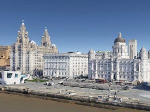
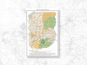
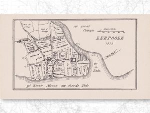
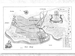
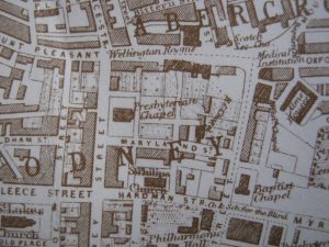
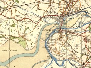
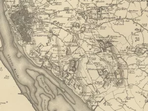
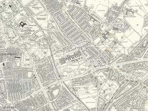
Maps and mapping
Old maps of Liverpool are a staple of this site. Some are included as large interactive maps, but these articles show smaller maps, or extracts of the larger ones. There’s a description of the main points of interest, and anything else that tells you about the time when that map was printed or surveyed.

Here’s 5 views of Google’s 3D Liverpool you might not have seen
| Leave a CommentLiverpool was one of the first British cities to be rendered in three full dimensions on Google Earth. There was, as a crazy extra, a rumour going around that it was in preparation for a new Google office which was opening in the city. That latter rumour was soon quashed, but as a blog interested […]

The historic villages of Liverpool – built to a template?
| Leave a CommentAll born-and-bred Liverpudlians (and many more people) will be aware that the city is made up of a collection of villages. The villages used to sit comfortably in their landscape, surrounded by fields, lanes, streams and hills. Over time, they were swallowed up by the emerging behemoth of Liverpool itself. In many ways Liverpool is unique […]

Lerpoole 1572
| 4 Comments on Lerpoole 1572This map has popped up twice for me recently, as someone asked me for a scanned copy, an a second person posted this image on one of the many great Liverpool history pages on Facebook. It’s a moment of Liverpool’s very early days captured on parchment. My favourite thing about this map is its ‘obviousness’ […]

Conjectural map of Liverpool in the 14th century
| Leave a CommentHere’s a lovely neat little map of Liverpool’s earliest history, from Ramsay Muir’s classic 1907 book A History of Liverpool. The book was produced to celebrate (you have guessed) the 700th anniversary celebrations of Liverpool’s founding in 1207. Muir had gained a first degree in History at University College Liverpool (as it was then known) […]

The Ancient Crosses of Lancashire
| 8 Comments on The Ancient Crosses of LancashireThis article is about a lovely little book from 1902, detailing one man’s niche interest… Here’s a quiz question: how many churches on Merseyside can you name which have pre-mid16th century origins? The Ancient Crosses of Lancashire by Henry Taylor is a small hardback book and a catalogue of hundreds of ‘ancient’ (read: historic) crosses […]

Mapping Local Food in Liverpool
| Leave a CommentMemories of Mr Seel’s Garden is a community project, funded by the Arts and Humanities Research Council, looking at the history of local food in Liverpool. The three local groups involved, Friends of Everton Park, Friends of Sudley Estate and Transition Liverpool, are all interested in finding out whether knowing more about the past might […]

Historic map of Halewood, 1934
| Leave a CommentFollowing a request from one of our Facebook ‘Likers’ (particularly appropriate word for Scousers, perhaps), I posted an old map of Brook House Farm in Halewood. Here I want to post a slightly larger version, taking in more of the surrounding area which was, at this time, on the cusp of great changes. Here you […]

Five fossils of Liverpool’s founding year
| Leave a CommentOn August 23rd 2007 Liverpool celebrated 800 years as a settlement! There are quite a few things which were laid down in 1207, the evidence of which is still visible today. 1 – Seven Streets Every historian of Liverpool should know about these: They are the original roads laid out when Liverpool was founded in […]

Local Knowledge, Dating, and Liverpool’s building milestones
| Leave a CommentI’ve often written about researching local history, either through maps, books, or old photos. But what’s been highlighted for me recently is that eventually all this feeds back, and you can occasionally use your knowledge gained through research to apply to a particular problem. Most maps have dates on them. I don’t know about you, […]

Old Maps for Local History Research
| 2 Comments on Old Maps for Local History ResearchAlthough Ordnance Survey maps chart the most significant changed in Liverpool’s history, older maps often are unique. They show details or aspects which no other map does, and can often show what was important to the map-maker. You can’t beat old maps for laying bare the great changes of a city like Liverpool. Modern maps […]

Ordnance Survey Maps for Local History Research
| 4 Comments on Ordnance Survey Maps for Local History ResearchThis is the first in a series of posts which will hopefully help you research the local history of your area, whether it’s Liverpool or elsewhere. It’s about maps, as my own main site, Historic Liverpool, is based on maps. Part 1 will focus on late 19th and early 20th Century maps. Beginning Map Research […]