Although Ordnance Survey maps chart the most significant changes in Liverpool’s history, older maps often are unique. They show details or aspects which no other map does, and can often show what was important to the map-maker. You can’t beat old maps for laying bare the great changes of a city like Liverpool.
Modern maps are often much more ‘objective’ in comparison. But old maps are still of use to the local historian, at the same time as being beautiful objects.
Early Liverpool Maps
Liverpool developed from seven streets, laid out at its founding in 1215. Soon there was a castle, a chapel and the Tower, a fortified house built by the Stanley family in 1404. Maps of this period (1205-1700) do exist, though most of them were drawn later. Here are a few of the easiest plans of Liverpool to get hold of.
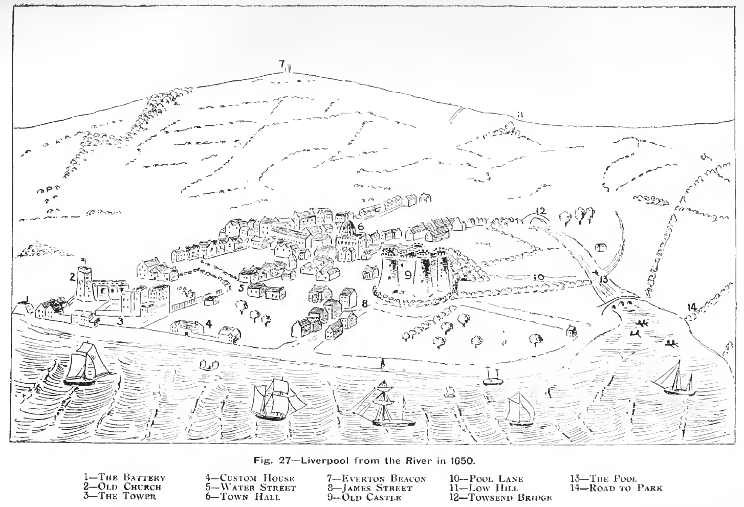
William Ashton included a simple sketch (above) of 17th century Liverpool in his book ‘Evolution of a Coastline’ in 1920.
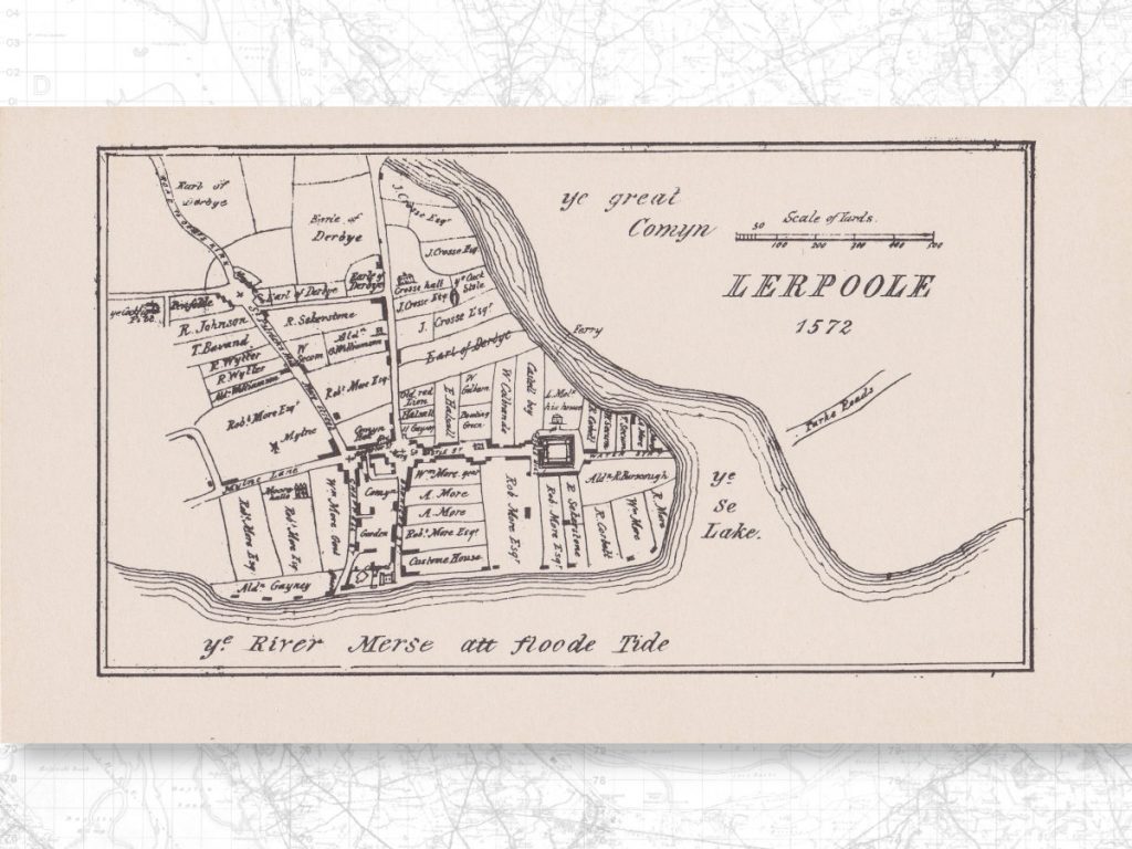
Ashton also drew a top-down plan of Liverpool (see my post Lerpole 1572 for more detail on this map)
The book itself has recently been reprinted, so if you want a higher resolution copy you can pick up ‘Evolution of a Coastline‘ at Amazon.
Genmaps
Cartophilia (once a Rootsweb-hosted site called Genmaps) has a page on Lancashire maps. There’s a huge range, so I’ve collected the Liverpool entries in the following table. In case newer maps get uploaded to that site, I recommend going to the original page and using your web browser’s inbuilt search function to search for ‘liverpool’.
Note: the Cartophilia page has many, many fewer Liverpool maps than the original Genmaps one. I’ve added links to the new Liverpool maps on there, and kept the entries below for the maps that were on the old page, but not the new one. For those maps, I’ve removed the links, but left the rest of the information there. If you know of a link to any map below, please let me know in the comments!
Pre-19th century
| Name | Date | Map-maker and Notes |
|---|---|---|
| A Plan of Liverpool | 1765 | John Eyes – an uncoloured version of John Eyes’ Plan of Liverpool. |
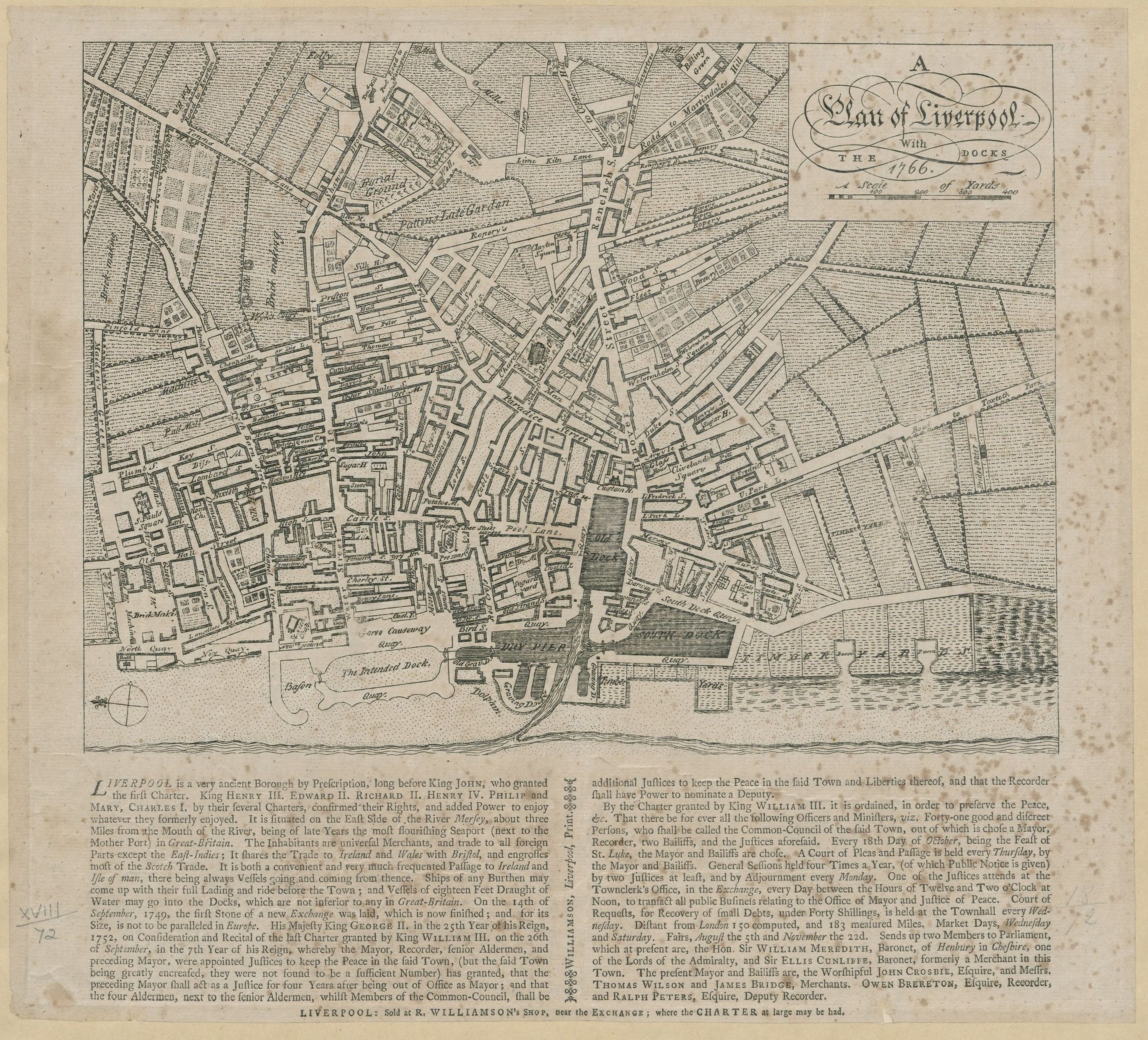
| A Plan of Liverpool with the Docks | 1766 | R. Williamson. |
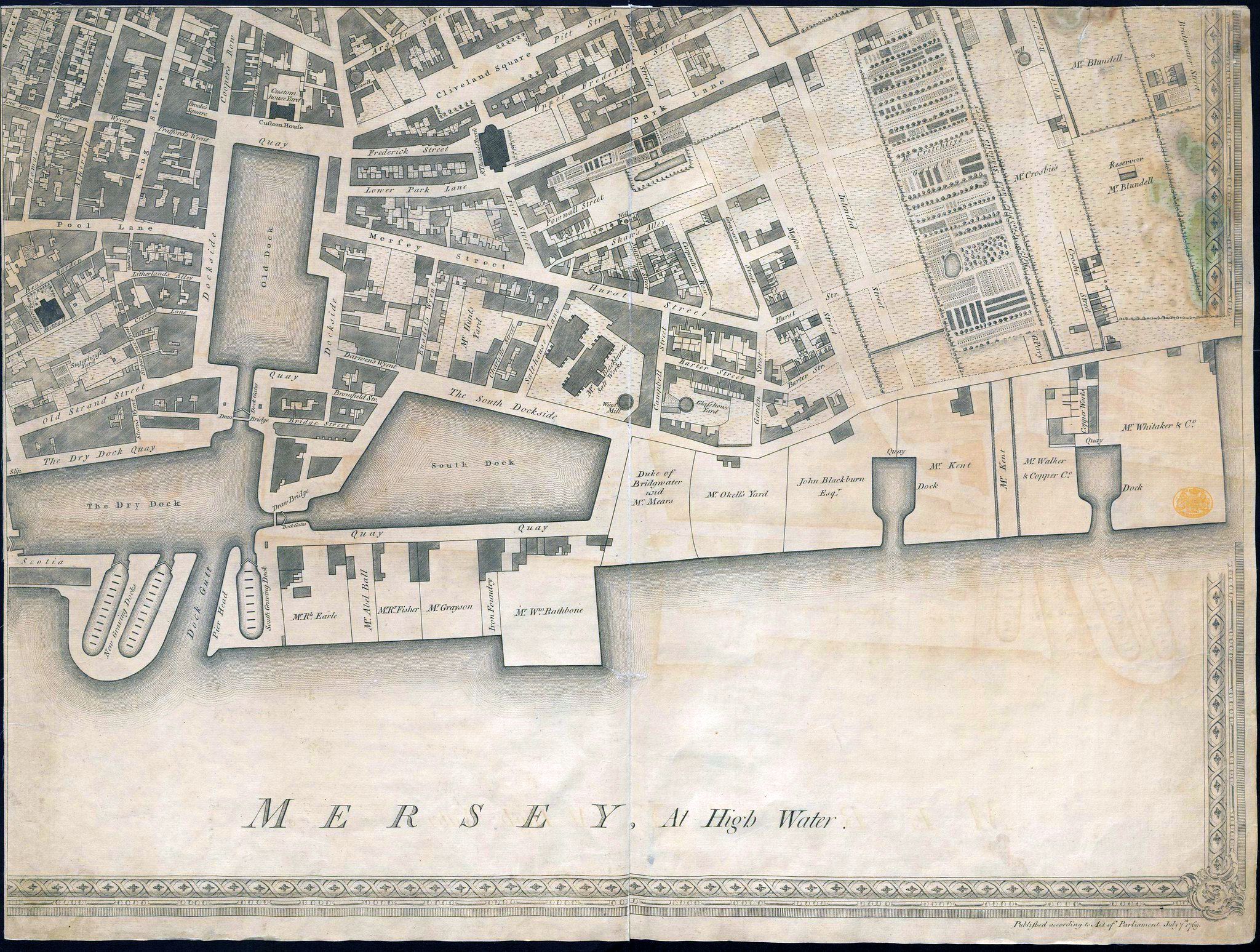
| A Plan of Liverpool | 1769 | George Perry – comes in four parts (lower left, lower right, top left, top right) |
| A Plan of Liverpool | 1790 | John Gore |
%20George%20Perry.jpg)
%20George%20Perry.jpg)
%20George%20Perry%20.jpg)
.jpg)
19th century
| Name | Date | Map-maker and Notes |
|---|---|---|
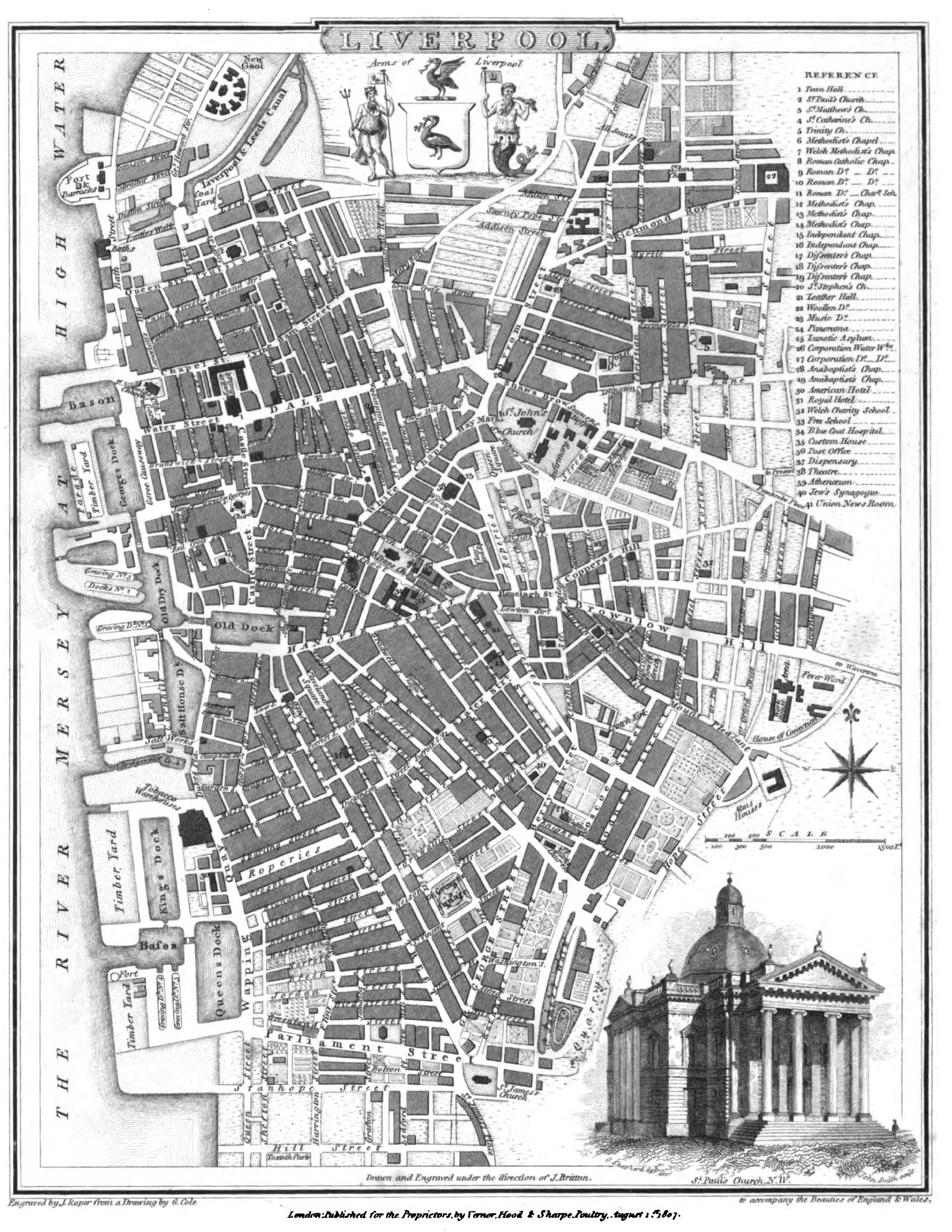
| A Plan of Liverpool | 1809 | John Roper, in the British Atlas of England and Wales. A black and white version of Roper & Cole. |
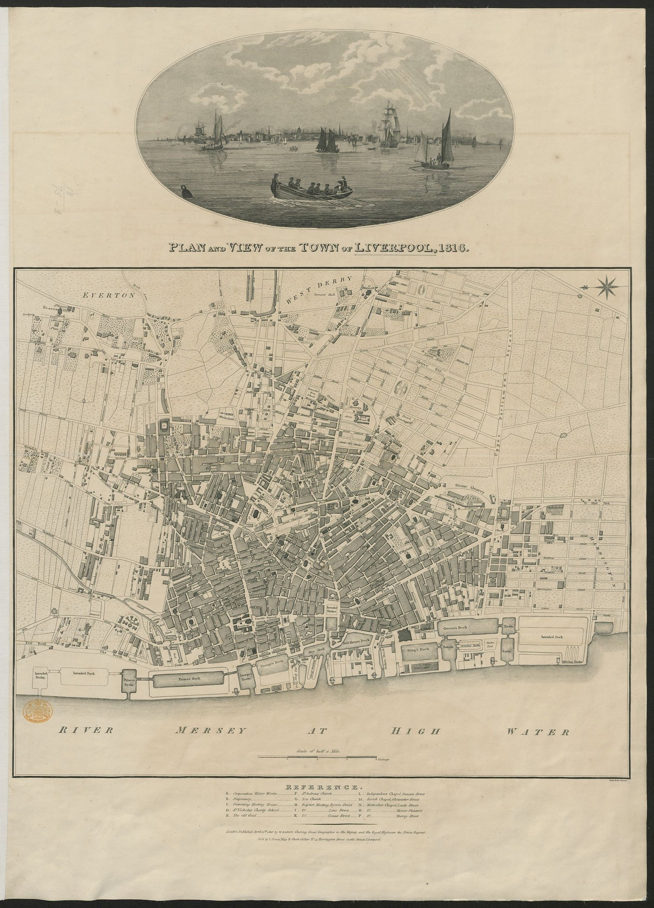
| A Plan of Liverpool | 1816 | William Faden – includes an engraving: Plan and View of the Town of Liverpool, 1816 |
| Liverpool, street plan | c.1801 | George Cole. engr.J.Roper in The British Atlas |
| Liverpool | 1854 | Bradshaw |
| Plan of Liverpool | 1883 | Adam Black, from Black’s Guide To England and Wales. |
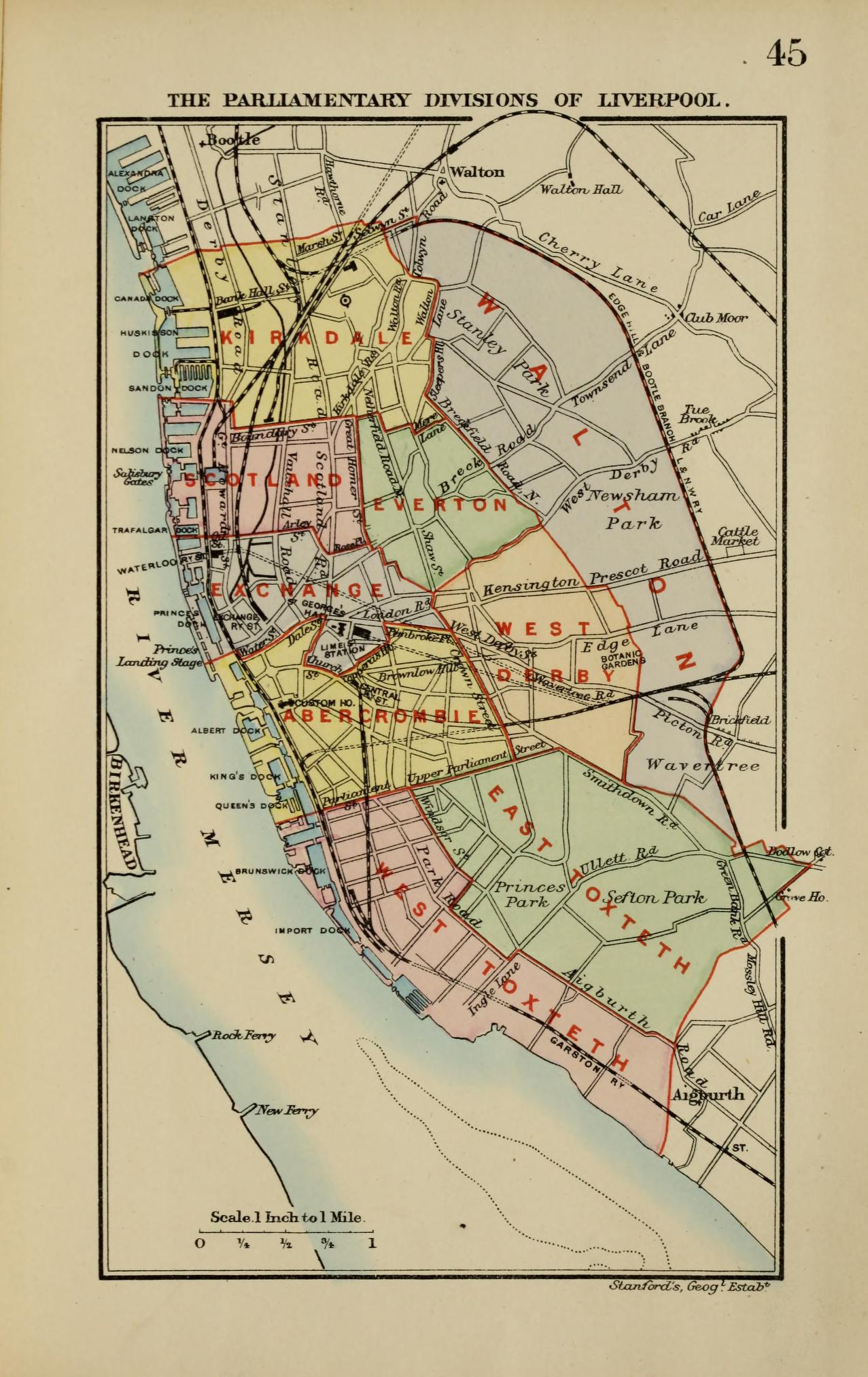
| Liverpool | 1885 | From Stanford’s Parliamentary Dictionary of England and Wales |
| Lancashire | 1809 | John Cary |
| Liverpool, Warrington, Leigh area | 1809 | John Cary (detail of map above) |
| Liverpool | 1832 | Lt. Robert Dawson in Plans of the Cities and Boroughs of England and Wales: shewing their boundaries as established by the Boundaries’ Act, passed 11th July 1832 |
| Liverpool, street plan | c.1833 | (includes plan of Liverpool in 1729) Society for the Diffusion of Knowledge. This is a hand-coloured (but smaller) version of my map by Mickleburgh, completed with engraved building profiles along the bottom. |
| Plan of the Liverpool Docks | 1846 | Jesse Hartley (Dock Surveyor) engr. C.B. Graham, Washington, D.C. |
| Environs of Liverpool | 1850 | Thomas Cowperthwait (inset detail from England) |
| Liverpool Docks | c.1860 | J.Bartholomew for R. Fullarton. |
| Liverpool | 1863 | John Dower, published in The Weekly Dispatch |
| South West Liverpool | 1863 | B.R.Davies (detail from Liverpool map in The Weekly Dispatch Atlas). Historic Liverpool has a much bigger and zoomable verion of the Weekly Dispatch Atlas. |
| Liverpool-Birkenhead area | c.1870 | A.Fullarton (detail from The Environs of Liverpool and the Estuaries of the Mersey & Dee) |
| The Town and Borough of Liverpool | 1880 | J. Bartholomew. (detail) |
| Plan of Liverpool | 1881 | Charles Letts |
| Liverpool.-sewers,contourlines and municipal boundaries | 1882 | Map maker not known |
| Liverpool – city plan | 1883 | George W. Bacon in The New Ordnance Atlas of the British Isles |
| Liverpool (Eastern Section) | 1885 | Report of the Boundary Commissioners for England and Wales. There’s a link through to a higher resolution version. |
| Liverpool (Western Section) | 1885 | Report of the Boundary Commissioners for England and Wales. |
| Liverpool | 1897 | Century Atlas Company. (detail from map of England and Wales) Quite a tiny map! |
| Liverpool | 1898 | Meyer in German lexikon Brockhaus. Published by Leipzig Bibliographisches Institut. Notable for being a German language map. |
.jpg)
20th century
| Name | Date | Map-maker and Notes |
|---|---|---|
| Liverpool: town-plan (and detail) | 1900 | K.Baedeker |
| Environs of Liverpool & the estuaries of the Mersey and Dee | c.1910 | J.Bartholomew |
| Liverpool Docks | 1920 | George Phillip (detail from The New Mercantile Marine Atlas) |
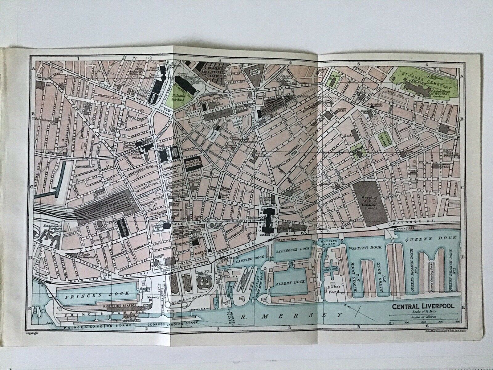
| Plan of Central Liverpool | 1922 | J.Bartholomew (detail from The Towns of England in The Times Atlas) |
Some of them are high resolution, and some not. Others have links to higher resolution versions of extracts below them.
Lancashire County Council
Lancashire County Council has the best collection of old maps for any student of Liverpool history. It runs from a reproduction of Gough’s 1320 map, through all the major map makers: Speed, Yates, Greenwood, Hennet.
Greenwood’s map of Lancashire from 1818, is undoubtedly the best! Click on the exact point you’re interested in, as this map has been cut up into sections when added to the site.
Old Maps of Liverpool
It will take a fuller article to go into all details hidden in maps like these. For us today they provide an immediate visual visit on the past, easy to interpret. For this reason one of my favourites has to be this 1833 Society for the Diffusion of Useful Knowledge map (if only for the name!) I now have a high resolution, zoomable version of this map.
It shows quite a lot of detail, including Bootle Castle at the end of Regent Street, an unfamiliarly station-free Lime Street, and is detailed right out to Kensington (the edge of the city back then). Click on the map to zoom in.
Oldest of the old maps
Finally, I want to mention a map included in the modern edition of The Calderstones by Ron Cowell. The map was made in 1568 to help solve a boundary dispute between Allerton and Wavertree. Not only does it show the Calderstones, but it also shows the mysterious Rodgerstone and the Pikeloo Hill.
The Rodgerstone might have been a single standing stone, while the Pikeloo Hill could be a burial mound. The Pikeloo Hill could even have been as large as Silbury Hill, a prehistoric mound in Wiltshire.
Not only does this seem to be the oldest map of the Liverpool area. It’s also a tantalising glimpse of a prehistoric complex now long lost. The map isn’t online, so if anyone has a high resolution scan, do get in touch.
Well, that rounds off this brief excursion into Liverpool maps. There are certainly some I’ve missed, so please share your own sources in the comments!
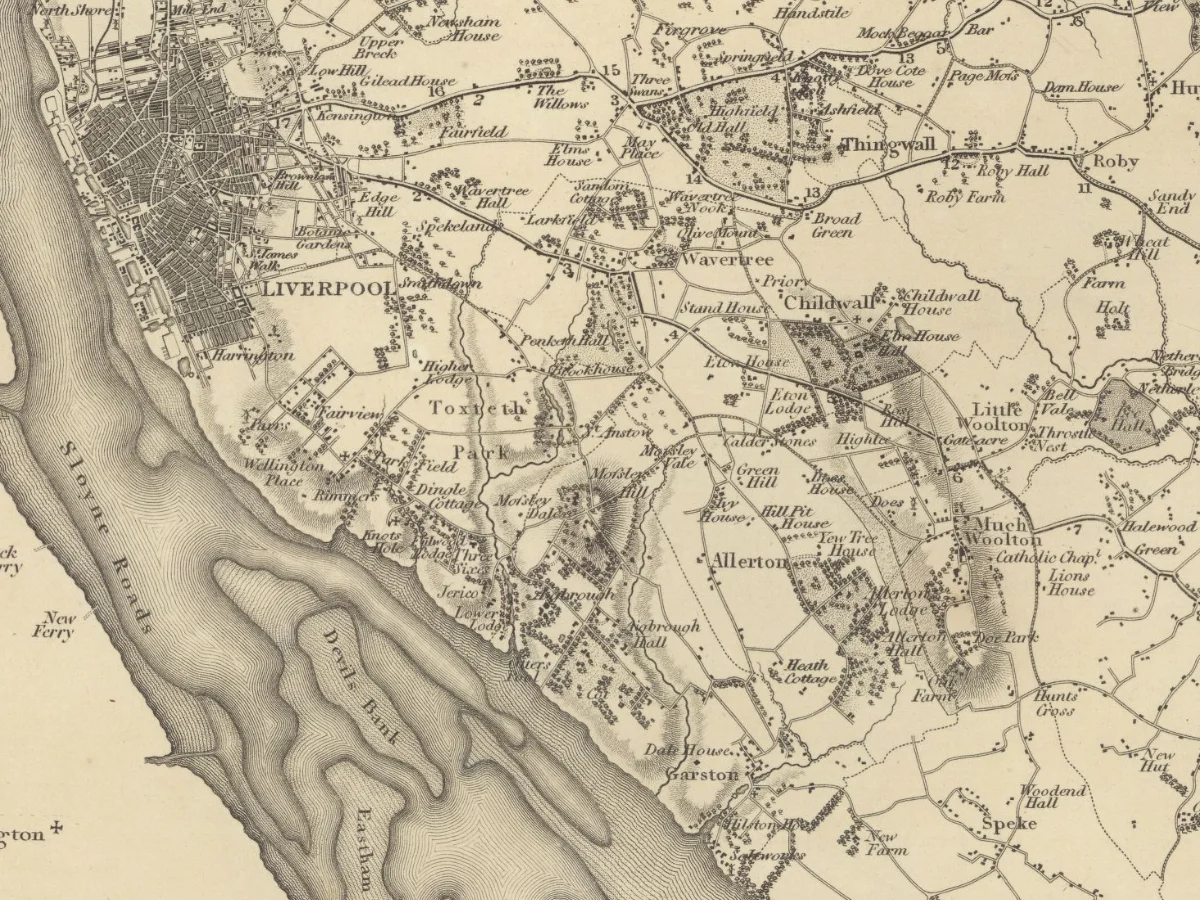
Image: Extract from the Greenwood map of Lancashire, 1818, used with the permission of the National Library of Scotland, available in full on the NLS website. A low resolution, but coloured, version is available from Lancashire County Council Old Maps of Lancashire website (you’ll need to scroll down the story to find Greenwood).