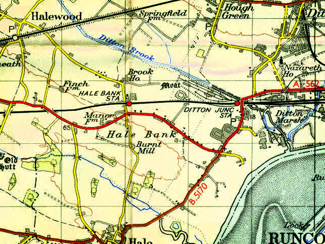
Brook House Farm is the name given to an Iron Age farmstead site in Halewood.
It consists of an enclosure surrounded by two ditches (one large and one small), and was discovered via an aerial photograph in 1990.
The site was excavated in advance of the building of the junction between the A5300 and the A563, first published in 2000. The main, larger, ditch was 3 metres deep by 8 metres wide, and suggests that the site was quite an important one in the middle Iron Age (400 – 50 BC). It may have belonged to a chieftain of a tribe, a locally powerful person.
The second ditch, a smaller feature which sat outside the first, may simply have been to allow the corraling of cattle between the inner and outer ditch. It has been suggested that cattle were an important symbol of wealth in the Iron Age, and whoever was powerful enough to build such an imposing structure would certainly have wanted to control large numbers of cattle.
Cattle farming would have occured at Brook House Farm, but it may also be true that cattle were brought from elsewhere and exchanged, traded or given as payment, overseen by the chieftain. The site was first occupied in the middle of the Iron Age, and was then abandoned later in the same period. It was re-occupied in the Romano-British period, as suggested by pottery evidence (see below).
Finds
The site was datable through the pottery types found in the ditches. There were 90 pieces of Cheshire Very Coarse Pottery (VCP), six of which were found in a Roman Iron Age setting. Other pottery included local Romano-British pieces and three Samian fragments.
Structures
Within the enclosure a number of structures were found across the entire area. There were also gullies and some pits, and slag found on-site reveals that some iron working probably took place at Brook House Farm.
The landscape around Brook House Farm
Analysis of the filled-in ditches suggests that the local landscape during the initial occupation of the enclosure was heavily wooded, with the trees encroaching close to the monument. In later centuries the wood was disappearing, either through human activity or a changing climate, and the dense woodland was replaced with a willow scrub woodland.
Further Reading
Cowell, RW and Philpott, RA, 2000, Prehistoric, Roman and medieval excavations in the Lowlands of North West England: Excavations along the Line of the A5300 in Tarbock and Halewood, National Museums and Galleries on Merseyside, Liverpool.
Engerdahl, T., 2010, A World apart? An Investigation of the Roman Influence on Rural Settlements in Britain compared to Sweden during the Roman Iron Age, Bachelor thesis in archaeology, Gotland University. (available at http://hgo.diva-portal.org/smash/record.jsf?pid=diva2:376110, retrieved 4th August 2011)

sue szikla
says:I am very interested in learning more about Brook Farm as my ancestor lived there in the 1800`s was named James Lyon and was a gardener for The Earle family. I will check out the site mentioned above thanks for any info Sue
Martin
says:Hi Sue,
Brook House Farm is a really interesting archaeological site. I’ll make my best effort to transfer some of the information from the Prehistoric Merseyside article to this one.
Thanks for your comment,
Martin
debbie
says:My question is “was there ever a brook/stream as it is noticed that some houses in the area close to Newsham park suffer badly of damp. We wonder was there a stream or something to make this
Martin Greaney
says:Hi Debbie,
I can’t see any substantial brooks or streams on the old pre-Park maps, though of course there would be little streams and drains all around (though nothing out of the ordinary). There may be something in the lie of the land (which doesn’t show on maps) which prevents good drainage in the area.
Regards,
Martin
Bill Longden
says:Hi,
I bought a piece of furniture from Brookhouse Farm. It is stamped by an English maker from Warrington. Do you know when the present building was built? It didn’t appear to have moved far.
Martin Greaney
says:Hi Bill,
All I can say for certain is that the farm buildings were there on the earliest OS maps, so predate 1900.
Best wishes,
Martin
stephanie Turner
says:Hi Bill,
I would really like to get in touch with you. It is not historically related but is about Brookhouse farm.
thanks stephanie
Bill Longden
says:Hi Stephanie,
Billlongden@aol.com
Bill.
Jean Kelly
says:I have looking at my Ancestry and found out that my ancestry starts at Brook Farm with folks on my dad’s side of his family. Brook Farm is on a early census form. Sorry if this is not the same farm I do apologise at this time. Jean kelly. Mrs. Ps. I have not seen these posts before so I am new to it.
Bill Longden
says:Hi Jean,
The Brook House Farm I am referring to has a post code of WA8 8NS. Feel free to contact me if it’s the right Brook House Farm.
Bill.
Bill Longden
says:https://maps.nls.uk/geo/find/#zoom=11&lat=53.65481&lon=-2.96466&layers=102&b=1&z=1&point=53.63497,-2.99849
The earliest os map on this site is 1845ish and I think shows the farm building.
The maker of the piece, R Bradley, Warrington, died in 1848. I would imagine the piece was probably bought to furnish the house.
There is a secrataire made by the father, also R Bradley in Warrington museum (unless they have sold it).
Kelly
says:Thank you for replying to my message about Brook farm, I will be looking into some census paperworkI have and getting back yo you soon. Thank you Jean