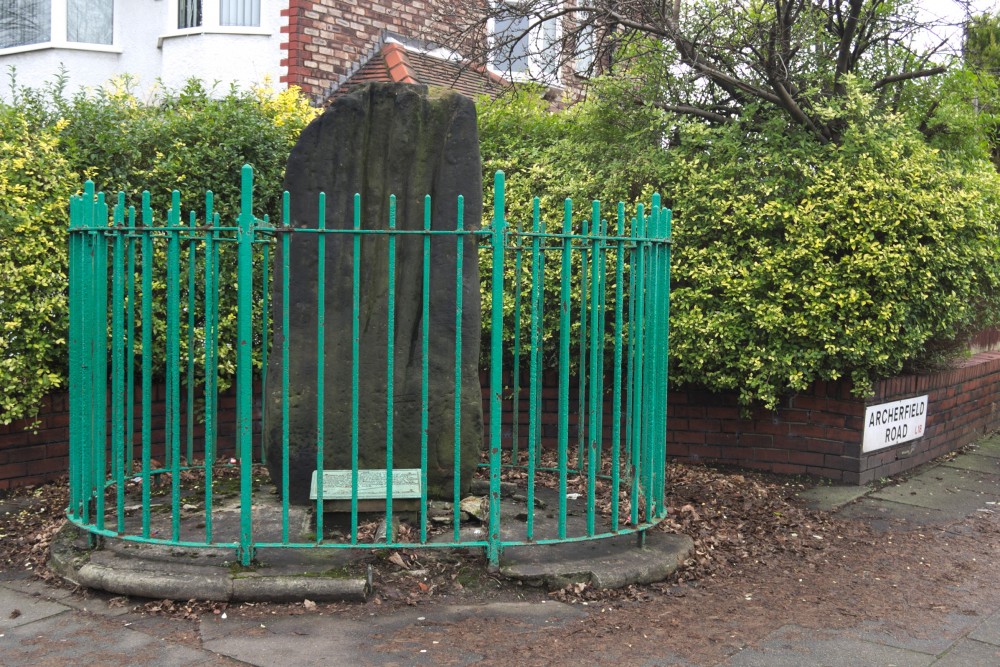
Robin Hood’s Stone (or the Robin Hood Stone) is a Neolithic or Bronze Age standing stone currently to be found within a set of railings on the corner of Booker Avenue and Archerfield Road. It originally stood to the north east in the middle of a field known as Stone Hey, but was moved when the nearby houses were built in 1928.
Description
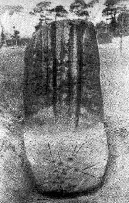
Robin Hood’s Stone is a roughly rectangular stone around two metres high, just under a metre wide and half a metre thick. Deep grooves run down one of the larger faces, and these stop at what would have been the original ground level. Everything beyond the end of the grooves was buried when Robin Hood’s Stone was in Stone Hey.
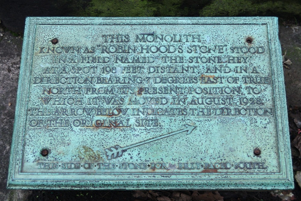
After it was placed inside the railings, a bronze plaque was attached with some information about its origins:
“This Monolith known as Robin Hood’s Stone, stood in a field named the Stone Hey at a spot 280 feet bearing North from its present position, to which it was moved in August 1928. The arrow below indicates the direction of the original site. This side of the stone formerly faced South”.

Engraved at the base of the stone, as has been mentioned, are a collection of cup and ring marks. Marks like these, made of concentric carved rings with circular ‘cups’ at their centre, can be found across the west and north of Britain and in Ireland too.
Original Location
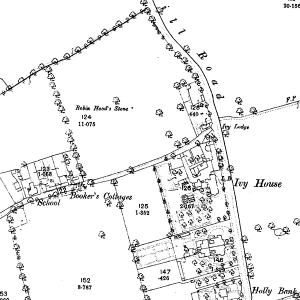
Robin Hood’s Stone originally stood to the north east of its current site, in a field known appropriately as Stone Hey. ‘Hey’ is a word of Anglo-Saxon origin, and suggests an enclosure, possibly for animals. It’s been suggested that a farmer brought the stone to this field to let the grazing animals scratch themselves on it.

Although Robin Hood’s Stone may originally have been part of the Calderstones, we know that it has stood alone in this part of Liverpool since at least 1771, when Eye’s map of Liverpool shows the Stone Hey field name. So it’s sensible to suggest that, although the Stone itself is not marked on that map, it was in this field at that time.
A boundary dispute of 1568, which uses a number of ancient monuments as boundary markers, mentions that a stone was removed from the mound of the Calderstones in around 1550. This may or may not have been Robin Hood’s Stone, but the cup and ring markings near the base of the pillar date the stone to a similar era to the Calderstones.
So the movement of Robin Hood’s Stone could have taken it from the Calderstones mound itself, to Stone Hey (now the location of 11 Greenwood Road), and finally 280 feet south east to its present location on Booker Avenue in 1928.
Legends
The very name of the stone is a reference, of course, to the famed archer of Sherwood Forest, and this comes from the long grooves in the rock. Legend has it that these grooves were made by medieval archers sharpening their arrow heads on the stone in the course of practising their aim. There’s no direct evidence for this, and the Robin Hood name is merely an extra layer in the mythology.
Another more gruesome legend suggests that the grooves are there as drains for the blood of the Druids’ human sacrifices! Needless to say this is a typical over-excited Victorian story, and quite far from the truth.
The mysterious carvings on the base of the monument, buried for so long in the ground at Stone Hey, have been seen by Alfred Watkins, inventor of ley lines, as a map of local leys. Considering Watkins ideas about the power of leys, it’s not entirely clear why you’d need a map of them…
Excavation and protection
Prior to its relocation to Booker Avenue, the Stone was excavated on October 29th 1910, which was when the carvings were rediscovered. These have since been compared to the carvings on the Calderstones, dating Robin Hood’s Stone to a similar date, the Neolithic.

In 1924 the Stone became a Scheduled Ancient Monument, but due to the threat posed by the new housing, it was relocated to its present site in August 1928 by the Liverpool Corporation and the Mersey Building Company. It was protected with the iron railings, and has stood in this state ever since.
References
Robin Hood’s Stone, Allerton, Liverpool, Lancashire, The Northern Antiquarian, https://megalithix.wordpress.com/2013/02/21/robin-hoods-stone/, accessed 7th January 2016
Robin Hood’s Stone – Standing Stone (Menhir) in England in Merseyside, https://www.megalithic.co.uk/article.php?sid=8435, accessed 7th January 2016
Robin Hoods Stone, PastScape, http://www.pastscape.org.uk/hob.aspx?hob_id=67205, accessed 7th January 2016
South Liverpool – Allerton (West and South Allerton), Allerton Oak, http://www.allertonoak.com/merseySights/SouthLiverpoolAL.html, accessed 7th January 2016
The Calderstones, Mike Royden’s Local History Pages, http://www.roydenhistory.co.uk/mrlhp/local/calders/calders.htm, accessed 8th January 2016

Roy Mcguire
says:A lot of old churches around the country have stones just outside the church. After service on the kings orders archers had to practice and refine their skills. the stones in question were used to sharpen their arrow heads. So maybe ths really was the stone purpose.
kevan Hubbard
says:Unlikely I’ve seen these fluted stones in Northumberland and Yorkshire and think weather erosion is the cause of the flutes.if I recall the duddo stone circle, duddo,Northumberland,and devils arrows,boroughbrbridge,Yorkshire, have similar flutes.