Features like rivers and hills, which can still have important impacts on the history of Liverpool and Merseyside.
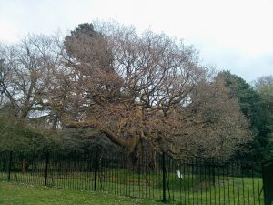
The Allerton Oak is a 1000 year old sessile oak that stands in Calderstones Park. It’s surrounded by a double fence to protect its ancient structure, and metal crutches installed in 1907 hold up its branches. Calderstones Park is in Allerton, which was mentioned in the Domesday Book and has a long history of its […]
Read more »
Hale township occupies a spot at the widest part of the River Mersey. Because of this the water slows down significantly. So much so that, at times in the past, a sandbank could once be seen to poke above the level of the water. This, the so-called Hale Ford, was an important crossing point of […]
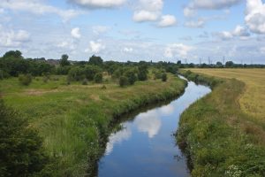
Ditton Brook makes up the northern boundary of Halewood, and flows in a south-westerly direction before flowing out into the River Mersey between the town of Ditton and Hale Bank. Along with the River Alt, this river flows down a valley carved out when glacial ice pushed south from what is now the Irish Sea. […]
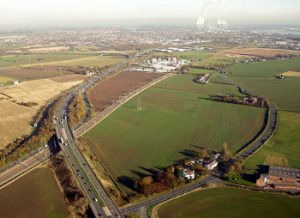
The River Alt flows north east through Lancashire and Merseyside. It rises in Huyton township at the Hag Plantation, and flows through Croxteth Park, West Derby and Maghull. It then flows out to the River Mersey
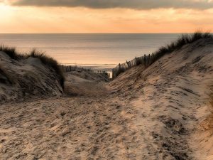
Wind dropped Shirdley Hill Sand across a vast swathe of land in the millennia since the last glaciation. The sand lies along the Sefton Coast several kilometres inland, and has created dunes up to 75m (246ft) tall. The sandy Sefton coast has attracted humans for centuries. The beaches on this coast are the location of […]
The Merseyside Uplands include the higher ground to the east of Croxteth, and strips at Mossley Hill and elsewhere. They have had an important influence on Merseyside and Liverpool throughout the region’s history. During the last ice age, glaciers drove in from the north west and moved south towards the Midlands. As they did so, […]
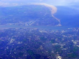
The valley of the River Mersey was created during the last ice age. Thick glaciers moved inland from what is now the Irish Sea, carving deep parallel iceways. The iceways were later occupied by the Mersey, the Dee, the mid-Wirral channel and the Alt–Ditton valley. The meltwaters of the glaciers formed the rivers which still […]
The Pool is arguably one of the major reasons for Liverpool’s existence. King John was looking for a suitable place from which to launch ships to Ireland, and Liverpool fit the bill. The Pool sprang up inland, and flowed down Whitechapel and Paradise Street into the River Mersey. Although completely invisible today, it played a […]