In archaeology, landscape archaeology is a way of looking at archaeological and historical sites in their wider context.
This view allows the researcher to bring together a number of sites into a model of what was going on at any one time across the city. Going further, it also allows us to see the changing nature of a particular landscape. For example, we can look at the changing character of the rural areas surrounding Liverpool. They go from scattered farmsteads in the early Medieval period, through enclosure hedgerows and walls, ending with the encroachment of the urban areas in the nineteenth and twentieth centuries.
Archaeology of urban and rural Landscapes
Landscape shapes movement. Who you are shapes what you can do and where you can go. Age, ethnicity, gender and social status are just some of the factors that play a role.
We can also see landscapes as the interaction of opposing natures, e.g. city vs countryside. As the city grows it changes the countryside – which has to be more intensely farmed to feed the urban population, and so on.
Aside from that there are the pairings of centre and edge, here vs there (‘us’ vs ‘them’…). We can see architectural styles spread from one area to another, following fashion. Slums might be a reflection of class distinction – the lack of entitlement to land. (See Smith, 2014 in Further Reading for a great overview of urban landscape archaeology.)
Landscape archaeology of Liverpool
Historic Liverpool, based around thematic maps and page, lets us take a wider look at the city and its surrounding region. Hopefully, it still recognises the different parts which come together as the “historic landscape of Liverpool”. That means I also want it to take in the monuments, buildings and roads which in turn make up these smaller areas.
Always remember that – despite the lines on the map – we can’t strictly define the individual areas, and nor should we try. The ‘docklands’ area extends out onto the river; the ‘inner suburbs’ overlap all over the city with the ‘outer suburbs’.
Even the areas vary within their own ‘boundaries’, both in age and appearance. Within the inner suburbs, for example, are the small Victorian terraces originally built for the factory workers of Liverpool’s 19th century hey-day. They might sit right next to large modern car dealerships, clubs, and other buildings less than twenty years old. It’s all part of the story of the developing landscape.
Finally, don’t forget that buildings built and used more than 150 years ago are still there. They’re being re-used for flats, shops and other very different purposes. This is all part of that same story, the ‘stratigraphy’ of the landscape.
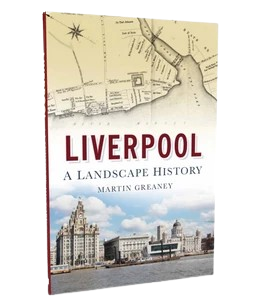
My hope is that this site conveys some of the nature of the changing landscape, and the way I myself like to look at the changing history of this city. You can see this in greater detail in my book, Liverpool: a landscape history.
Further Reading
Smith, M., 2014, The Archaeology of Urban Landscapes, Annu. Rev. Anthropol, 2014. 43:307–23, https://www.researchgate.net/publication/275487033_The_Archaeology_of_Urban_Landscapes, accessed 30th January 2025.
Wally Edwards
radio Merseyside are looking for info re the first world war, I am an old man now, but I remember being told (when I was a nipper) by an old ww1 soldier that the site of Walton Hall park was used as a ammunition storage depot, and as the park did not open till 1934 this seems possible can any one verify this please.