Allerton is a green and pleasant land of parks, mansions and ‘neatly-kept hedges’. Early maps show that it remained entirely rural until the middle of the 19th Century. The history of Allerton stretches all the way from Liverpool’s oldest prehistoric remains to Victorian merchant palaces.
From that time, the area became dotted with the homes of wealthy merchants. These have survived into today’s landscape, with the the houses gardens under new use. Even as Liverpool, Garston and Woolton encroached on all sides, Allerton kept its acres of open greenery. Now the area is home to some of Liverpool’s most evocative landmarks – the Calderstones, Strawberry Field, and Robin Hood’s Stone.
- A Tidy Township
- Earliest Days on Merseyside
- Merchant Palaces
- Public Parklands
- Expanding Suburbia
- Allerton as a Suburb
- Bibliography
Recommended sources
Website: https://web.archive.org/web/20200126020415/http://www.allertonoak.net:80/AMH/AMHHome.html The parish council’s own website has loads of large images and a wealth of information on the history of Aintree.
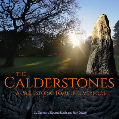
Book: The Calderstones: a prehistoric tomb in Liverpool, by Liz Stewart, George Nash & Ron Cowell, Merseyside Archaeological Society (2008). A great introduction to the monument. Includes plenty of illustrations and details of the tomb’s links with other prehistoric monuments beyond Mersyeside.
Allerton c.1900
Use the slider in the top left to change the transparency of the old map.
A Tidy Township
Allerton lies on the gentle slopes of a ridge that rises up from Garston. At the beginning of the 20th Century it still had a view overlooking the Mersey. The Victoria County History noted “An air of tidiness reigns over what remains of the natural features, with neatly-kept hedges and railed-in paddocks, and shrubs grown to rule and measure”. The soil was good, and useful for growing anything from root vegetables to tree plantations.
Earliest Days on Merseyside
Although a handful of prehistoric objects are known from Liverpool, Allerton has both of the most spectacular ancient monuments in the city: the Calderstones and Robin Hood’s Stone. Little is known about these monuments. Robin Hood’s Stone is most likely a Bronze Age standing stone (perhaps even part of the Calderstones). The Calderstones themselves are the remains of a Neolithic or Bronze Age burial chamber.
These monuments, lying close together, were part of a larger prehistoric landscape. A Bronze Age cemetery once existed in Wavertree, and in Allerton itself the Pikeloo Hill and Rodgerstone are two more ancient monuments which have vanished from the landscape.
Merchant Palaces
As the VCH suggested, Allerton was an attractive area for those wealthy enough to live here.
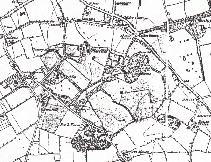
The 1st Edition OS map shows a scatter of farms and small houses (e.g. Booker’s Cottages, Beech Farm, Calder Cottage, Vale Cottages, Fletcher’s Farm – now Fletcher’s Barn). Larger homes include The Hall, Calderstones, Quarry Bank, Hay Hill, Greenhill and Allerton Hall. This map also shows the house known simply as ‘Allerton’, built right in the centre of the township, between Dowse House and Allerton Priory.
Allerton Hall is perhaps the most significant of the large houses in the area. It was owned in it’s time by two very different men. William Roscoe, famed abolitionist, moved in during 1799. Later, Richard Wright, a cotton trader, flew the Confederate Flag from Allerton Hall during his time there.
Streets of Allerton
The other main feature on the 1850 map is Allerton Road, winding north to south down the centre of the township. Folly Vale Lane (later Menlove Avenue and Vale Road) runs to the east, between Allerton and Woolton. Greenhill Road (later Mather Avenue) runs to the west, next to Garston. It crosses under the Edge Hill and Garston branch of the London and North Western Railway at Allerton Station (now Liverpool South Parkway).
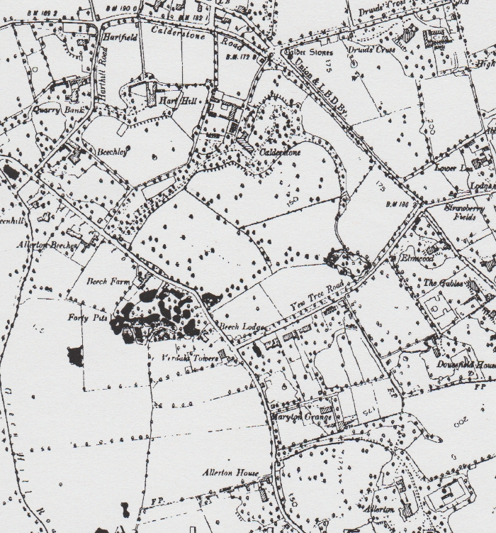
The building of these merchants’ palaces continued to the end of the century; the 1891 edition shows the appearance of Strawberry Field and Allerton Tower.
The merchants’ wealth depended on the increase in trade and industry as part of the industrial revolution. The railways were expanding, and Speke Junction (where the London and North Western Railway met the Cheshire Lines Railway) grew to include Allerton Engine Shed and a group of new sidings (now all part of Allerton Traction Maintenance Depot).
Allerton’s Parklands
Liverpool Corporation bought the area now known as Calderstones Park in 1902 from Henry & Charles MacIver, who had owned it since 1875. It is first marked as a park on the 1904 map, with the Allerton Oak shown within its boundaries.
The house known as ‘Forty Pits’ is shown opposite the junction of Allerton Road and Yew Tree Road. The area was wooded, and it was certainly an attractive cove of woodland and ponds until the 1970s. One of the ponds still exists behind the houses.
It is hard to know whether the pits were originally a quarry for sandstone or sand. It may have been a natural feature that the local house owner exploited to enhance his own lands.
Expanding the Suburbs
The pace of change increased as the 20th Century reached the half way point. Areas like West Derby, Childwall and Woolton transformed into semi-detached suburbia, but Allerton remained a very green place. The biggest change on the 1939 map is the creation of Mather Avenue, leading from the Greenhill Nursery to the housing estates of Garston.
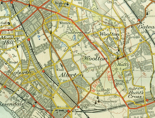
Other changes show the city encroaching: Short Butts Farm is now surrounded by Allerton Cemetery. Menlove Avenue grew from the widened and straightened Folly Vale Road. That now snakes off to the north just before it reaches Mendips, a kind of fossil of the former road.
By 1947 the edge of built-up Liverpool sits on the north boundary of the old township. By 1952 the metropolis had all but encompassed the parklands.
Hunt’s Cross
This is an area adjacent to Allerton, and paired with it as the Allerton and Hunts Cross city council ward. There is a cross in the centre of the suburb. Tradition says that the Liverpool Hunt used to meet in this area, but there was an area of land, now part of Liverpool John Lennon Airport, called Hunt’s Tenement (shown on a map of 1855). A closer link may be found here.
Allerton as a suburb
Since the late 20th Century little has changed in Allerton. It is this feeling of history which gives Allerton its distinctive character. Although no remnants of the ‘natural’ landscape have survived, a huge proportion of the area has never been built on. The parks allow all of today’s Liverpudlians to enjoy something only the wealthiest could before they gave their estates to the city.
Bibliography
- https://web.archive.org/web/20120205091629/http://www.mersey-gateway.org/pastliverpool/housing/mansions/mansions.htm – details of Forty Pits under Mansions, PASTLIVErpool, retrieved 23rd January 2010 (archived from the original at http://www.mersey-gateway.org/pastliverpool/housing/mansions/mansions.htm)
- Cowell, R., 2008, The Calderstones: a prehistoric tomb in Liverpool, Merseyside Archaeological Society, Liverpool.
- Farrer, W., & Brownbill, J., 1907, ‘Townships: Allerton’, A History of the County of Lancaster: Volume 3, pp. 128-131.