History of Everton: Civil War, housing and the Blitz
The highest point in the district is St. George's Church, with the ground sloping away rapidly to the north and west. The ridge on which the village stands extends to Low Hill and Edge Hill, and the foot of the ridge is the western boundary of the township. The centre of the old village is, unsurprisingly, Village Street.
There was a mere, later known as St. Domingo's Pit, which was just below the Beacon, and which Mere Lane led down to. At the beginning of the 20th Century Moss Lake Brook flowed towards the town centre from Everton.
Recommended sources
Website: https://www.bootlehistory.co.uk/ The Bootle Times website seems to be a hive of activity. There are dozens of oral history recordings and an active forum where you can discuss all Bootle topics from history to wanted ads.
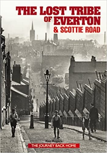
Book: The Lost Tribe of Everton & Scottie Road, by Ken Rogers. This book goes with the website of the same name. It contains reminiscences of the area from current and former residents, and tonnes of photos to help you with research.
Everton c.1900
Use the slider in the top left to change the transparency of the old map.
Transport
The main route east out of the city of Liverpool was once the road along Everton Brow, the old name of which was Causeway Lane. Halfway up the slope to the west of Everton Netherfield Lane turns to the north, with a branch leading up the hill. From the top of the village, this road led north to Everton Beacon (demolished in 1803). The road then divided, running downhill to Kirkdale and Anfield. In the fork of these two roads stood St. Domingo's House. The roads remain as Heyworth Street and Everton Road.
After passing through the village, the road from Liverpool divides into Breck Lane, leading to Walton Breck, and another road, which again divides into roads to Newsham and West Derby respectively.
Development

Everton was one of the first areas of Liverpool popular with rich merchants who traded through the city. However, later chemical works and riverside industries arrived, and the large mansions were knocked down, and replaced with hundreds of terraces. The roads were then widened along the main routes, and tramways were serving the district by the 19th Century. As the main centre of the city decreased in population in the 18th and 19th Centuries, Everton was one of the areas which gained population in its stead. This trend was most apparent in the early 19th Century, but in Everton the pattern reversed towards 1900. Although no longer the area for the rich merchants, Everton attracted master mariners as well as working families.
As the 20th Century continued, Everton became infamous for cramped and squalid slums. Hundreds of houses were bulldozed, here and in other areas, and were replaced by equally infamous high-rise flats such as the Piggeries in Everton Park.
Industry
A large sandstone quarry occupied the northern slope of Everton Brow.
Landmarks
An old pumphouse, or bridewell, was built above the village in 1787, and was still standing in 1907. Until 1820 the shaft of a market cross stood in the open area in the middle of the village, with a sundial fixed to it. There was also a holy well in the area, but the exact location of this has been lost. Everton Beacon was a sandstone tower of two storeys, roughly 20 foot square. During Napoleonic times it was used as a semaphore station.
The Necropolis, an enclosed burial ground for Non-Conformists, is now a public garden. There was also once an open space, triangular in shape, known as Whitley Gardens, on the corner of Shaw Street and Brunswick Road.
Everton was incorporated into Liverpool in 1835.
Old Ordnance Survey Maps of Everton
1851
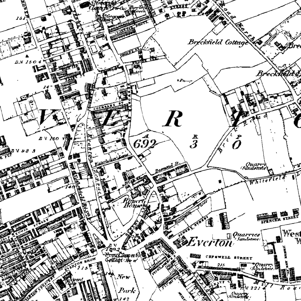
In the middle of the 19th Century Everton was only heavily built up to the west of Netherfield Road. The village of Everton (located at Village Street and Brow Side) was still just about discernable from the rest of the area even as the city of Liverpool encroached from the west.
New Park was marked on the 1851 Ordnance Survey map to the south of the village centre, and 'Prince Rupert's Cottage' was identified. The 'Cottage' sat in the middle of the village green, which was stood alone in the middle of the incoming roads: Rupert Lane, Netherfield Road South, Everton Terrace and Everton Brow. Rupert House, a building commemorating the royal visit of Prince Rupert in 1644, is also marked.
Most of the township at this time was covered in large villas with back gardens or yards. These were the dwellings of the wealthy businessmen who saw moved out of the dirty city to places like Everton, Toxteth Park and Kirkdale in the 18th Century.
Along with the houses a large number of sandstone quarries are marked. These are only small and the stone for them would have been used only locally.
An area to the north east of Everton village was St. Domingo. This centres around the Church of St Domingo and also Mere Bank, a large house. St. Domingo's Pit is also identified on the map, and the area is surrounded with the large merchant houses already mentioned. The pit was a shallow lake, or mere, from which the house no doubt got its name, along with Mere Lane which led down to the lake.
The two largest features on the map are the West Derby Union Workhouse which stood at the end of Mill Road in the east of the township, and the Zoological Gardens (complete with fireworks department!) just to the south east of this.
Finally, at the very south end of the township was the Liverpool Collegiate Institute on Shaw Street (now converted into flats) and the already dense areas making up Kensington.
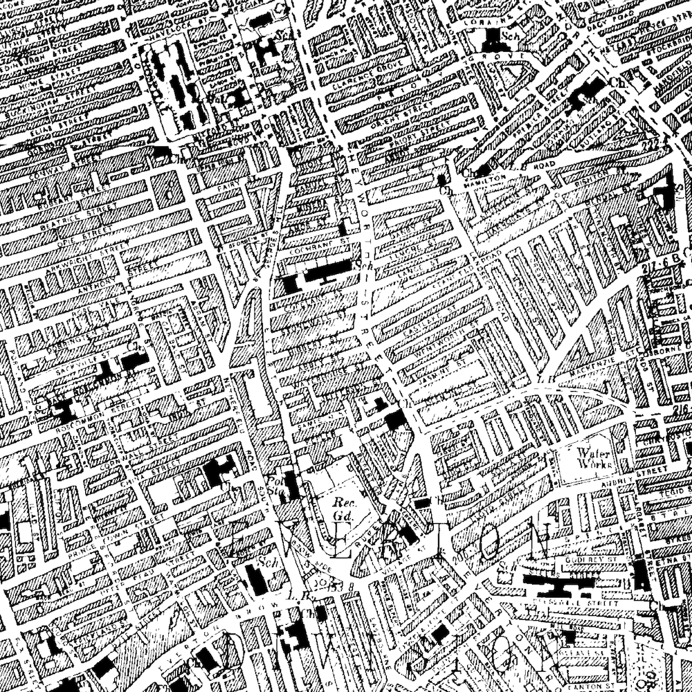
1894
The next Ordnance Survey map to be published of the area was in 1894. These forty years were some of the most crucial for Liverpool, and saw the almost complete transformation of the township of Everton.
Little remained from previous years save for the main roads and Rupert's Tower. A massive number of terraced houses had been built for the influx of people coming to find a job. Everton in particular was an area populated by Irish migrants; a high proportion of those who settled in this township were Roman Catholic. These terraces now appear to cover the entire area of the 1894 map. One of the largest gaps in this swathe of housing was the first building of the Notre Dame Catholic College.
The grounds of Rupert House (known to have been standing in 1830) by this time had a militia barracks built upon them.
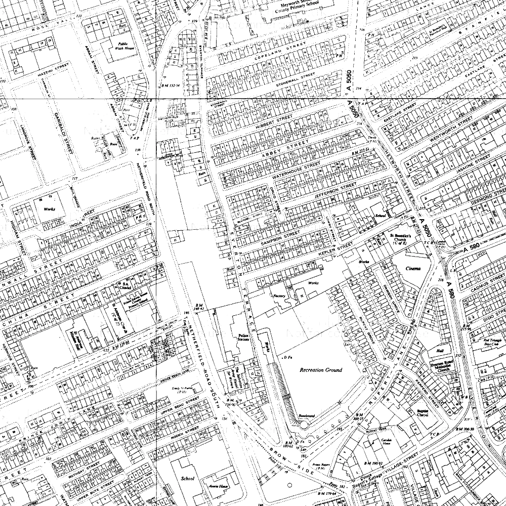
1910 to 1930
While this was a very important period in world history (with the Great War and a recession) Everton does not appear to have changed much on the map. The area was still covered in dense terrace houses and courts. Churches dotted the landscape and small industrial works can be made out.
The feature marked as 'New Haymarket' on earlier maps is now a covered market on the newly lengthened and straightened Cazneau Street.
By 1930 the militia barracks had been turned into a recreation ground.
Soon after the end of the Second World War Britain was entered a boom time. Attempts were being made to expand Liverpool's industry from dock working to manufacturing, and new plants like those at Speke and Aintree were the result of this. Alongside the new factories, edge-of-town suburbs were springing up to rehouse those who had been, until then, still living in the cramped Victorian streets.
During the 1950s and 60s these streets in Everton were to be demolished, but on the 1910 and 1930 maps there was no evidence of this was coming change.
1970
Although Everton was still generally a gridiron mass of roads and houses, the main arterial roads into the city had changed massively by the mid-1960s.
Scotland Road, Great Homer Street and Byrom Street had been widened and straightened, and a spiral junction had been built to take traffic into the Kingsway Tunnel.
Holes were beginning to appear in the fabric of Everton housing between Netherfield Road and Great Homer Street, north of Roscommon Street and where Campion Catholic High School now stands.
1978
By 1978 the clearances were almost complete (although the rebuilding was far from so). The space now occupied by Rupert Recreation Ground and Whitley Gardens had been cleared, but the roads were still marked on the Ordnance Survey map as rather sad dotted lines (a mirror image of when this was done on Victorian maps to denote streets in the process of being built). These large areas were later to be redeveloped as Everton Park.
2000
The transformation of Everton from its state in 1984 had now been completed. Almost all the small, straight side roads had disappeared, or been cut short and reshaped. Roads which once existed as part of the characteristic grid pattern can still be seen, but they are either dead ends or curved cul-de-sacs: Fitzclarence Street, Cochrane Street, Beau Street and Upper Beau Street are all roads marked on the 1894 map but which would be unrecognisable to their Victorian residents.
Conclusion
Everton was one of the first townships to see an influx of rich residents in the 18th and 19th Centuries. It was also one of the first to be overrun with masses of Victorian terraces which housed the dockworkers for which the city was famous.
As dock work became scarce, and well-meaning councils cleared the 'slum housing' after the Second World War, Everton was one of the many places where the heart was ripped out of the community and shipped the city outskirts.
While it remains one of the most deprived parts of Liverpool, it has been redeveloped with masses of green space, and still enjoys the lofty view over the city centre it was noted for in the Victoria County History.
Everton has been buffeted on the winds of change sweeping across Liverpool. How it fairs in the future will be just as dependent on Liverpool's fortunes as it ever was.
Mapping the history of Liverpool
Old maps, interactive maps and the historic landscape of Merseyside.
Buy maps
Many of the maps on this site can be bought as high quality prints, either as paper or ready-framed.
You can also buy notebooks, postcards, greetings cards and other map-printed items!
Go to the shop to find out more
The book
Liverpool: a landscape history is a book about Liverpool and Merseyside from the very earliest days to the 21st century.
You’ll learn about everything from the Calderstones to the Capital of Culture.
Signed copies are available direct from me, the author, in the shop.
#ads

A set of three matching Cassini maps from three different periods, designed to appeal to anyone who wants to discover the hidden history of their local landscape.
- Cassini Old Series Maps first published between 1805 and 1874
- Cassini Revised New Series Maps first published between 1896 and 1904
- Cassini Popular Edition Maps first published between 1919 and 1926
Leave a comment
james harry
06/16/2011 21:05:04
Reply to james harry
Martin
06/18/2011 17:44:20
Thanks for your comment. You're absolutely right - Ireland was part of Great Britain until 1921, and so the people coming over to Liverpool were not 'immigrants' by the strict definition of that word.
I've changed it in this article to 'migrant', which can refer to someone who goes "from one country, region, or place to another" (Dictionary.com) and so includes movement within a country.
I've also updated the History of Toxteth article, which referred to people moving from Staffordshire as 'immigrants'!
Thanks again for the tip-off. Hope the site has been useful and/or interesting for you.
Martin
Reply to Martin
Alane
10/23/2011 23:14:36
Do you know how I would go about finding an old map of where my Great Grandfather used to live in Everton ? I believe the house/mansion? was called Ashleigh and it was on Walton Breck road.
Alane
Reply to Alane
Martin
10/24/2011 19:12:46
It's funny you should ask this now, as I've just read a book about Anfield and Breckfield (Ordinary Landscapes, Special Places, by Adam Menuge) which mentions Ash Leigh (which was technically in Anfield).
Ash Leigh was a cul-de-sac which had five very large semi-detached villas on it, plus a couple of other large houses. These were inhabited by some of the wealthier Liverpudlians in the 19th century (In the 1851 census three of the inhabitants were Polish, German and Prussian merchants respectively), so perhaps your Great Grandfather was a business owner or merchant?
You can see the location of Ash Leigh on Google Maps: http://bit.ly/pXrdPX - draw an imaginary line between the end of Oban Road on the right and the right hand corner of Oakfield (the square road on the left).
To see old maps of the area, go to http://www.old-maps.co.uk, find the 'coords' boxes on the home page, and type 336715 in the first and 392705 in the second, then press 'Go'.
There is a list of maps down the right hand side - click on the second one down and wait for it to load a larger version in the main pane, and then click on the big version to zoom in once. You should just be able to make out the isolated cul-de-sac next to the words Monckton Lodge.
Clicking on the fourth map down (1851) will show you a much more zoomed-in map (scale 1:500), taken from a time when the area was much more built-up. You can buy copies of these maps by clicking on the Add to Cart buttons next to the relevant map (note, I've no connection with Old Maps and have not used the buying service, so can't vouch for them personally).
Reply to Martin
Martin
10/24/2011 20:19:01
Reply to Martin
Alane Beyer
09/05/2015 15:53:31
Happy to let you know we just came back from England visiting many Beyer family relatives, from London, to Guildford, Liverpool to Chester/Christleton ( they had all passed ). While in Liverpool we went to Rumford Place where G.G. Grandpa Gottlieb Beyer and his son each had their own office Gottlieb was in the Insurance business and Thomas Ernst was in Cotton. We also went to Ashleigh in Anfield but the family house had been long torn down.
Thanks to you for helping me find some of my history, Best Regards Alane
Reply to Alane Beyer
Martin Greaney
09/07/2015 21:28:43
That's great! I'm so glad this site helped you ground some personal family history in the landscape.
Regards,
Martin
Reply to Martin Greaney
Alane Beyer
09/25/2012 15:25:39
Gottlieb came from Preussisch Stargardt near Dantzig in Prussia he was listed as a Merchant” Preussisch Stargardt translated means Prussian Stargard, which is now Starogard Gdanski in Poland.
I also just found this link and it states in the 1851 Ordnance Survey map Gottlieb Beyer was living in a Villa called Ash Leigh http://www.walkingbook.co.uk/liverpool/anfield/pages/villas.htm
So exciting ! My husband and I are thinking about going to Gdanski in Poland next year ... but I am uncertain if any records of my family still remain there or were they are shipped off to Berlin were the Prussian records are suppose to be. ?
Thanks for your links this is just wonderful !~ Best Regards Alane.
Reply to Alane Beyer
Raif
01/07/2012 10:06:16
I'm trying to find some information about the history of buildings/properties in Fox Street Everton but not having much luck. I'm douing a resarch project for my university course.
I appreciate if you know how to access them.
Many Thaks
Raif
Reply to Raif
Martin
01/12/2012 12:15:18
Maps are probably a good first port of call, so http://old-maps.co.uk is a good place to start for old Ordnance Survey maps. You can search for the road name itself, and then the site gives you a list of maps on the right hand side which cover the area from 1850 onwards. You can buy copies of the maps from Old Maps, but you can also view them at Record Offices (Liverpool and Lancashire both cover the area).
There's a comprehensive coverage of researching the history of buildings (including residential ones) at http://www.buildinghistory.org/. For listed buildings, try English Heritage's Images of England (http://imagesofengland.org.uk) or their Heritage List (http://list.english-heritage.org.uk/)
Hope this starts you off on your research, but if there's something specific I've not covered, do let me know.
Regards,
Martin
Reply to Martin
Peter Bridle
01/23/2012 23:24:36
Reply to Peter Bridle
Maureen Lavis
02/10/2021 08:16:36
Reply to Maureen Lavis
Bob Edwards
01/25/2012 17:59:29
Reply to Bob Edwards
Alan Fargher
02/16/2012 20:58:21
Thanks Alan Feb 2012
Reply to Alan Fargher
Martin Greaney
02/16/2012 21:50:03
Having had a look around, I see from this discussion (http://www.rootschat.com/forum/index.php/topic,239503.msg1323962.html#msg1323962) that there are photographs of the home in Liverpool Record Office. The discussion mentions that one of the bosses was a Thomas Clingan.
For general information on workhouses, you can't do much better than http://www.workhouses.org.uk/. There are links to further resources. I think these should answer most of your questions which might apply to all workhouses (such as conditions, funding and who went there).
Regards,
Martin
Reply to Martin Greaney
sharon burke
03/06/2012 02:45:13
can anyone tell me if there were any houses on cochrane street in 1966?
my boyfriend is looking for his birth dad and on his dads birth certificate the address of his mother and father is 30 cochrane street however when i look on any map its either not there or there is only the hill o zion methodist church, anybodys help would be much appreciated
thanks
sharon
Reply to sharon burke
Martin Greaney
03/06/2012 17:48:56
Cochrane Street was in a huge area of dense 'grid-iron' pattern streets from the 19th Century up until the mid 20th Century. The small portion left of this street now runs through Everton Park, with just the chapel left. The 1967 Ordnance Survey map shows the street still in existence (including the chapel) and is marked with grey areas denoting buildings. So I'd say it did still have houses on in 1966, although this was a period of rapid change, and so would welcome any eye witness accounts!
See a map extract from Old-Maps.co.uk posted on the Historic Liverpool Facebook page.
Reply to Martin Greaney
Kay Roney
11/05/2013 07:32:35
Reply to Kay Roney
Martin Greaney
11/06/2013 18:49:44
Thanks for adding some very useful information to the site. I know that quite a few enquirees read and even respond to messages here, so they're definitely read!
Regards,
Martin
Reply to Martin Greaney
Karl
03/25/2012 01:03:36
Im looking for photographes of the two blocks of flats that were situated on Netherfield Brow, can anyone help? They were two massive blocks from what I remember. Id love to see any pictures of them.
any help would be most appreciated, thanks.
Reply to Karl
Martin Greaney
03/27/2012 14:56:59
There are a handful of photos of this area on the Orange Pages website. I think the blocks you are looking for are in the left hand photo on the 7th line down.
Martin
Reply to Martin Greaney
Steve Noonan
03/27/2012 09:56:23
Cochrane Street still existed in 1966, although they were starting to demolish parts of St Georges Hill around that time which Cochrane Street ran into. There are photo's of the street available. The L5 site on facebook has a few which are easily accessible. Hope this helps.
Steve Noonan (eyewitness, I was 11 at the time).
Reply to Steve Noonan
Martin Greaney
03/27/2012 12:53:46
Thanks for your comment. Do you have a link to the L5 site? Would love to see those photos you mention.
Martin
Reply to Martin Greaney
George Kinder
08/25/2014 11:06:06
Reply to George Kinder
Ron Creer
04/09/2012 13:32:00
Reply to Ron Creer
Martin Greaney
04/11/2012 16:33:12
While it's hard to pin down exact reasons why certain roads and areas were redeveloped, large areas of Everton (and elsewhere in the city) were cleared because the housing quality was deemed too low. While I'm aware that these decisions were not always agreed with, Liverpool in the 1960s was caught up in clearance fever after the Second World War destroyed many old buildings and presented an opportunity to redesign the whole city like never before. Great Homer Street, Scotland Road and the areas right over to Breckfield Road were redeveloped several times in the 20th century, in trying to deal with a housing problem (of quality and quantity). It's likely that your family's shop fell in an area destined for widespread redevelopment.
You may (rightly) believe that your own house was in perfectly good condition, and many were, but these massive schemes were too ambitious to worry about such details. Many of my own ancestors homes in Everton (Back Roscommon Street) and Toxteth disappeared beneath both road widening and slum clearance, even though in some cases I believe the quality of houses was not consistently bad enough to warrant total destruction. The market was probably part of this, in all a giant redesign of Everton.
You may find more information about the reasons for, and impacts of, the clearance of this area in Ken Rogers' very popular book The Lost Tribe of Everton and Scottie Road.
I'd be really interested to read the book you're writing. Is this something you'll be publishing widely?
Martin
Reply to Martin Greaney
im david duffys lost son adopted in 1960
04/12/2012 11:21:55
Reply to im david duffys lost son adopted in 1960
tony farley aka john milligan
04/25/2012 10:26:00
i was born in 1960 given up for adoption mum went to america
Reply to tony farley aka john milligan
john milligan
04/18/2012 11:27:16
i might be related to the duffy family
either david or john.
Reply to john milligan
Stephen Bell
05/23/2012 22:42:32
Trying to find Hibbert Street around 1880!
Reply to Stephen Bell
Martin Greaney
05/24/2012 11:15:25
Thanks for your kind comment - I'll definitely correct that spelling, as I think you're right!
Hibbert Street was located where Everton Park now is, between Roscommon Street to the west and Stanfield Road to the east. My map of 1890 has road names on it, and the bigger version, centred on Hibbert Street, is here: http://historic-liverpool.co.uk/old-maps-of-liverpool/plan-of-liverpool-north-sheet-1890/#5/51.193/-26.279 The smaller version is available on the Old Maps of Liverpool page of this website, the 'Plan of Liverpool - North Sheet (1890)'.
Enjoy the site, and good luck with your family history!
Martin
Reply to Martin Greaney
Kay Roney
08/30/2013 02:58:15
Reply to Kay Roney
Kay Roney
11/05/2013 07:25:57
Reply to Kay Roney
ann kilshaw
07/15/2012 20:31:11
Reply to ann kilshaw
Martin Greaney
07/23/2012 21:27:18
Regards,
Martin
Reply to Martin Greaney
Tom
07/25/2012 21:44:10
Reply to Tom
Martin Greaney
07/26/2012 21:17:00
Not sure if this is what you were after, but those streets where Gerard Gardens were built are shown on an 1890 map as being in St Anne's Street Ward. Let me know if this wasn't what you meant.
Martin
Reply to Martin Greaney
Phil Holt
08/15/2012 22:24:01
I've been tracing my family tree for a while now and have recently found out that my family also lived in 30 Cochrane Street for a long time, maybe your partners family and my family are connected?
Reply to Phil Holt
pat obrien
09/24/2012 17:56:15
Reply to pat obrien
Martin Greaney
10/14/2012 11:55:23
I'm not sure of the specifics of the demolished villa or its owner, but St Domingo Grove was built in about 1846, but had stalled in 1851. At this time the demand for large houses in Anfield / Everton was on the decline, because the middling and lower classes were moving in! The merchants were on their way out to West Derby or Childwall. Some more building took place on the Grove in the 1860s.
In the years leading up to this time, Anfield had become one of the first new suburbs to be popular with merchants, bankers and diplomats after Liverpool's expansion had gone beyond the likes of Kirkdale and Islington. The first houses to be built in Anfield (after the original village and farms) were all large houses like the one you mentioned. There's a lot of good information about the changing landscape of Anfield and Breckfield in English Heritage's book Ordinary Landscapes, Special Places, available in the Liverpool History Bookshop or on Amazon.
Reply to Martin Greaney
pat obrien
09/26/2012 19:03:00
Reply to pat obrien
Pearl Evans
10/09/2012 00:57:33
Many thanks Pearl
Reply to Pearl Evans
Martin Greaney
10/14/2012 12:30:44
I've not been able to find any contact details for them. Perhaps you can get in touch with St. George's Church in Heyworth Street, where they had their first meeting in February. They may be in touch with the organiser. There's some details for them on the A Church Near You website. I'll try to find out the group's details myself and post back if I find them.
Martin
Reply to Martin Greaney
Angela
11/04/2012 19:55:44
they meet at the WECC. Get in touch with Paula at WECC, Friary Centre (Old Faith School), Bute Street – 0151 282 0303. She surely can tell you more details. The History Group will be happy about new companions.
Angela from Berlin
Reply to Angela
Martin Greaney
11/14/2012 21:44:48
Martin
Reply to Martin Greaney
Dawber street liverpool 6
10/10/2012 17:32:48
a pub called the Cottage at the bottom of the street and Whitefield Terrace also ran into Dawber Street.
Reply to Dawber street liverpool 6
Brian Taylor (Tinker)
03/27/2013 00:04:05
Reply to Brian Taylor (Tinker)
Kevin Balmer
11/24/2015 13:24:17
I am aged 58 my dad's coming up to 83
Reply to Kevin Balmer
pete an hilda
12/01/2016 19:25:02
Reply to pete an hilda
Kevin Balmer
06/15/2017 02:59:02
My dad Joe is okay, sadly my mum Elsie passed away in 1990 she had a stroke.
She was only 53 then.
I love thinking about the old areas and streets where we grew up.
Lovely to hear from you and interesting that you knew mum and dad. x
Reply to Kevin Balmer
Judy
10/12/2012 05:27:33
Reply to Judy
Martin Greaney
10/14/2012 12:43:24
There's a list here of lost pubs in Liverpool, of which the only one on Great Homer Street is the Lamplighter. Could this be the one you're interested in?
Martin
Reply to Martin Greaney
marjie mayne
01/17/2013 22:38:59
Marjie
Reply to marjie mayne
Martin Greaney
01/27/2013 17:04:58
There's a couple of good photos of Grants Gardens on the Liverpool Picturebook website, including one of the playground. Liverpool Picturebook is proving itself to be a great resource!
Hope this is of interest to you.
Regards,
Martin
Reply to Martin Greaney
jim todd
01/19/2013 23:18:09
Reply to jim todd
Sue Carmichael
02/19/2013 17:20:43
My great-grandfather, John Henry Naylor lived at 13, Rupert Hill in 1891. I believe the building was the Labour Party Rooms and John Henry & his wife were caretakers. John Henry was also a City Councillor in the early part of the 20th century.
Reply to Sue Carmichael
Martin Greaney
02/21/2013 15:53:11
Thanks for your kind comment, and your extra info on Rupert Hill! Interesting facts about John Henry as caretaker and Councillor.
Martin
Reply to Martin Greaney
Sue Cottrell
02/24/2013 13:12:02
Reply to Sue Cottrell
Andy Hyams
02/27/2013 16:57:48
I don't known if you know anywhere where I can find photos of where I was born which was Aubrey St which sadly no longer stands?
Reply to Andy Hyams
Martin Greaney
03/17/2013 13:00:32
There's a photo of Aubrey Street on Flickr, taken in 1954, which might be of interest. I've also seen a reference to one of a pumping house, which is held by English Heritage in their Archive. The record, named "Water Works, Aubrey Street, Everton, Liverpool" is on the English Heritage Archives website. They're normally happy to send you a decent quality photocopy for free, or a better copy at various prices.
Martin
Reply to Martin Greaney
Andy Hyams
04/19/2013 14:15:43
Just wanted to say thanks!
Reply to Andy Hyams
Julie o Hanlon
04/19/2013 01:12:38
I am trying to find any pics etc of my grandparents shop on Everton brow
Any ideas please
Julie
Reply to Julie o Hanlon
Sheila
05/08/2013 17:13:47
Sheila.
Reply to Sheila
Sheila
05/08/2013 17:11:08
The family name is Earlam.
They definitely ran the shop during the second world war, upto I guess the mid 1950's. Be great to find any history, photos etc if you can help or point me in the right direction. Many thanks. Sheila.
Reply to Sheila
Kay Roney
08/30/2013 03:12:21
Reply to Kay Roney
Kay Roney
08/30/2013 03:13:48
Reply to Kay Roney
Martin Greaney
09/01/2013 14:06:21
Thanks for sharing your memories with us! Sound like fond recollections!
Martin
Reply to Martin Greaney
Sheila Williams nee Earlam
09/12/2015 18:28:37
Please forgive the time in answering. I am sorry that I haven't read your answer till now.
You have the right Earlam family! Thank you for telling me where on Heyworth Street it was as I can now research whether the building remains.
They did indeed have a Lancashire accent, although they hailed from Frodsham/Runcorn (think my Great Grandparents had Lancashire connections, they ran the shop too).
It's so surreal to write to someone who remembers them!
They moved to Melling Road Aintree at some point in the 1950's.
Thank you so much xx
Reply to Sheila Williams nee Earlam
Kay Roney
12/05/2017 18:18:26
Reply to Kay Roney
Mary Wadsworth
05/04/2014 18:33:00
You have been asking about your grandparents in Everton LIverpool you also. mentioned Rosscomon St. My grandmother and mother were born in Rosscomon st no 18and16 .The property,s were bourght by my gg grandfather a farmer from Shropshire and turned intoThe Farmers Arms an Hotel for farmers to stay who took produce to sell in The Haymarket there were also large stables for their horses., The property,s were purchased in 1865 and sold in 1948 after the Haymarket was moved to Smithdown Road.I was born in 1931 a farmers daughter from Melling and well remember visiting my grandfather most week,s. Two or three doors away lived a Mr Earlam a Vet he was a friend of my grandfather and his family and I am wondering if this Mr Earlam is your relation . Mary
Reply to Mary Wadsworth
Mary Wadsworth
05/04/2014 18:37:34
Reply to Mary Wadsworth
Sheila Williams nee Earlam
09/12/2015 18:40:52
My apologies for not replying until now and thanks for your comment.
Kay has definitely got my Grandparents shop (see her comment above) and I wish I had seen her reply sooner.
The Mr Earlam you mention, who was a vet, I don't think has any connection to my family. But thank you anyway.
Xx
Reply to Sheila Williams nee Earlam
Gerry Quinn
05/27/2013 21:25:56
My father was born and lived the early part of his life in Roscommon and Langrove Street around 1910 and I'm having some difficulty piecing together those times. Do you know where I could locate the history of the local schools of that area please?
Thanks
Gerry.
Reply to Gerry Quinn
Martin Greaney
05/28/2013 11:57:41
There's a bit of information on certain schools in that area. The Liverpool Record Office has some records, as detailed on the Liverpool Genealogy website. Roscommon Street School gets a mention on the In A City Living site which has all sorts of great images on it.
Were there any specific schools you were interested in?
Regards,
Martin
Reply to Martin Greaney
Gerry Quinn
05/28/2013 12:08:21
Thanks for your quick reply. I am not sure which schools I should be looking at. The family were in Langrove Street and then moved to Binns Road so I first need to find which schools served those areas. I am in the Central Library on Thursday so will have a chance to look at some more schools information then,
Regards,
Gerry.
Reply to Gerry Quinn
Rose
08/20/2013 19:42:09
Have you any pictures of a block of flats just three story high!
My family lived there on the top floor right along side the little Everton castle.
Our surname was Lowry
Love to see a picture.
Reply to Rose
Jude Burns
10/02/2013 23:42:58
Reply to Jude Burns
gay fairbrother nee usher
11/03/2013 15:02:09
Reply to gay fairbrother nee usher
Fiona Sneesby nee McCullock
01/26/2014 20:10:31
I am looking for help with a photograph of my nanas's house. It was on Walton breck road and was one of the house on the left hand side going down towards everton valley, that were demolished in the 1960's. it just a grass patch now. My nanas's name was Mary Chatterley and she had twin daughters May and Lilian. If anyone can help with this I would be so very happy..
Reply to Fiona Sneesby nee McCullock
Joan Jaffrey
02/10/2014 13:51:42
Reply to Joan Jaffrey
Mike jones
09/21/2014 00:45:27
Give me a message to shirburn @ gmail.com
My grandad was Pop Jones who lived at acacia house
Mike
Reply to Mike jones
Sue Stewart
05/13/2014 02:12:48
Reply to Sue Stewart
Martin Greaney
05/16/2014 08:16:26
Cazneau Street was named after Mr. B. B. Cazneau, who laid out the street, and probably owned the land. He lived at the bottom of Islington.
If I ever get to lay out a new road, I'll certainly be naming it after myself! ;-)
Regards,
Martin
Reply to Martin Greaney
Dave Davies
09/09/2014 15:11:53
I`m looking for any information about my Dads family who lived at 43 Stanfield Road until it was demolished.
The family name was Davies and later Earle.
Any added information about my Grandad Davies who was employed by the Corporation Water Dept`until the late 1950`s would be helpful .
Reply to Dave Davies
Martin Greaney
09/11/2014 17:59:40
Unfortunately I'm no family historian, so wouldn't really know where to start on family research. I'm more knowledgeable about streets, buildings, maps etc, so if there's anything specific you're interested in just let me know.
Regards,
Martin
Reply to Martin Greaney
MARGARET BURNETT
11/17/2014 17:00:14
Reply to MARGARET BURNETT
Martin Greaney
11/18/2014 17:40:37
Village Grove was a very small road which extended south from Village Street. It survived until the 1960s when a huge part of Everton was redeveloped. Although Village Grove no longer exists, Village Street is still there, and runs through Everton Park. You can see the original street layout in this map from the 1940s or 1950s:
Compare that to a satellite view of the same position today on Google Maps: https://goo.gl/maps/lDBoF
Hope this helps!
Regards,
Martin
Reply to Martin Greaney
Jane
04/08/2016 07:54:00
I'm new to this site as Martin will attest to - I love family research.
If its not too late - & hopefully you still check in - I've just found your Grandfather Edward Davies living at 43 Stanfield Road, b.24 August 1888 - Occupation:Road's Labourer working for the L/pool Corp.
His wife Alice b.18 March 1899 - her surname possibly Cooper married 1924.
Elsie b.27 September 1924 - Elsie marries Robert Earle on 22 April 1954
Ironically I have an Earle branch in my family tree so there could be a possibility there's a closer connection!
Hopefully you'll get this message
Kind regards
Jane
Reply to Jane
Dave Davies
09/17/2024 00:11:02
Reply to Dave Davies
Roy
09/21/2014 14:22:23
I apologise if this question is off-topic, but I'm trying to remember the name of a second-hand shop in this area where I bought a guitar in the early to mid 1970's.
As far as I can remember, it was located at or near the three-way junction of Scotland Rd, Stanley Rd and Kirkdale Rd. I'm almost sure it was on the right-hand side of Scottie Rd as you're facing the town centre.
Does anyone remember the name of this shop?
Reply to Roy
sharon ray
10/13/2014 22:19:12
Reply to sharon ray
mike wiliams
11/12/2014 07:25:44
My grandmother lived at 35 Everton Valley. Last name was Chapman first name Eva. Sisters were named Alice and Phyllis. Brothers were Fred, Edward and Sidney. just wondering if anyone had any pictures of the houses on everton road before they were demolished. I can remember going there in the 1970's as a child. family members lived at 35 Everton Valley from the 1920's to 1990's. I moved to Canada in 1982 and haven't been back since.
Reply to mike wiliams
Pauline cook nee lawson
05/05/2015 15:06:32
Reply to Pauline cook nee lawson
Steve Lord
06/02/2015 09:48:40
Reply to Steve Lord
Steve Lord
06/02/2015 09:50:02
Reply to Steve Lord
Sheila Williams nee Earlam
09/12/2015 18:55:05
Reply to Sheila Williams nee Earlam
Kay Roney
12/07/2017 19:54:19
Reply to Kay Roney
Paul Martin
02/18/2016 19:33:20
Reply to Paul Martin
Martin
02/19/2016 15:57:32
Thanks for pointing this out!
Martin
Reply to Martin
Stacey
06/24/2016 15:48:47
Just found this page today... and I love reading the history *and* all the posted comments.
I was looking for Beatrice Street in Everton where my Grandfather was born in 1872, and figured out before finding your page, that it is now gone.. and there's a huge park in that area. :) I'm ok with that. lol My grandfather and grandmother had set sail for Canada in the late 1800s. I had heard through the family chit chat that my GG (John Bradley / wife: Mary Alice (Smith)) had once owned a very popular candy / sweet shop in the area. I haven't any further information, however I had thought I would post the comment in case someone may know something about it. I'm also looking for any of my grandfather's siblings (he was also John Bradley, as was my dad and now my brother)
Thank you!
Stacey
Reply to Stacey
Stacey
06/27/2016 02:28:18
Reply to Stacey
Martin
07/10/2016 21:11:33
Martin
Reply to Martin
Hilary mern
10/01/2016 10:40:25
Do you have any old photos of Langrove street, (no. 4)
My gg uncle John Frithiof Lundstrom lived there with his wife Caroline Jane Maylor. Old homes replaced by new ones hence the request for photos , does anyone recognise the names, he was Finnish, a mariner he was living there in 1878.
Reply to Hilary mern
Martin
11/03/2016 21:55:35
Sorry, I've not been able to find any photos of that street from the period you're interested in. I've seen a couple with newer housing on from the 1980s, but I'll keep an eye out!
Martin
Reply to Martin
Jane Francis
11/22/2016 16:31:42
Reply to Jane Francis
Martin
11/30/2016 20:59:49
After a quick look I can't find any photos at the moment, but if I do come across any I'll be sure to share them!
Martin
Reply to Martin
Jane Francis
12/05/2016 23:48:13
Reply to Jane Francis
Chris Bailey
12/28/2016 19:06:31
Reply to Chris Bailey
Gwen Brophy
08/21/2022 22:10:11
Reply to Gwen Brophy
Chris Gatley
08/07/2017 22:33:49
Just wondered if anyone else knows anything that sounds familiar?
Annie, at the time, lived at 14 Fielding Street and Edward was at 77 Eastbourne Street.
Thanks,
Chris
Reply to Chris Gatley
Vivien Lake
07/09/2018 04:49:49
Reply to Vivien Lake
Martin
08/02/2018 18:25:41
I can't find out for certain, but it doesn't look like Everton Road would have gone that high in 1891. It's quite a short road and even today (with fewer houses on it) it only goes up to about 70 - 80. Could the census have been mis-transcribed, and said 30b or something like that? I might be wrong on the house numbers anyway, but it's just an idea.
Best wishes,
Martin
Reply to Martin
Vivien Lake
08/03/2018 03:40:03
Thank you for looking into my request and replying to me. The information regarding the address came from my grandfather's army papers and is very clear with three numbers. I asked this question on another site many years ago and your answer is the same as the one that I received. That the street numbers did not go that high in 1891 and still don't. Maybe there is another Everton Road somewhere in Lancashire with numbers that go that high.???
Regards
Vivien
Reply to Vivien Lake
Martin
08/14/2018 15:40:30
Martin
Reply to Martin
Sherry Rowley
11/24/2025 21:38:15
Reply to Sherry Rowley
Kay Roney
08/15/2018 20:36:20
Reply to Kay Roney
Claire
08/27/2018 15:51:33
My Great Grandfather lived at number 19 in the 1890s' but I can't find it on a map.
Regards
Claire
Reply to Claire
Martin
08/28/2018 11:31:23
Church Place was off Heyworth Street, and there is now the Beacon School on the site. On my North Plan (1890) it is probably one of the unnamed streets just south of St George's church here: https://historic-liverpool.co.uk/old-maps-of-liverpool/plan-of-liverpool-north-sheet-1890/#5/62.755/-29.136
Source: http://www.yoliverpool.com/forum/showthread.php?37208-Church-Place-Everton
Best wishes,
Martin
Reply to Martin
Joseph carroll
09/22/2018 13:35:44
Reply to Joseph carroll
Alannah
02/18/2019 18:50:01
1. Liverpool's Capt Edward Hayes family of West Derby, Everton and Kirkdale from 1500's trying to connect them to
2. the Heyes family of 1600's/1700's early Everton recorded In many old 'google books. I have descriptions of where the Heyes Everton manors were and records of the development involvement by George and Thomas Hayes.
3. then onto my family of poor William Heyes born approx 1805 (married in St Mary's Walton on the Hill with very nice signature spelling of HEYES which later was always HAYES) very difficult finding anything on his origins.
It is also kind of a reflection of the Rich to Poor residency of Everton through my own Heyes family of which I knew nothing about until I discovered my ggrandfather was a BHC from Liverpool Sheltering Home not an Irishman from Dublin. I have pages of research but if you know a researcher willing to assist me I would be grateful. The Lancs History forum pointed me to the old google books which was extremely informative. Thanks...love your site.
Reply to Alannah
Martin
02/20/2019 09:39:57
Glad you like the site! Heyes Street is not that old - it's shown on OS maps from 1891 without any buildings yet on it, so that'l be close to its building date. It takes a while for the houses to be built there. Little Heyes Street is even later. It's not marked until the 1950s, and then only as Heyes Street as well. (See for example https://www.old-maps.co.uk/#/Map/337503/391500/12/101104)
Though the streets aren't old, it's still possible that they were named after the landowners, perhaps of the Heyes estates. This might make sense if the plots of land still hadn't been purchased from the old owners. For that you'd have to see if you could find land deeds. I'm not a great expert on them, but I'm sure the Record Office could help, and perhaps someone on here could too.
Martin
Reply to Martin
Alannah
02/20/2019 12:28:38
Reply to Alannah
Martin
02/20/2019 12:52:25
Martin
Reply to Martin
Martin
02/21/2019 09:38:16
I just noticed this while browsing a new website I'd been told about. Not sure if you've seen it before, or even if it's related (different spelling), but: https://www.watercolourworld.org/painting/untitled-inscribed-wall-mounted-tablet-tww00c10f
Martin
Reply to Martin
Alannah
02/21/2019 15:22:28
My great grandparents had no idea they had a common ancestor 300 years prior (prob so common) if I can find the link in the chain within this area between 1800 and 1550 and no false paternaties (again prob common). BTW one of the London publishers of Shakespeare's folios was bookseller Thomas Hayes and have only been able to discover his son took over the biz nothing else on them. Curiously it was my grandmothers line back to 1600s Stratford that all of a sudden revealed Sir Thomas's daughter which opened up this whole investigation. I have never had a family history unfold like this before in its magnitude they were mostly Cdn Irish descent fisherman. I really do encourage people to look into their DNA (Not talking about being tested Not a fan of giving it away) by combining genealogy and the historical events going on around our ancestors for a bigger cultural experience. Sorry Martin my passion gets away from me. I appreciate the personal assistance you and your site offer very much. I find British history forums are very helpful.
Reply to Alannah
Martin
02/22/2019 15:18:27
Blimey, sounds like you have an excellent genealogy to look into! No wonder you're so keen. :) My ancestors are Irish on both sides if you look at about 3 generations ago, with branches coming in from Scotland and across northern and southern England. It's mostly 'ordinary' folk (if there is such a thing) with a couple of interesting highlights. Best of luck with further research!
Best wishes,
Martin
Reply to Martin
Alannah
02/24/2019 04:34:18
describing the houses heading north of the Welsh Chapel left after some demolition 1860's although not mapping it well I have found more info on exact properties...
'This site, with a great part of the other property in the neigh- - bourhood, formerly belonged to the Heyes's, one of the Heyes. original Everton families. By marriage this property passed to the Rowes, who resided here for some time. It was subsequently sold to Mr. James Plumpton, who about 1830 took down the old house and erected the present mansion. The next house to the north, with stone front and mul- lioned windows, was the residence of the Heyes's. It bears the inscription on the front 'Thos. Heys, 1734.' a.d. 1734. This property passed by marriage to the Pykes, who also owned large property in Everton, and erected several of the houses in this immediate neighbourhood. On the west side of the road immediately opposite formerly stood a mansion erected by Mr. John Pyke, who resided there Pyke. for many years. At the four lane ends we will turn westward down import Rupert Lane. '
Reply to Alannah
Alannah
02/24/2019 06:07:00
1716: Henrietta Maria daughter of the Earl of Derby leased to J Seacome of LP, H Halsall R Johnson and T HAYES of Everton 115 acres in Everton incl Hangfield Whitefield and Netherfield . In 1790 the whole of Locality 19,k was owned by widow Mrs Thomas Heyes a family with extensive possessions in old deeds maps etc. The name Heyes has become extinct in the township except for some of the juvenile descendants. The property went down to her niece's husband John Pyke. Both Mr John Rowe and Mr Beezley married George Heyes' daughters who were co-heriesses of their father's estates including locality 19,i or Beacon-Hey. George Heyes owned approx 10 acres Mere C19i, Beacon A 2m & n, Hill-side A46 a, Widdowsons A 15q, Whitefield G, Sleepers Hill D15a, End Whitefield G 15m, /butter-holes G 15s, /rottome Honefield E 15c. 1737-38 Thomas Heyes was constable tax collector etc 1737-38, 1741-42.
So looks like Beezley and Rowe inherited all the property down from Thomas to the grandaughters through George so the Heyes name daughtered out in the area except for some 'junior members of the Heyes family'. One of them could have been my William Heyes father as he was born 1802-5 ish. So will attempt this Heyes family tree and look for this 1790 property map. I'm getting somewhere at least with this 'middle' timeline in my missing links.
Reply to Alannah
Martin
02/25/2019 17:19:34
Best wishes,
Martin
Reply to Martin
Robert Farrell
05/01/2019 23:43:23
Do you have a link or any details of photographs of Beacon Lane from around 1910. I have been researching family history and two ancestors have shown this address. Thanks
Reply to Robert Farrell
Kay
05/02/2019 18:09:57
Reply to Kay
Martin
05/02/2019 18:13:30
Beacon Lane was in that part of Everton that was once a fashionable area with large villas, and their grounds. By 1910 (or at least the 1908 map) it was covered in terraced houses. You can see these on this old map: https://www.old-maps.co.uk/#/Map/335631/392596/13/100674.
Large swathes of these houses were demolished in the 1950s and 1960s, and so now Beacon Lane is an L-shaped road which has two ends onto St Domingo Road. Though if you look on the Google Maps Satellite view you can see the line of the old road in the green space north of it.
I haven't got any photos from 1910, but the Liverpool Pictorial website has a lot of those terraced houses from 1967 which might be of interest: https://web.archive.org/web/20210731092116/https://www.liverpoolpicturebook.com/p/l4-l5.html
Regards,
Martin
Reply to Martin
Jen
02/14/2021 13:41:25
Thank you
Reply to Jen
Martin Greaney
02/19/2021 11:39:14
It might be worth looking on the National Library of Scotland website, where there is a detailed map, though of course it depends on the era we’re talking about. Start here and see if you can see what you’re looking for: https://maps.nls.uk/geo/explore/side-by-side/#zoom=17.619553573199852&lat=53.41865&lon=-2.96100&layers=168&right=ESRIWorld
Regards,
Martin
Reply to Martin Greaney
Kay
02/19/2021 16:51:09
Reply to Kay
Jim Quinn
03/02/2024 12:48:07
I was born (literally) and lived for 20yrs in Steers St., which you mention . I knew the places in your article which is one of the few which mentions Steers St.
I was most disappointed when "The Lost Tribe of Everton " did not even acknowledge that it even existed!
Jim Quinn
Reply to Jim Quinn
Verity Ferguson
03/02/2021 21:42:55
Reply to Verity Ferguson
Richard Glover
04/10/2021 05:13:49
I am really interested in the location and any existing old photographs of Beresford Street and Bute Street, Everton.
My 3rd Great Grandfather, Thomas Glover was a resident of 5 to 7 Beresford Street in 1861 and occupation was Cowkeeper. I am presuming a large backyard at this location.
The family moved and were living at 45, 47 & 49 Bute St, Everton. I presume again with such a large family the houses at these locations were small.
Finally a move to 77 Hawkstone St, Toxeth Park by 1881. Not sure if a Cowkeeper or not.
I very much doubt these buildings or streets exist today
Thankyou
Cheers
Richard
Reply to Richard Glover
Martin Greaney
04/13/2021 20:44:09
You're right, the houses there (all long gone now) were small terraces, with larger buildings for breweries, other industries, and churches and pubs. I couldn't say exactly which one your GGG Grandfather worked at but there are all sorts of yards and alleys: https://www.old-maps.co.uk/#/Map/335318/391608/13/100871
Really interesting vocation, and worth reading these notes and discussion on them in Liverpool: http://www.davejoy-author.com/daves-blogchat/a-sense-of-place-the-cowhouses-of-liverpool
Best wishes,
Martin
Reply to Martin Greaney
Valerie
04/28/2022 19:43:42
Reply to Valerie
David Peate
01/21/2024 14:27:43
Reply to David Peate
Jim Quinn
03/02/2024 12:31:17
The word FAIR should be spelt - FARE. A rather different meaning!
Reply to Jim Quinn
Tracy
09/09/2024 14:25:04
Thank you
Reply to Tracy
Tracy Williams
10/05/2025 09:09:47
My Dad never went back there?
Does anyone know any living Bambrough’s in this area or surrounding.
Reply to Tracy Williams
Julie First
10/29/2025 18:27:03
As a previous contributor said Aubrey St is no longer there so we have very little information to go on.
It would be really helpful if any one did know the Michaels' family at that time.
Thanks very much
Reply to Julie First
Carole
01/25/2026 19:17:34
Reply to Carole