Buildings Queensway Tunnel January 3, 2018 / July 7, 2026 by Martin Greaney | Leave a Comment The thing which inspired this website from the outset was the huge number of historic features in Liverpool that we take for granted every day. The Queensway Tunnel is one... read more Read more »
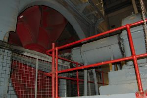
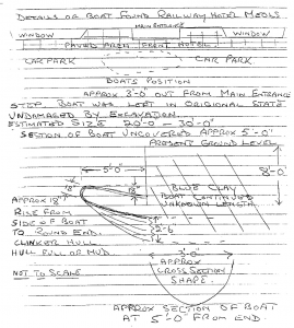
Archaeology Viking boat at Meols November 11, 2017 / July 7, 2026 by Martin Greaney | 1 Comment on Viking boat at Meols In 2007, Professor Stephen Harding and a team of archaeologists from the University of Nottingham brought attention to a possible Viking boat buried under the car park at the Railway... read more Read more »
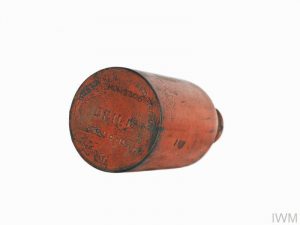
Archaeology World War II Grenades, Kirkby November 11, 2017 / July 7, 2026 by Martin Greaney | 1 Comment on World War II Grenades, Kirkby In 2009, workmen discovered twenty Second World War grenades in Ruffwood Drive, Kirkby, while digging foundations. Police carried out controlled explosions on the grenades. The AW Bombs (manufactured by Albright... read more Read more »
Archaeology Ridge and Furrow, Medieval farming remains in West Derby August 15, 2017 / July 7, 2026 by Martin Greaney | 5 Comments on Ridge and Furrow, Medieval farming remains in West Derby Ridge and Furrow formations are possibly one of the best-known archaeological features which survive into the modern day. You can see these long, sinuous raises beds of earth across Britain.... read more Read more »
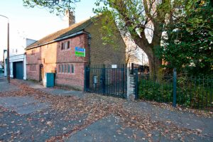
Buildings Yeoman’s House, West Derby Village February 5, 2017 / July 7, 2026 by Martin Greaney | Leave a Comment The ‘Yeoman’s House’ (as it is known locally) dates from the 1580s, so is a cherished historical feature in the village of West Derby. Others include the similarly-aged courthouse across... read more Read more »
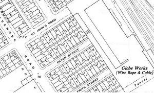
Landscapes Paton Street, Kirkdale, in aerial photos and maps January 9, 2017 / July 7, 2026 by Martin Greaney | Leave a Comment A question came in back in October 2016, looking for information on Paton Street in Kirkdale. I couldn’t find out any information on this myself, as there were few clues.... read more Read more »
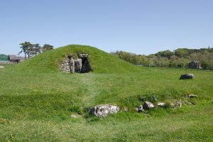
Landscapes Neolithic Anglesey and the Merseyside connection May 22, 2016 / July 7, 2026 by Martin Greaney | 1 Comment on Neolithic Anglesey and the Merseyside connection Anglesey and North Wales are very close to Liverpool hearts. Countless Welsh builders helped create some of our inner suburbs in distinctive yellow brick, and the red bricks of the... read more Read more »
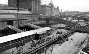
Hidden History Rail remains of Liverpool Riverside Station February 20, 2016 / July 7, 2026 by Martin Greaney | Leave a Comment Following the curve of Princes Parade, on the north west side of Princes Dock, are a set of rails which are one of the few clues left to the presence... read more Read more »
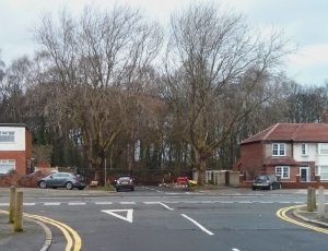
Hidden History Parkside Drive – a West Derby bypass? February 12, 2016 / July 7, 2026 by Martin Greaney | 5 Comments on Parkside Drive – a West Derby bypass? Plans were once put together to make West Derby a more peaceful village. Only a few clues now remain to those plans, like Parkside Drive. Martin’s Note: I’m indebted to... read more Read more »
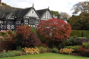
Buildings Speke Hall and the Speke Estate February 6, 2016 / July 7, 2026 by Martin Greaney | 4 Comments on Speke Hall and the Speke Estate Speke Hall is one of the most famous historical features on Merseyside. Its distinctive black and white appearance, highlighting its amazing timber structure, make it a memorable sight for visitors.... read more Read more »