History of Walton: ancient church to modern suburb
Walton-on-the-Hill has always been a very large township, containing some of the familiar suburbs in north Liverpool. At the north of the township is Warbreck, on the border with Aintree. The Guildhouses were also to the north. Spellow, Anfield, Walton Breck (also known as Cabbage Hall after an old pub) and Newsham run from the north west to south east.
The old village originally surrounded the church, and Rake and Cherry Lanes ran east to West Derby.
The church at Walton (like that at Childwall) has a circular churchyard, suggesting it was part of a settlement in existence before the Norman Conquest. It was certainly the mother church of a medieval parish. As such, it may have had its name changed to a 'British' one, perhaps through a grant of land from the church to someone else.

Recommended sources
Website: https://waltononthehill.wixsite.com/liverpool The Walton-on-the-Hill History Group have a full website where they sell their books and give details of their activities. There's everything from photos to articles on local history.
Book: The Township of Walton, by Walton on the Hill History Group. The Walton-on-the-Hill History Group are active in publishing their own books, and this is the one to go for to start your Walton research. It has plenty of images, and the history is sound.
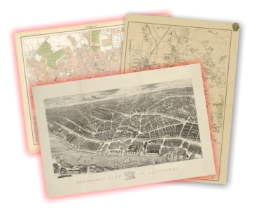
Walton c.1900
Use the slider in the top left to change the transparency of the old map.
Transport
The principal road through the township is that running from Liverpool to Ormskirk, known as Rice Lane as it descends the hill.
The Lancashire and Yorkshire Railway ran through the township, with Walton Junction station lying on the Liverpool to Preston route. The line to Bury and Manchester branched off, as did a smaller line to serve the docks. The London and North West Railway ran from Edge Hill to the docks, Walton and Spellow. The Cheshire Lines Committee Railway from Manchester to Southport ran through the district, with a station at Walton-on-the-Hill from 1870 (which closed in 1918), and a branch to the docks. A tunnel is the only remains of this line.
In 1905 the train lines were electrified.
Expansion
By the end of the 19th Century, Walton was already expanding as a suburb. There was a large Welsh presence here, and Liverpool itself was often jokingly referred to as the Capital of Wales. The Welsh community was heavily involved in timber, slate and stone trades, and would often retire back to Wales.
Their involvement in such 'home trades' resulted in the spread of the 'Welsh house', a solid, quick-to-build six room house. A famous father and son partnership of William Owen Elias and son built many of the streets in Walton, and if you look to the names of the streets beginning at Oxton Street, opposite Goodison Park, the initials spell out the names of these two men, with the exception of the final N, a victim of more recent demolitions in the area. Between 1919 and 1939 council housing was built up in out of town areas, and Walton was one such district.
Landmarks
Walton-on-the-Hill was for a long time the centre of Christian organisation in this part of Lancashire. In fact, until 1699 Liverpool parish came under the control of Walton parish church before it was made independent.
Walton Prison
Walton Prison was built by the Liverpool Corporation, who had purchased land for it in May 1847. It was built between 1849 and 1854-5 by Messrs Furness & Company and John Weightman esq, and although there are rumours that it was built by French prisoners of war, it's been pointed out (see comments) that such men were probably no longer held in Britain such a long time after Waterloo (34 years).
The prison opened in 1855 with 300 cells alongside dwellings for a whole host of staff: governor, matron, chaplain, gatekeeper, turnkeys and more. Women were housed in addition to men until 1933, with facilities provided for the children of female prisoners. In a sign of those times, the women were employed in washing, cleaning and sewing for the staff. This may be even more ironic considering that there were Suffragettes amongst the inmates.
Hangings took place in front of large, sometimes noisy crowds who packed stalls like a theatre.
Walton Park Cemetery
Burial grounds in Walton were often co-opted for use by St. Nicholas's church in central Liverpool when the pressure was high. For example, in 1361 an outbreak of plague meant that Liverpool itself quickly ran out of space its dead, and by the middle of the 19th century the growth of slums and the population explosion caused further problems.
Therefore in 1851 Walton Cemetery was laid out. There were both free and paid-for plots, with the latter placed closer to the footpaths and employing large monuments to the interred. These plots were, of course, only available to the richer members of society, like mayors and the governor of the local jail. In fact, the free plots were often shared between many people - what we might refer to now as paupers's graves. All people buried on the same day would be placed in the same grave.
Robert Noonan (who, under the pen-name Tressell, wrote The Ragged Trousered Philanthropists) is buried in the cemetery, as he died while waiting in Liverpool for a ship to take him to Canada. His is a pauper's grave, where he was buried alongside 12 others, although since it was rediscovered it has been marked with a memorial stone.
When St Peter's in Church Street was demolished in September 1922, several of the graves were moved from there to Walton Cemetery, demonstrating the continued importance of this northern suburb to Liverpool's spiritual make-up. In the 20th century Dutch war graves were added to the burial ground, tended to by the Fazakerley branch of the British Legion.
Zoological Gardens
The Monkey House was a half-timbered building like the restaurant and concert hall which graced the centre of the park. Great effort went into these pieces of architecture, with cement moulding, red tile roofs and copper details. The restaurant block was built to a polygonal bandstand-like design, and included a restaurant, dining hall, cloak rooms, service apartment and a garden quadrangle for open air concerts.
The architect responsible was William Sugdens & Sons of Leek, with landscaping by John Shaw of Bowden in Cheshire. A number of companies came together to build the Gardens, including W. Rummage of 42 Old Broad Street, the Everton Quarry Company, Messrs Wards of Limerick Foundry, Tipton and Robert Hird of Shipley.
The only remains today are the gate house buildings which were used by the Dunlop factory. Until at least 1985 the wall of the elephant enclosure also still stood.
Walton Workhouse
In 1834 the Poor Law Act united parishes (who had previously cared for the poor separately) into a Union. This prompted the need for a workhouse to deal with the area's needy. The foundation stone for the Walton Workhouse was laid in 1864, and in the April of 1868 the institution was opened.
The workhouse taught sewing, knitting, weaving, woodwork and maintenance skills to both boys and girls (although the tuition was divided along traditional gender lines). There was a nursery for the youngest.
The food for the workhouse inmates was far from luxurious: bread, gruel, scouse, soup, potatoes, porridge, milk and broth were the norm. It would have been blind scouse (without meat) most times, with meat added perhaps once a week.
As well as teaching practical skills (and probably to help pass them on) the workhouse had its own blacksmith, cobbler, stables and joiner. As well as those, there were a laundry, gasworks, bakery, chapel and burial ground. It was a fairly self-contained community!
At its peak the workhouse admitted 90 people were weak, which goes to show the extent of the poverty problem in Victorian Liverpool
By 1930, however, times were changing, and the Poor Law Guardians who were responsible for the workhouses were abolished. Chronic illnesses such as tuberculosis were a more pressing problem than terrible poverty, underlined by the 1918 influenza pandemic, which affected staff as well as inmates. What by this time was known as the Walton Institution became Walton Hospital, and the current Walton Hospital still retains some of the buildings it inherited in the 1930s.
Progress continued under the eye of Dr. Henry McWilliam, who was Resident Assistant Medical Officer from 1913 until 1952, by which time he had become Medical Superintendant. He changed the working conditions of the Hospital, such as the introduction of the 112 hour fortnight for nurses, who until then had worked even longer hours than this.
Walton Hall and the Walton Family
The manor of Walton was given to Gilbert (or 'Waldeve') of Walton by King John in 1189, on the condition that he become the bailiff of West Derby. Thus began the family line of the Waltons.
Walton Hall Park is now the only remains of the Walton Hall estate, and the best known incarnation of Walton Hall is actually the second building to take the name. Parts of the previous version, dating to the 12th century, were found when the more recent hall was demolished in around 1900.
By the time the second hall was demolished, the Walton family had long died out, and the structure had been falling into disrepair for some time.
After the Walton line came to an end, the next record we have of the Hall is once it came under the ownership of one Robert Brere, who bequeathed it to his son.
In 1746 it was owned by the influential Fazakerley family, specifically Nicholas Fazakerley, an agent of John Atherton. The Athertons were the last family to live in Walton Hall, putting it up for sale and moving on in 1804.
Thomas Leyland, privateer, lottery winner, merchant, slave trader and mayor of Liverpool on three occasions, bought the hall from the Athertons. He had lived in Houghton Street and Duke Street previously, and clearly wanted a slice of the rural gentlemanly life!
In 1827 Thomas died, and he passed the house onto his nephew, Richard Bullin, who took on the Leyland surname at that time. Richard never married, and so his sister Dorothy inherited the Hall from him, before it passed into the family of John Naylor upon her death.
It was at this time that the building deteriorated, and a decision to demolish the house was made at the turn of the 20th century.
In 1907 a triangular plot of land, formerly part of the Walton Hall estate, was bought by the Corporation for use as a recreation ground. Then in 1913 a further 120 acres were purchased for £51,000 to create Walton Hall Park. The design of the park was done by H. Charlton Bradshaw, although the First World War meant that the space was requisitioned for a time as a munitions depot.
Finally, in 1924 the land reverted to the Corporation, and in 1934 Walton Hall Park officially opened to the public. On the 18th of July King George V conducted the opening ceremony, before moving along to open the Mersey Tunnel later the same day.
St Mary's Church
The site of St. Mary's Church, and it's use as a religious centre, are both very old indeed. The circular shape of the churchyard, still evident on the 1893 Ordnance Survey map, suggests that it could be early medieval in date, or possibly pre-Christian. There have been suggestions made that there was even a henge (a roughly circular bank and ditch monument) here, but no firm evidence exists for such an ancient origin.
However, the shaft of a cross was discovered under the foundations of the building during some construction work, and so some medieval activity is certain.
A later episode in St. Mary's history is its use for holding prisoners after the battle of Worcester (c.1651). Such was the damage caused by these prisoners that a tax on West Derby was requested in order to pay for the damage, though this request was turned down.
With all the evidence to hand, it looks like St Mary's was first built in 800, with new buildings replacing the old in 1326, 1724 and 1941. In addition, the tower alone was rebuilt in 1829, and the churchyard was extended beyond those old circular boundaries in pieces up to 1958.
Landmarks and Trivia
Winestan held the manor of Walton when the Domesday Book was compiled.
Much of the terraced housing in Walton was built for workers on the railway.
In 1884 Northcote Road School was built opposite the York Villas. The school had originally occupied a building at 33 Rice Lane in 1885.
St Nathaniel's Church, designed by Frank Rimmington, was to be built in the early part of the 20th century. The Second World War intervened, however, and only a church hall was put up, opening on the first day of October 1949.
There was a lime pit adjacent to what became the Dunlop factory site.
In the book Pictures and Thoughts on Walton's Past History, 'A Group of Locals' report that the area around the workhouse was once covered in allotments, stables, orchards and a coaching inn. Quite a rural feel!
The Evered Avenue Library, funded by Andrew Carnegie, was opened in 1911 by the Earl of Derby.
Dunlop had its UK head office and a manufacturing plant in the Cavendish Drive area. This operated for much of the 20th century, despite a devastating fire in September 1980, but the building finally made way for a housing estate in 2004.
A rumour persists that there are tunnels running from the Jewish cemetery to the Littlewoods offices, and that caves stretch from Walton Hall Park to the church of St Mary's.
Dairies were once a common feature of Walton, such as Heygarth's and Williams's.
Haggerston Road takes its name from Haggerston, a town in Northumberland. This town was once part of the Leyland estate (see Walton Hall and the Walton Family below).
A stone bridge was replaced with a box girder bridge when Walton Hall Avenue was expanded into a dual carriageway.
Walton became part of Liverpool in 1895.
Walton Grammar school was built in or before 1613.
Walton Town Hall was built in 1893, and nothing now remains of it except a part of the stone facing, which stands in one wall of the Queens Drive flyover.
Public Houses and Bars
The Brown Cow stood opposite the Town Hall on the corner of Rice Lane and Church Lane. The Rice Lane pub, named after the road, was demolished in 1968 to make way for the flyover, as were many other buildings. Standing opposite the Queens Drive Baths, the Herb Shop sold soft drinks like Vimto, Sarsparilla and Dandelion & Burdock.
Roads
Rice Lane gets its name from Rice House, belonging to the family of that name in the 18th century. William Rice was an "allottee of the common lands" in 1716.
Further Reading
A Group of Locals, 1985, Pictures and Thoughts on Walton's Past History, W.E.A West Lancashire and Cheshire District
Recommended links
Walton on the Hill, Liverpool, in the 1950's and 60's
Liverpool Zoo, Rice Lane, 1975
http://streetsofliverpool.co.uk/liverpool-zoo-rice-lane-1975/
Mapping the history of Liverpool
Old maps, interactive maps and the historic landscape of Merseyside.
Buy maps
Many of the maps on this site can be bought as high quality prints, either as paper or ready-framed.
You can also buy notebooks, postcards, greetings cards and other map-printed items!
Go to the shop to find out more
The book
Liverpool: a landscape history is a book about Liverpool and Merseyside from the very earliest days to the 21st century.
You’ll learn about everything from the Calderstones to the Capital of Culture.
Signed copies are available direct from me, the author, in the shop.
#ads

A set of three matching Cassini maps from three different periods, designed to appeal to anyone who wants to discover the hidden history of their local landscape.
- Cassini Old Series Maps first published between 1805 and 1874
- Cassini Revised New Series Maps first published between 1896 and 1904
- Cassini Popular Edition Maps first published between 1919 and 1926
Leave a comment
roy bartley
02/16/2012 00:04:06
Reply to roy bartley
Martin Greaney
02/21/2012 10:45:26
If Hall Lane is the new boundary, then it's certainly changed from its historic shape. A good source for the parish boundary is on http://maps.familysearch.org/. Here you can click through a map of Lancashire, then select the option to list all the parishes. This will take you to a map. The parish of Walton-on-the-Hill stretches further north than Hall Lane. Also, on my own site you can see the rough outline of the old townships (which are generally larger than parishes). Again, the historic township stretches further north than Hall Lane. See the Map of Walton Township.
I'm not sure exactly if or when the boundaries changed, as these areas are historical. I thought perhaps the Boundary Commission might be making changes, but their map of Liverpool North does not have a boundary at Hall Lane either (though it's not far off, near Aintree Rail Station). See http://rr-bce-static.s3.amazonaws.com/wp-content/uploads/2011/08/Liverpool-North-BC.pdf?9d7bd4 for a PDF of a map of the local authority and wards. Either way, the Commission's decisions are not yet final (they'll be published in March).
Hope this is of some help.
Martin
Reply to Martin Greaney
Janis Baggott
05/17/2012 13:03:09
Reply to Janis Baggott
Martin Greaney
05/21/2012 12:23:36
Do you have any more info on the location of the Church?
GENUKI have a list of churches in Walton, and the only St. Thomas is in Seaforth (http://www.genuki.org.uk/big/eng/LAN/Seaforth/StThomas.shtml), but this is currently in Sefton Parish, not Walton.
Regards,
Martin
Reply to Martin Greaney
james
10/03/2012 04:32:09
Reply to james
Dave Bridson
10/07/2013 18:21:11
Beginning near junction of Sandy Lane and Higher Lane the boundary runs along Higher Lane, across Longmoor Lane and about one third of the way along Seeds Lane it turns north-east across the fields to meet the side of Aintree Racecourse opposite the end of Barlow's Lane. From here it runs alongside the Racecourse (following the line of Becher's Brook), past the end of Signal Works Road and then turns south-east to the bend in Sherwood's Lane. It runs north-easterly along Sherwood's Lane then turns south-east just before the junction with Aintree Lane before turning south-west to meet the corner of the Cottage Homes.
The boundary then runs along the eastern side of the Cottage Homes, crosses Longmoor Lane and turns north-east towards Copplehouse Lane but then turns roughly south about 20 yards before Copplehouse Lane to follow a small stream which joins Fazakerley Brook near the junction of Copplehouse Lane and Field Lane. It then runs roughly alongside Stonebridge Lane to the original stone bridge where it turns south-west to follow the course of Sugar Brook across the former sewage works, under Lower Lane, then under what is now the East Lancs Road and under that corner of Norris Green as far as Scargreen Avenue Playing Fields. The playing fields are where Sugar Brook starts. I say starts because it's still there in a culvert.
From the playing fields the boundary zig-zags under Norris Green before passing under Strawberry Lane (now Road) near its present-day junction with Townsend Avenue. Turning north-west it then runs under Scarisbrick Road and the old railway before meeting the Tue Brook under the playing field on Richard Kelly Drive.
The boundary then follows the course of the Tue Brook alongside Richard Kelly Drive, around the edge of what is now Walton Hall Park, around the back of the old Dunlops site on Rice Lane and continuing northward under Rice Lane Recreation Ground to the back of St John's Church on Rice Lane. The brook (and the boundary) then turn north-east under Chapel Avenue, under Archbishop Beck School and its playing field before emerging across Long Lane alongside Durley Road. It meanders alongside the Liverpool-Kirkby Railway line, crosses under the railway and through Higher Lane Allotments and passes under Higher Lane to the point at which this description started.
Reply to Dave Bridson
julie
11/18/2012 22:45:32
Thank you
Reply to julie
Susan
08/15/2015 21:17:30
Look forward to hearing from you
Susan
Reply to Susan
julie savage
07/01/2017 22:05:56
Good luck with your research
Julie
Reply to julie savage
Michelle Donovan
01/24/2013 11:57:11
Reply to Michelle Donovan
Martin Greaney
01/27/2013 18:25:05
Looking at the early Ordnance Survey maps, 45a was built at the same time as the surrounding houses, and first appears on the 1908 edition. Unfortunately I've not been able to find out anything else about the building, although it all looks exactly the same on that map as it does today.
However, there were three railway lines passing each other in that area, and so the function of the building may very well have related to that. The land to the north east (where Renwick Road now stands) was still a field, and so some enterprising individual may have built what you might think of as a mini farm or other commercial building which could take advantage.
Regards,
Martin
Reply to Martin Greaney
Dave Bridson
10/07/2013 18:32:26
Reply to Dave Bridson
Marie McIntosh
06/10/2013 17:19:43
Reply to Marie McIntosh
Martin Greaney
06/10/2013 17:38:09
Could it possibly be Tynville Road? Tynville Road is at the north end of Liverpool, in Fazakerley, but this would have been part of Walton parish (and possibly still is). You can still see 54 Tynville Road on Google Maps Street View (with the blue door).
Martin
Reply to Martin Greaney
Mike J
04/30/2025 03:26:24
Reply to Mike J
Martin Greaney
04/30/2025 09:13:04
Yes, that sounds like a very likely possibility. I'm sure it's more likely that T and J would get mixed up than O and Y.
Martin
Reply to Martin Greaney
sara osborne
07/18/2013 16:47:44
Reply to sara osborne
Martin Greaney
08/06/2013 10:21:28
Walton on the Hill was a parish which stretched across a large area of Liverpool / South Lancashire, and so the St. James church you're looking for is likely to be the one in Toxteth, which still stands. There's a Wikipedia page on St. James.
Regards,
Martin
Reply to Martin Greaney
Angela O’Donnell
11/04/2021 14:30:16
Reply to Angela O’Donnell
David Smith
11/04/2021 20:36:04
Reply to David Smith
sara osborne
07/18/2013 16:50:15
Reply to sara osborne
Martin Greaney
08/06/2013 10:27:49
Reply to Martin Greaney
Dave Bridson
10/07/2013 17:02:16
Reply to Dave Bridson
Sue Sayers
03/18/2017 23:32:36
Reply to Sue Sayers
Peter Yates
11/09/2014 20:48:17
Reply to Peter Yates
bill cross
09/17/2015 12:28:16
Reply to bill cross
Sally Montgomery
09/01/2013 07:48:45
Thank you
Reply to Sally Montgomery
Bruce Eames
09/01/2013 20:55:09
In the 1870s Kelly Brothers came into being as the partnership of Richard's four sons : Richard, James, William and Benjamin. They took on many large contracts, including Fazakerley Cottage Homes (1887-89), Toxteth Park Infirmary (1892), Ogden's Tobacco Works (1899-1901), Walton Board Schools (1894), and perhaps most famously, Goodison Park (1892).
The brothers were community-minded and served in many public offices. Richard (1839-1918) became an alderman of Liverpool after holding a position on Walton Local Board. Youngest brother Benjamin (1854-1918) was involved in Everton Football Club from its beginnings as a Director and also Chairman at one stage.
Reply to Bruce Eames
Martin Greaney
09/02/2013 17:20:57
Thanks for your contribution. I'm really interested in details of who built Liverpool, from all eras. It's always interesting when they dealt with big landmarks like Goodison too.
Regards,
Martin
Reply to Martin Greaney
Shirley Borsa nee Kelly
06/11/2021 12:45:36
Reply to Shirley Borsa nee Kelly
Catherine
09/19/2013 14:20:06
Reply to Catherine
Martin Greaney
10/08/2013 21:32:28
Those houses on Breeze Hill are almost all Victorian, with the roads around the modern flyover first appearing on maps of 1891. You can indeed find out information about former inhabitants of houses, but you'll have to find your way around censuses, which I'm not much of an expert on. If you know anyone with access to the likes of Ancestry.com, then they will probably know how to help you.
Regards,
Martin
Reply to Martin Greaney
Wally Edwards
10/21/2013 14:36:17
Reply to Wally Edwards
bill
01/31/2014 20:27:17
Reply to bill
Martin Greaney
02/03/2014 17:06:55
The Copplehouse Pub was built at around the same time as the surrounding houses, between 1927 and 1937, while the Railway pub was built some time in the last half of the 19th century, first appearing on the 1893 map, but not present on the 1850 edition.
Martin
Reply to Martin Greaney
ste latimer
04/08/2014 19:54:08
Many thanks, Ste.
Reply to ste latimer
Martin Greaney
04/10/2014 10:26:56
You're right - Walton Hall Cottages, marked on a map of 1908, after the demolition of Walton Hall itself, but also appearing unlabelled on earlier maps, were to be found near that junction, a little to the east. They stretched from about Baythorne Road right across Walton Hall Avenue and into the modern park area. See the old map here: http://www.old-maps.co.uk/maptiles/m100674_336970_394743.png.
Regards,
Martin
Reply to Martin Greaney
c h friend
09/12/2014 18:38:09
Reply to c h friend
Rose Ledsham
07/01/2014 09:43:56
Reply to Rose Ledsham
c h friend
08/13/2014 17:03:59
Reply to c h friend
mary mcloughlin
06/05/2015 10:26:11
Many Thanks
Reply to mary mcloughlin
Martin Greaney
06/05/2015 15:33:02
If you're looking at records from before 1900 then it's most likely that you're looking for St. James in Toxteth. Before 1900 the whole of the city of Liverpool was part of Walton-on-the-Hill parish, and so St. James would have been too. The church is still standing, and the Wikipedia is a good one: http://en.wikipedia.org/wiki/Church_of_St_James,_Liverpool
Reply to Martin Greaney
Michael ball
08/24/2015 21:20:18
Reply to Michael ball
Kate
09/24/2015 03:17:38
Reply to Kate
David
12/22/2015 17:56:16
Many addresses in this area are described as in Aintree for example 'Aintree Baptist Church' not far from Walton Vale. My family and many of our neighbours addressed their letters as from Aintree Liverpool 9
Aintree, of course, is about three quarters of a mile away along the A59 to the north and is located in the Borough of Sefton.
Reply to David
Martin Greaney
01/05/2016 14:17:05
Martin
Reply to Martin Greaney
Bill Chapman
12/30/2015 16:53:06
Reply to Bill Chapman
Martin Greaney
01/05/2016 14:18:27
Martin
Reply to Martin Greaney
William Fawcett
01/10/2016 12:52:28
Thanks
Reply to William Fawcett
Martin Greaney
01/12/2016 11:27:01
I can't find a smithy marked on the old maps, but up until the 1950 maps (at least) the road called Walton Village is called Smithy Lane for a short stretch up to Queens Drive.
The Lifestyles Gym seems to have replaced a public baths, which were already there in the 1920s. However, there's a 'Glebe Farm' further south on that street, so perhaps it was part of that? I'd welcome any memories from others here!
Here's a map (click for larger version):
Reply to Martin Greaney
William Fawcett
01/12/2016 12:50:37
Thanks for that, Queens Drive baths was still there in the late 80s. I seem to remember the Smithy being where Moores House Care Home is now situated next to the Lifestyle Gym. I used to watch the blacksmith at work when on my way home from infant school.
Cheers. Bill
Reply to William Fawcett
Peter Lowe
01/16/2016 00:12:57
I wonder if anyone remembers him or the dairy?
Reply to Peter Lowe
Mal Holmes
12/23/2016 20:04:29
Reply to Mal Holmes
Simon Hart
02/06/2016 10:15:59
Reply to Simon Hart
Martin
02/08/2016 18:22:14
The original street was a straight road of terraces, and appears on the 1890s Ordnance Survey map, but not the 1849 edition, so the houses date from between those times. The current houses were built to replace the terraces, which were deemed unsuitable for modern habitation and were demolished in the 1960s and 70s. I think the houses were built in the 1980s.
Martin
Reply to Martin
Simon Hart
02/08/2016 18:25:02
Best wishes,
Simon
Reply to Simon Hart
Sue
02/23/2016 05:21:30
Sue.
Reply to Sue
Martin
02/26/2016 09:53:51
I'm not much of an expert on domestic heating, but coal fires would have been the most common source of heat. Also some oil heating might have started making its way into the home by the 1940s, at least in the larger houses, so radiators might have been present. As for the water source, the reservoir at Lake Vyrnwy has been supplying Liverpool with water since the late 19th century, so the most likely source is that. There were also some more local water storage sources, though I'm not sure of the specifics for the Walton area.
Martin
Reply to Martin
Sue
02/27/2016 04:30:04
Hi Martin,
Thanks very much for your reply which narrows down the possible types of heating & the water supply sources my grandparents might have used in their rental home (possibly a semi-detached house) at 70 Rawcliffe Rd. in Walton. This is interesting and helpful information.
Sue.
Reply to Sue
Martin
02/28/2016 21:25:46
Martin
Reply to Martin
Wandsy
02/21/2024 22:52:03
Reply to Wandsy
Sue
02/23/2016 05:26:03
Sue
Reply to Sue
Charlie
03/18/2016 20:00:59
Reply to Charlie
Ian Farrell
04/14/2017 18:20:03
Reply to Ian Farrell
Brenda
04/05/2016 20:28:20
I too am seeking information on these barracks as I have just discovered that my great, great grandfather Henry McCawley (from Carrickfergus,Antrim) was stationed there in 1851, before getting married and moving to Scotland.
Hope someone can enlighten us!
Reply to Brenda
Peter curlett
01/24/2017 15:33:04
If there is anybody on here who is interested in the local Walton Labour party or who knows they have had family who were members I have a number of books from the labour club which include meeting minutes ledgers members and a many other ledgers from the local club. I think they were to do with the labour club on Hale road. Some of the books go back as early as 1900 and there are a number covering the war years both first and second world war. They include ledgers about ration distribution and many other things if anyone is interested please contact me as they are gathering.dust at my house and I think they will be of real interest to some people. There isabout 30 ledgers and notebooks in total I think.
Reply to Peter curlett
Patricia Shirley Loveridge.
02/17/2017 20:42:07
Reply to Patricia Shirley Loveridge.
Ian Farrell
04/14/2017 17:52:19
This map may be of use looking for stuff! Hope it helps!
Reply to Ian Farrell
susan mason
05/01/2017 14:21:37
Regards
Sue Mason
Reply to susan mason
A.Petts
05/04/2017 17:36:14
Reply to A.Petts
Jane Rodda
06/27/2017 22:20:03
Reply to Jane Rodda
Dawn J. Galletly
03/05/2018 11:42:55
I am researching 2 Cemetery Cottages, Rice Lane Cemetery, Walton. I am trying to find information about the occupants during the period 1938-1946. One of the people I am looking for was probably a gravedigger, called Thomas O'Brien. I am also looking for Patricia Elizabeth (nee Webster) and Mary Elizabeth (born 1940). Are there any records of people coming from S Ireland to Liverpool to work as labourers, gravediggers etc? Thanks
Reply to Dawn J. Galletly
Martin
03/14/2018 16:17:37
There are definitely histories of people from Ireland coming to work in Liverpool at manual jobs. For the period you're looking at, the census's aren't available yet (they're confidential for 100 years). If anyone has records (e.g. electoral register) for those cottages then it will be the local archives: http://liverpool.gov.uk/libraries/archives-family-history/ They should be able to help, or at least point you in the right direction.
Martin
Reply to Martin
Charlie
03/14/2018 16:50:07
Reply to Charlie
Dawn J. Galletly
03/14/2018 17:31:24
Reply to Dawn J. Galletly
Joan Warburton
08/29/2018 03:19:25
Thank you and love this forum which I have only just found today.
Joan Warburton
Perth, Western Australia
Reply to Joan Warburton
Martin
08/30/2018 11:13:06
I'm not surprised you haven't been able to find it - it's a very small road and not named on many maps! Luckily, I've found it on an old map, and it's here on my Plan of Liverpool - North Sheet: https://historic-liverpool.co.uk/old-maps-of-liverpool/plan-of-liverpool-north-sheet-1890/#5/60.131/-99.712
It's the unnamed road West of Snowdon Street, and runs north to south near the railway line. You can see it sits in a group of Welsh-named streets like Denbigh, Cemaes, Barmouth, Menai... No doubt some of Liverpool's famous Welsh builders operating in that area!
Martin
Reply to Martin
Bryan Day
08/29/2018 20:54:52
Reply to Bryan Day
Joyce mciver
01/09/2022 19:34:07
Reply to Joyce mciver
Mick
10/08/2018 20:44:04
Reply to Mick
Dawn Elliott
11/14/2018 20:44:35
Any help would be much appreciated
Reply to Dawn Elliott
Martin
11/16/2018 17:55:27
I've not been able to find any references either. The only thing that might be a clue is that there's a Walton Park near Rice Lane station, and I wonder whether there was a school in one of the buildings on that street. There were a couple of very large houses, with plenty of room to house a small school. It might be a red herring though.
Martin
Reply to Martin
Keith Arnold
12/04/2018 17:31:36
Reply to Keith Arnold
Brian Rowlands
12/10/2018 07:07:02
Reply to Brian Rowlands
leslie Stockley
01/06/2019 14:02:24
Reply to leslie Stockley
Eileen Cochrane
01/17/2019 14:07:26
Reply to Eileen Cochrane
Martin
02/04/2019 13:05:24
I've looked at aerial photos and the maps of 100 Walton Village, and the building is a bit larger than the ones surrounding it. I can't find it labelled on the maps, but it looks like it was some kind of workshop. It has a very institutional building at the front, with a series of buildings behind it, so there was certainly something out of the ordinary about the building! These buildings also look like they were there before the surrounding houses. Here's a streetview of the place today: https://www.google.com/maps/@53.4453322,-2.9623444,3a,75y,168.38h,106.14t/data=!3m6!1e1!3m4!1sHreJxAby4PfOBun7VbmhNw!2e0!7i13312!8i6656?hl=en
Reply to Martin
Jay
01/28/2019 22:21:16
Reply to Jay
Eileen Cochrane
01/29/2019 10:41:21
Reply to Eileen Cochrane
Eileen Cochrane
02/05/2019 11:11:17
Reply to Eileen Cochrane
David Smith
02/17/2019 16:55:42
The only 'Throstles Nest' I have found is an hotel in Scotland Road. I am not sure if that area was part of Walton on the hill at that time.
Any help would be appreciated.
Reply to David Smith
Martin
02/20/2019 09:42:53
It's certainly possible that the Throstles Nest was recorded as being in Walton on the Hill. For centuries that was the mother parish of the whole area, right into Liverpool. Although that wasn't really officially the case by 1871, I think some records might still have recorded it as such.
Martin
Reply to Martin
robert doughty
10/13/2025 13:53:35
Reply to robert doughty
Martin Greaney
10/17/2025 18:05:18
Best wishes,
Martin
Reply to Martin Greaney
Robert Howgate
12/20/2020 01:52:14
Reply to Robert Howgate
Tony Sumner
03/01/2019 10:24:45
I am in possession of a football team photo which I believe to be Walton Amateurs FC who played in the Liverpool League Division 1, the photo was taken in 1946-7 and includes my late father (Leslie Sumner). I would like to confirm the photo is definitely of Walton Amateurs and if so some knowledge of the clubs history.
I can of course email or bring a copy of the photo to the Library, if you think you can help please advise.
Regards
Tony
Reply to Tony Sumner
Dave Latham
09/16/2020 09:51:33
Reply to Dave Latham
Bill Fawcett
12/20/2020 13:14:08
Bill
Reply to Bill Fawcett
David Smith
12/20/2020 15:45:20
I have seen a pub on Scotland Road which has this name.
Reply to David Smith
Bill Fawcett
12/20/2020 17:26:02
Bill
Reply to Bill Fawcett
Jane Gallagher
12/28/2020 15:28:37
Does anyone have any information on the ship roads? Specifically Woolhope Rd.
Reply to Jane Gallagher
Glynis Purland
01/03/2021 10:57:31
Can anyone tell me what 176 Rice Lane originally was. Part of it is now Didis Gate House Pizza. The left part is old sandstone and there is lovely white designs above the pizza sign?
Reply to Glynis Purland
Martin Greaney
01/14/2021 10:06:24
This was once the entrance to Walton’s Zoo! There’s a great article on this blog: https://liverpoolhiddenhistory.co.uk/waltons-zoo/ Sadly, there’s not an old picture on that blog, but I’ll try to find one to upload here later if I can.
Regards,
Martin
Reply to Martin Greaney
David Carey
02/07/2021 15:07:40
Reply to David Carey
Catherine Kelly
08/11/2021 04:52:27
Reply to Catherine Kelly
Marcella Goodge
12/21/2021 06:24:02
I am trying to find out who lived at 100 Rice Lane in circa 1918 and if indeed it was a house?
Any information on where I can trace records for this address will be much appreciated, my father is trying to find his father's father from this address.
My father does not have his true surname as this was never given as his grandmother was not married to the gentleman who lived at 100 Rice Lane and back in 1918 this was unacceptable!
Thankyou, kind regards Marcella
Reply to Marcella Goodge
Eileen
12/28/2021 20:40:35
Reply to Eileen
andrew wood
04/03/2022 12:58:37
Walton Prison
Walton Prison was built by the Liverpool Corporation, who had purchased land for it in May 1847. It was built between 1849 and 1854-5 by Messrs Furness & Company and John Weightman esq, and there is the possibility that many of the workmen were French prisoners of war.
Britain and France hadn't been at war since 1815 and were in fact allies by the time of the Crimean War which started in 1853. It's highly unlikely that French prisoners were still held here 34 years after Waterloo.
Reply to andrew wood
Martin Greaney
04/07/2022 18:27:34
I think you might be right! I’ve just looked up the source for my statement and in hindsight, despite their best intentions, this sounds more like a local myth than solid research. I know too little about European history at the time to know better, so thanks for taking the time to point out the inconsistency !
It looks like this page could do with a bit of a rewrite as it’s pretty piecemeal, and when I do I will be sure to tidy up that part of the article.
Thanks again,
Martin
Reply to Martin Greaney
Clare Graham
10/21/2023 16:03:12
I wondered if anyone would help me with the history of this pub at 122 Walton Village, as I believe that my great-grandfather Thomas Carey used to run it around 1915 (birth certificate for his daughter Marjorie lists him as Licenced Victualler at this address. It is on the 1910 map on your web site as a P.H. but I don't know what it was called back then.
Any information gratefully received,
Thanks,
Clare
Reply to Clare Graham
Clare Graham
10/21/2023 16:04:01
Reply to Clare Graham
Susan Coleman
02/11/2024 14:27:26
Reply to Susan Coleman
Rhonda
03/24/2024 15:23:11
I've just learned from this website that there was a large Welsh presence in the Walton area, which is of interest to me as I am researching maternal family history with the surname Jones who had a connection to no. 4 Lusitania Road. All I know so far is that Elsie Jones lived there. The address is listed on my late Mother's birth certificate in 1929.
I would be grateful if anyone has access to any records or other sources and can help shed a bit more light please.
Many thanks.
Reply to Rhonda
Liz Hodge
08/05/2024 18:33:27
Reply to Liz Hodge
W. Mckittrick
12/03/2024 18:13:35
Reply to W. Mckittrick