History of Everton: Civil War, housing and the Blitz

Evreton, 1094; Everton, 1201; Erton, 1380; Everton from 13th Century (VCH Lancs III).

Origins of the name: Old English eofor – wild boar, and tun – settlement.

Image: Everton Library, by Martin Greaney

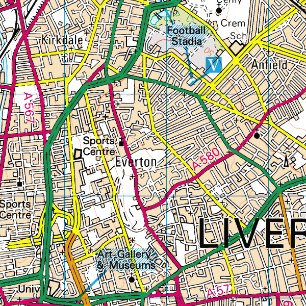
Historic Features in Everton

The highest point in the district is St. George’s Church, with the ground sloping away rapidly to the north and west. The ridge on which the village stands extends to Low Hill and Edge Hill, and the foot of the ridge is the western boundary of the township. The centre of the old village is, unsurprisingly, Village Street.

There was a mere, later known as St. Domingo’s Pit, which was just below the Beacon, and which Mere Lane led down to. At the beginning of the 20th Century Moss Lake Brook flowed towards the town centre from Everton.

Book

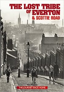
This book goes with the website of the same name. It contains reminiscences of the area from current and former residents, and tonnes of photos to help you with research.

Buy the book

Website

This website has brilliant discussions from people who have fond memories of north Liverpool. There are also resources for the keen family historian.
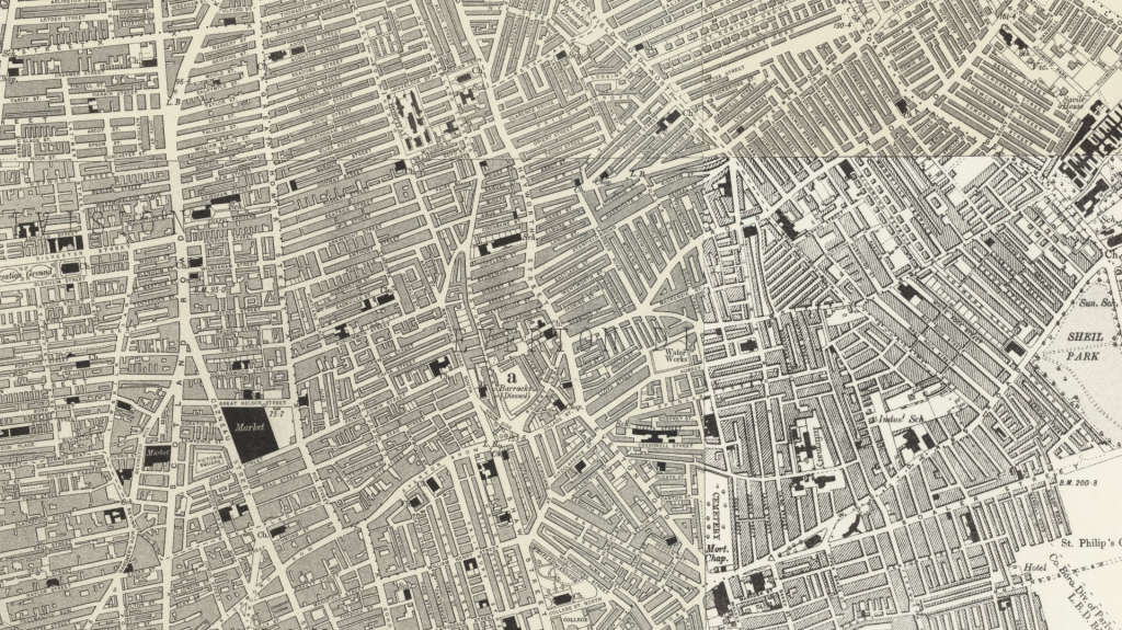
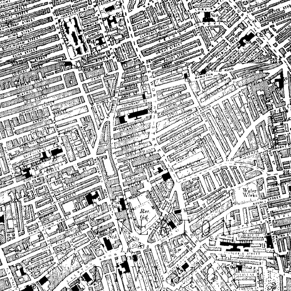
Visit the website

Everton c.1900

Use the slider in the top left to change the transparency of the old map.

Transport

The main route east out of the city of Liverpool was once the road along Everton Brow, the old name of which was Causeway Lane. Halfway up the slope to the west of Everton Netherfield Lane turns to the north, with a branch leading up the hill. From the top of the village, this road led north to Everton Beacon (demolished in 1803). The road then divided, running downhill to Kirkdale and Anfield. In the fork of these two roads stood St. Domingo’s House. The roads remain as Heyworth Street and Everton Road.

After passing through the village, the road from Liverpool divides into Breck Lane, leading to Walton Breck, and another road, which again divides into roads to Newsham and West Derby respectively.

Back to top

Development

Everton was one of the first areas of Liverpool popular with rich merchants who traded through the city. However, later chemical works and riverside industries arrived, and the large mansions were knocked down, and replaced with hundreds of terraces. The roads were then widened along the main routes, and tramways were serving the district by the 19th Century. As the main centre of the city decreased in population in the 18th and 19th Centuries, Everton was one of the areas which gained population in its stead. This trend was most apparent in the early 19th Century, but in Everton the pattern reversed towards 1900. Although no longer the area for the rich merchants, Everton attracted master mariners as well as working families.

As the 20th Century continued, Everton became infamous for cramped and squalid slums. Hundreds of houses were bulldozed, here and in other areas, and were replaced by equally infamous high-rise flats such as the Piggeries in Everton Park.

Back to top

Industry

A large sandstone quarry occupied the northern slope of Everton Brow.

Back to top

Landmarks

An old pumphouse, or bridewell, was built above the village in 1787, and was still standing in 1907. Until 1820 the shaft of a market cross stood in the open area in the middle of the village, with a sundial fixed to it. There was also a holy well in the area, but the exact location of this has been lost. Everton Beacon was a sandstone tower of two storeys, roughly 20 foot square. During Napoleonic times it was used as a semaphore station.

The Necropolis, an enclosed burial ground for Non-Conformists, is now a public garden. There was also once an open space, triangular in shape, known as Whitley Gardens, on the corner of Shaw Street and Brunswick Road.

Everton was incorporated into Liverpool in 1835.

Back to top

Old Ordnance Survey Maps of Everton

1851

Extract from the 1851 Ordnance Survey map showing Everton on the outskirts of Liverpool. Land to the east is rural.

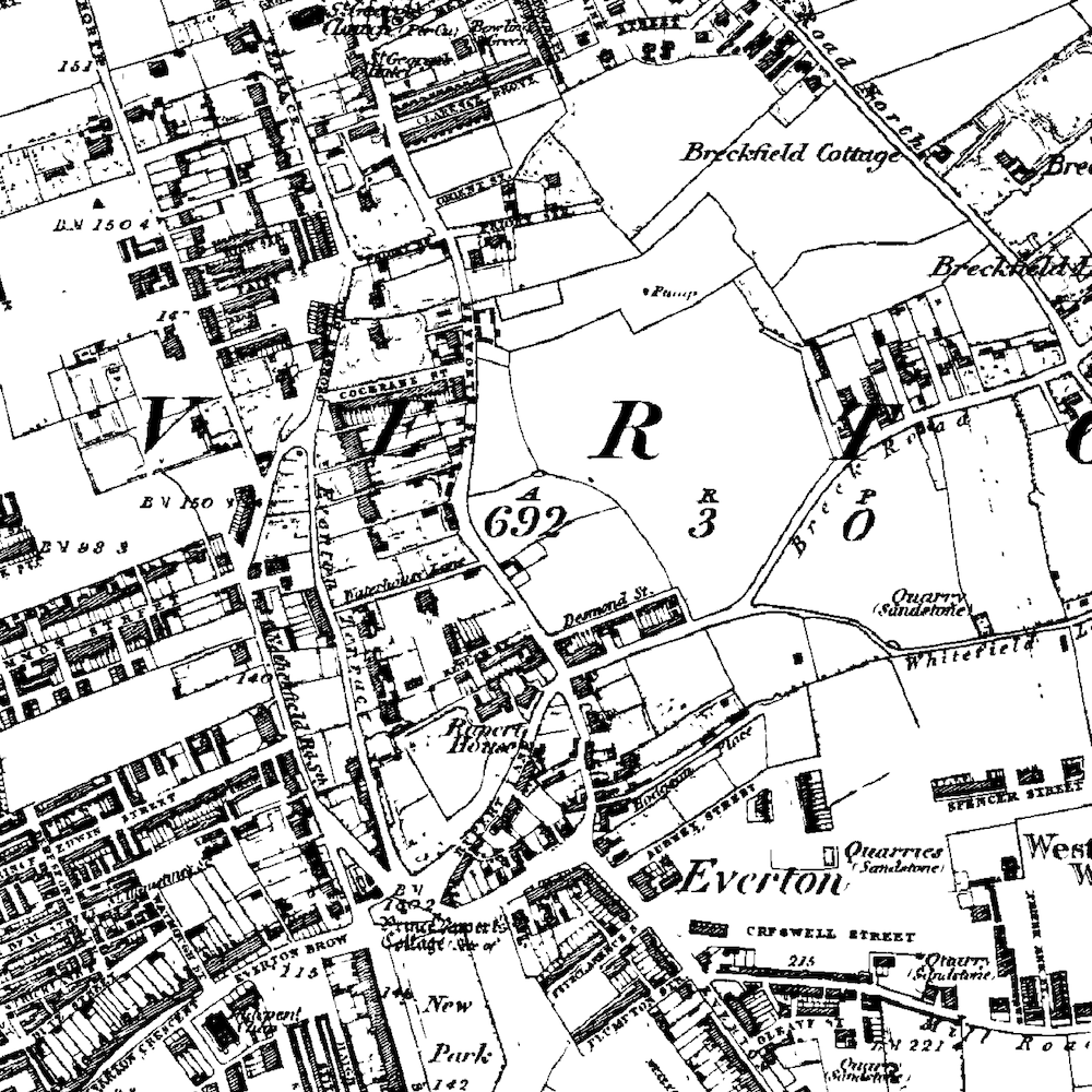
In the middle of the 19th Century Everton was only heavily built up to the west of Netherfield Road. The village of Everton (located at Village Street and Brow Side) was still just about discernable from the rest of the area even as the city of Liverpool encroached from the west.

New Park was marked on the 1851 Ordnance Survey map to the south of the village centre, and ‘Prince Rupert’s Cottage’ was identified. The ‘Cottage’ sat in the middle of the village green, which was stood alone in the middle of the incoming roads: Rupert Lane, Netherfield Road South, Everton Terrace and Everton Brow. Rupert House, a building commemorating the royal visit of Prince Rupert in 1644, is also marked.

Most of the township at this time was covered in large villas with back gardens or yards. These were the dwellings of the wealthy businessmen who saw moved out of the dirty city to places like Everton, Toxteth Park and Kirkdale in the 18th Century.

Along with the houses a large number of sandstone quarries are marked. These are only small and the stone for them would have been used only locally.

An area to the north east of Everton village was St. Domingo. This centres around the Church of St Domingo and also Mere Bank, a large house. St. Domingo’s Pit is also identified on the map, and the area is surrounded with the large merchant houses already mentioned. The pit was a shallow lake, or mere, from which the house no doubt got its name, along with Mere Lane which led down to the lake.

The two largest features on the map are the West Derby Union Workhouse which stood at the end of Mill Road in the east of the township, and the Zoological Gardens (complete with fireworks department!) just to the south east of this.

Finally, at the very south end of the township was the Liverpool Collegiate Institute on Shaw Street (now converted into flats) and the already dense areas making up Kensington.

Back to top

1894

The next Ordnance Survey map to be published of the area was in 1894. These forty years were some of the most crucial for Liverpool, and saw the almost complete transformation of the township of Everton.

Little remained from previous years save for the main roads and Rupert’s Tower. A massive number of terraced houses had been built for the influx of people coming to find a job. Everton in particular was an area populated by Irish migrants; a high proportion of those who settled in this township were Roman Catholic. These terraces now appear to cover the entire area of the 1894 map. One of the largest gaps in this swathe of housing was the first building of the Notre Dame Catholic College.

The grounds of Rupert House (known to have been standing in 1830) by this time had a militia barracks built upon them.
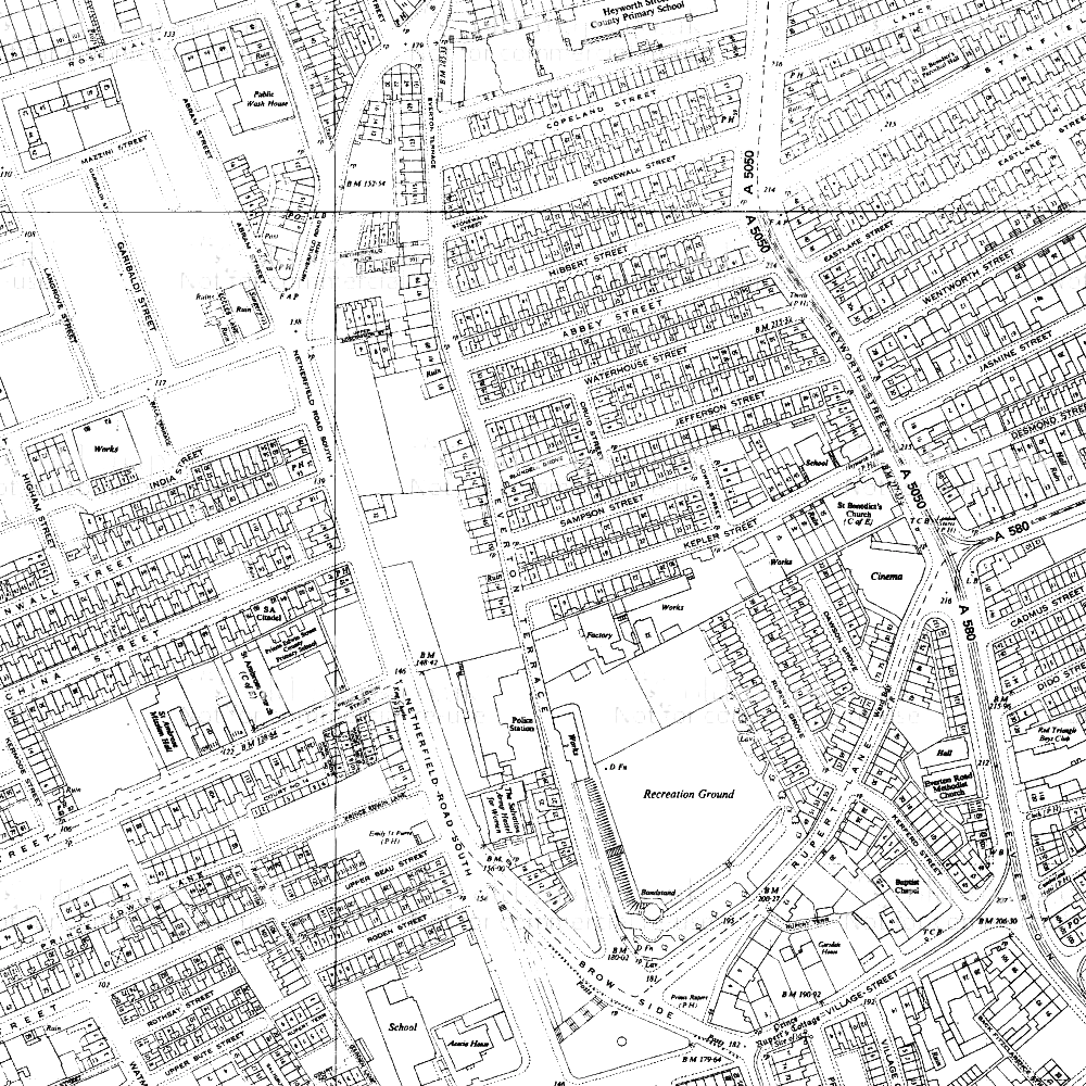
Back to top

1910 to 1930

Extract from the 1930 Ordnance Survey map. Everton has been built up into a dense grid of streets

While this was a very important period in world history (with the Great War and a recession) Everton does not appear to have changed much on the map. The area was still covered in dense terrace houses and courts. Churches dotted the landscape and small industrial works can be made out.

The feature marked as ‘New Haymarket’ on earlier maps is now a covered market on the newly lengthened and straightened Cazneau Street.

By 1930 the militia barracks had been turned into a recreation ground.


Soon after the end of the Second World War Britain was entered a boom time. Attempts were being made to expand Liverpool’s industry from dock working to manufacturing, and new plants like those at Speke and Aintree were the result of this. Alongside the new factories, edge-of-town suburbs were springing up to rehouse those who had been, until then, still living in the cramped Victorian streets.

During the 1950s and 60s these streets in Everton were to be demolished, but on the 1910 and 1930 maps there was no evidence of this was coming change.

Back to top

1970

Extract from the 1964 Ordnance Survey map. Holes have appeared in the formerly dense fabric of Everton township

Although Everton was still generally a gridiron mass of roads and houses, the main arterial roads into the city had changed massively by the mid-1960s.

Scotland Road, Great Homer Street and Byrom Street had been widened and straightened, and a spiral junction had been built to take traffic into the Kingsway Tunnel.

Holes were beginning to appear in the fabric of Everton housing between Netherfield Road and Great Homer Street, north of Roscommon Street and where Campion Catholic High School now stands.

Back to top

1978

By 1978 the clearances were almost complete (although the rebuilding was far from so). The space now occupied by Rupert Recreation Ground and Whitley Gardens had been cleared, but the roads were still marked on the Ordnance Survey map as rather sad dotted lines (a mirror image of when this was done on Victorian maps to denote streets in the process of being built). These large areas were later to be redeveloped as Everton Park.

Back to top

2000

Map extract of Everton from 2000
Extract from the 2000 Ordnance Survey map. Everton has been completely transformed with wide open spaces and curved roads

The transformation of Everton from its state in 1984 had now been completed. Almost all the small, straight side roads had disappeared, or been cut short and reshaped. Roads which once existed as part of the characteristic grid pattern can still be seen, but they are either dead ends or curved cul-de-sacs: Fitzclarence Street, Cochrane Street, Beau Street and Upper Beau Street are all roads marked on the 1894 map but which would be unrecognisable to their Victorian residents.

Back to top

Conclusion

Everton was one of the first townships to see an influx of rich residents in the 18th and 19th Centuries. It was also one of the first to be overrun with masses of Victorian terraces which housed the dockworkers for which the city was famous.

As dock work became scarce, and well-meaning councils cleared the ‘slum housing’ after the Second World War, Everton was one of the many places where the heart was ripped out of the community and shipped the city outskirts.

While it remains one of the most deprived parts of Liverpool, it has been redeveloped with masses of green space, and still enjoys the lofty view over the city centre it was noted for in the Victoria County History.

Everton has been buffeted on the winds of change sweeping across Liverpool. How it fairs in the future will be just as dependent on Liverpool’s fortunes as it ever was.

Back to top

143 Comments on “History of Everton: Civil War, housing and the Blitz”

  • james harry

    says:

    your article mentions irish ‘immigrants’ in liverpool. the irish were actually british citizens as ireland was part of britain and they were coming to their own country when they arrived in liverpool.

    Reply

    • Martin

      says:

      Hi James,

      Thanks for your comment. You’re absolutely right – Ireland was part of Great Britain until 1921, and so the people coming over to Liverpool were not ‘immigrants’ by the strict definition of that word.

      I’ve changed it in this article to ‘migrant’, which can refer to someone who goes “from one country, region, or place to another” (Dictionary.com) and so includes movement within a country.

      I’ve also updated the History of Toxteth article, which referred to people moving from Staffordshire as ‘immigrants’!

      Thanks again for the tip-off. Hope the site has been useful and/or interesting for you.

      Martin

      Reply

  • Alane

    says:

    Hi Martin,

    Do you know how I would go about finding an old map of where my Great Grandfather used to live in Everton ? I believe the house/mansion? was called Ashleigh and it was on Walton Breck road.
    Alane

    Reply

    • Martin

      says:

      Hi Alane,

      It’s funny you should ask this now, as I’ve just read a book about Anfield and Breckfield (Ordinary Landscapes, Special Places, by Adam Menuge) which mentions Ash Leigh (which was technically in Anfield).

      Ash Leigh was a cul-de-sac which had five very large semi-detached villas on it, plus a couple of other large houses. These were inhabited by some of the wealthier Liverpudlians in the 19th century (In the 1851 census three of the inhabitants were Polish, German and Prussian merchants respectively), so perhaps your Great Grandfather was a business owner or merchant?

      You can see the location of Ash Leigh on Google Maps: http://bit.ly/pXrdPX – draw an imaginary line between the end of Oban Road on the right and the right hand corner of Oakfield (the square road on the left).

      To see old maps of the area, go to http://www.old-maps.co.uk, find the ‘coords’ boxes on the home page, and type 336715 in the first and 392705 in the second, then press ‘Go’.

      There is a list of maps down the right hand side – click on the second one down and wait for it to load a larger version in the main pane, and then click on the big version to zoom in once. You should just be able to make out the isolated cul-de-sac next to the words Monckton Lodge.

      Clicking on the fourth map down (1851) will show you a much more zoomed-in map (scale 1:500), taken from a time when the area was much more built-up. You can buy copies of these maps by clicking on the Add to Cart buttons next to the relevant map (note, I’ve no connection with Old Maps and have not used the buying service, so can’t vouch for them personally).

      Reply

      • Martin

        says:

        And just another short note. If you get hold of the Ordinary Landscapes book, Ash Leigh is discussed at some length (with an extract from the 1:500 1851 map) on pages 18-20.

        Reply

        • Alane Beyer

          says:

          Hi Martin,
          Happy to let you know we just came back from England visiting many Beyer family relatives, from London, to Guildford, Liverpool to Chester/Christleton ( they had all passed ). While in Liverpool we went to Rumford Place where G.G. Grandpa Gottlieb Beyer and his son each had their own office Gottlieb was in the Insurance business and Thomas Ernst was in Cotton. We also went to Ashleigh in Anfield but the family house had been long torn down.
          Thanks to you for helping me find some of my history, Best Regards Alane

          Reply

          • Hi Alane,

            That’s great! I’m so glad this site helped you ground some personal family history in the landscape.

            Regards,
            Martin

      • Alane Beyer

        says:

        Hi Martin, I just found your reply … one year later ! Yes this is the place, My Great Great Grandfather was the Prussian you speak of. His name was Gottlieb Ferdinand Beyer, and he was born in 1814.

        Gottlieb came from Preussisch Stargardt near Dantzig in Prussia he was listed as a Merchant” Preussisch Stargardt translated means Prussian Stargard, which is now Starogard Gdanski in Poland.

        I also just found this link and it states in the 1851 Ordnance Survey map Gottlieb Beyer was living in a Villa called Ash Leigh http://www.walkingbook.co.uk/liverpool/anfield/pages/villas.htm

        So exciting ! My husband and I are thinking about going to Gdanski in Poland next year … but I am uncertain if any records of my family still remain there or were they are shipped off to Berlin were the Prussian records are suppose to be. ?

        Thanks for your links this is just wonderful !~ Best Regards Alane.

        Reply

  • Raif

    says:

    Hi there

    I’m trying to find some information about the history of buildings/properties in Fox Street Everton but not having much luck. I’m douing a resarch project for my university course.

    I appreciate if you know how to access them.

    Many Thaks
    Raif

    Reply

    • Martin

      says:

      Hi Raif,

      Maps are probably a good first port of call, so http://old-maps.co.uk is a good place to start for old Ordnance Survey maps. You can search for the road name itself, and then the site gives you a list of maps on the right hand side which cover the area from 1850 onwards. You can buy copies of the maps from Old Maps, but you can also view them at Record Offices (Liverpool and Lancashire both cover the area).

      There’s a comprehensive coverage of researching the history of buildings (including residential ones) at http://www.buildinghistory.org/. For listed buildings, try English Heritage’s Images of England (http://imagesofengland.org.uk) or their Heritage List (http://list.english-heritage.org.uk/)

      Hope this starts you off on your research, but if there’s something specific I’ve not covered, do let me know.

      Regards,
      Martin

      Reply

  • Peter Bridle

    says:

    I visited Netherfield Road, Everton last week to look for the house that my grandfather was born in – 10A or 102 Netherfield road (the birth cert is unclear) Has anyone a photo of this part of netherfield road in 1882 or thereabouts? Thanks Peter

    Reply

    • None of those old houses exist in Everton any more. It was swept clean, first by Hitler then local government. I had a lot of family (myself born in Everton) who lived there.

      Reply

  • Visit our Forum, I’m sure we will be able to help with your questions.

    Reply

  • Alan Fargher

    says:

    I am looking for any information on ‘The New Boys Home’ on Everton Road. My grand father appears on the 1901 Census as an inmate there and i would like to find out more about it. Why children went there? What the conditions were like? Who ran it and how was it funded? How and why the children came out? Are there any photographs of the building or children?
    Thanks Alan Feb 2012

    Reply

  • sharon burke

    says:

    hi,
    can anyone tell me if there were any houses on cochrane street in 1966?
    my boyfriend is looking for his birth dad and on his dads birth certificate the address of his mother and father is 30 cochrane street however when i look on any map its either not there or there is only the hill o zion methodist church, anybodys help would be much appreciated

    thanks
    sharon

    Reply

    • Hi Sharon,

      Cochrane Street was in a huge area of dense ‘grid-iron’ pattern streets from the 19th Century up until the mid 20th Century. The small portion left of this street now runs through Everton Park, with just the chapel left. The 1967 Ordnance Survey map shows the street still in existence (including the chapel) and is marked with grey areas denoting buildings. So I’d say it did still have houses on in 1966, although this was a period of rapid change, and so would welcome any eye witness accounts!

      See a map extract from Old-Maps.co.uk posted on the Historic Liverpool Facebook page.

      Reply

      • Kay Roney

        says:

        Not sure if these replies are read by the enquierers (enquirees?) anyway Cochrane Street was still full of houses when I left home in 1965.

        Reply

        • Hi Kay,

          Thanks for adding some very useful information to the site. I know that quite a few enquirees read and even respond to messages here, so they’re definitely read!

          Regards,
          Martin

          Reply

  • Karl

    says:

    Hi
    Im looking for photographes of the two blocks of flats that were situated on Netherfield Brow, can anyone help? They were two massive blocks from what I remember. Id love to see any pictures of them.
    any help would be most appreciated, thanks.

    Reply

    • Hi Karl,

      There are a handful of photos of this area on the Orange Pages website. I think the blocks you are looking for are in the left hand photo on the 7th line down.

      Martin

      Reply

  • Steve Noonan

    says:

    Sharon,
    Cochrane Street still existed in 1966, although they were starting to demolish parts of St Georges Hill around that time which Cochrane Street ran into. There are photo’s of the street available. The L5 site on facebook has a few which are easily accessible. Hope this helps.
    Steve Noonan (eyewitness, I was 11 at the time).

    Reply

    • Hi Steve,

      Thanks for your comment. Do you have a link to the L5 site? Would love to see those photos you mention.

      Martin

      Reply

    • Hi Sharon, My family lived in Cochrane Street from 1911 until 1966. the back of the house had a long back yard which backed on to Everton Terrace School I lived at number 8 from 1936 to 1966, and can remember most of the neighbours. Hope this could be of some use. George

      Reply

  • Ron Creer

    says:

    Do you know exactly why Great Homer Street in particular was widened in the late 1960s? I am a member of the Duffy family whose shop was compulsorily purchased for this [I’m actually writing the history of the shop which existed in the area from 1907 till 1971] and I know the family was annoyed that they were forced to move but the site of the shop once demolished was used for the market [it was where the new NSPCC building is now on the corner of Rose Vale]. So, clearly the site was not needed for any road widening, whether for the new Wallasey tunnel or any other reason. I’d like to be accurate on this but am not sure how to find out.

    Reply

    • Hi Ron,

      While it’s hard to pin down exact reasons why certain roads and areas were redeveloped, large areas of Everton (and elsewhere in the city) were cleared because the housing quality was deemed too low. While I’m aware that these decisions were not always agreed with, Liverpool in the 1960s was caught up in clearance fever after the Second World War destroyed many old buildings and presented an opportunity to redesign the whole city like never before. Great Homer Street, Scotland Road and the areas right over to Breckfield Road were redeveloped several times in the 20th century, in trying to deal with a housing problem (of quality and quantity). It’s likely that your family’s shop fell in an area destined for widespread redevelopment.

      You may (rightly) believe that your own house was in perfectly good condition, and many were, but these massive schemes were too ambitious to worry about such details. Many of my own ancestors homes in Everton (Back Roscommon Street) and Toxteth disappeared beneath both road widening and slum clearance, even though in some cases I believe the quality of houses was not consistently bad enough to warrant total destruction. The market was probably part of this, in all a giant redesign of Everton.

      You may find more information about the reasons for, and impacts of, the clearance of this area in Ken Rogers’ very popular book The Lost Tribe of Everton and Scottie Road.

      I’d be really interested to read the book you’re writing. Is this something you’ll be publishing widely?

      Martin

      Reply

    • apparently david duffy was my dad had a quick affair with norma milligan when they were 15 or 16
      i was born in 1960 given up for adoption mum went to america

      Reply

  • john milligan

    says:

    anyone remember norma milligan im her son she gave me up for adoption and moved to america
    i might be related to the duffy family
    either david or john.

    Reply

  • Stephen Bell

    says:

    Exc site, just winding into a family history project, family had several generations in and around Everton. Just a picky note where you conclude ‘ …howit fairs in the future ‘ I believe the spelling is ‘fares’…

    Trying to find Hibbert Street around 1880!

    Reply

  • ann kilshaw

    says:

    Hi ,I have been doing my family history for some years now and have never been able to find any photos of ELIAS St Everton,where most of my family lived before moving to Norris Green,can anyone help with this? Or if anyone remembers Mrs Annie Thomason of Elias st in the 1950s

    Reply

  • Tom

    says:

    Hi Martin, what district do you think Gerard Crescent/Gardens was in?

    Reply

    • Hi Tom,

      Not sure if this is what you were after, but those streets where Gerard Gardens were built are shown on an 1890 map as being in St Anne’s Street Ward. Let me know if this wasn’t what you meant.

      Martin

      Reply

  • Phil Holt

    says:

    Hi Sharon – (Sharon Burke posted on 6 Mar 2012)

    I’ve been tracing my family tree for a while now and have recently found out that my family also lived in 30 Cochrane Street for a long time, maybe your partners family and my family are connected?

    Reply

  • pat obrien

    says:

    do you know of a large house in st domingo grove ,it was a sandstone large house that must have been a merchants house or a rich persons house ,it has recently been demolished and i would love to know its history thanks

    Reply

    • Hi Pat,

      I’m not sure of the specifics of the demolished villa or its owner, but St Domingo Grove was built in about 1846, but had stalled in 1851. At this time the demand for large houses in Anfield / Everton was on the decline, because the middling and lower classes were moving in! The merchants were on their way out to West Derby or Childwall. Some more building took place on the Grove in the 1860s.

      In the years leading up to this time, Anfield had become one of the first new suburbs to be popular with merchants, bankers and diplomats after Liverpool’s expansion had gone beyond the likes of Kirkdale and Islington. The first houses to be built in Anfield (after the original village and farms) were all large houses like the one you mentioned. There’s a lot of good information about the changing landscape of Anfield and Breckfield in English Heritage’s book Ordinary Landscapes, Special Places, available in the Liverpool History Bookshop or on Amazon.

      Reply

  • pat obrien

    says:

    trying to find out anything on large sandstone villa that stood in st domingo grove now demolished thanx

    Reply

  • Pearl Evans

    says:

    Dear Martin, I have an item of interest that I would like to pass on to the Everton Local History Group. Do you have a contact number for them please ?
    Many thanks Pearl

    Reply

    • Hi Pearl,
      I’ve not been able to find any contact details for them. Perhaps you can get in touch with St. George’s Church in Heyworth Street, where they had their first meeting in February. They may be in touch with the organiser. There’s some details for them on the A Church Near You website. I’ll try to find out the group’s details myself and post back if I find them.

      Martin

      Reply

    • Angela

      says:

      Hi Pearl,

      they meet at the WECC. Get in touch with Paula at WECC, Friary Centre (Old Faith School), Bute Street – 0151 282 0303. She surely can tell you more details. The History Group will be happy about new companions.

      Angela from Berlin

      Reply

  • Dawber street liverpool 6

    says:

    Does anybody have any photographs of Dawber Street off Boundary Lane there was
    a pub called the Cottage at the bottom of the street and Whitefield Terrace also ran into Dawber Street.

    Reply

    • Brian Taylor (Tinker)

      says:

      Hi I lived on Dawber street with my family until it was demolished. Brian Taylor (known as Tinker) we were the last family to move out. I have just turned 70. If anyone here remembers me or wishes to share memories, please get untouched.

      Reply

      • Kevin Balmer

        says:

        Hi Brian we, as children lived in a couple of rooms in what used to be the pub with my dad Joe Balmer and my mum Elsie Balmer, my Grandma lived in the next street Pinder street Elsie ( Mary ) Campbell and my great Grandmother Mrs. Gray lived around the corner in Atwell Street.
        I am aged 58 my dad’s coming up to 83

        Reply

        • hi kev what a surprise i knew your mam and dad your dad paid £10 for an old humber car he moved me and hilda from one room to our next place we just openned the back door of the car and walked in with adouble bed the space was so big you dont mention elsie i hope shes still around she l have a laugh love to your dad and family we were known as pete and hilda x x

          Reply

          • Kevin Balmer

            says:

            Sorry I did not see this, I forgot about this site.
            My dad Joe is okay, sadly my mum Elsie passed away in 1990 she had a stroke.
            She was only 53 then.
            I love thinking about the old areas and streets where we grew up.
            Lovely to hear from you and interesting that you knew mum and dad. x

  • Judy

    says:

    Is there any place I can research to find the pubs that were on Great Homer St? My grandfather was well known in the area and ran a pub, but I do not know the name of it. Thanks

    Reply

    • Hi Judy,

      There’s a list here of lost pubs in Liverpool, of which the only one on Great Homer Street is the Lamplighter. Could this be the one you’re interested in?

      Martin

      Reply

  • marjie mayne

    says:

    Hi does anyone have any photos of Grants Gardens?. I lived in Aber Street till about 1968 when my family moved to Cantril Farm. I drive past Grants Gardens quite often and remember the fun times i had as a kid playing on the swings, slide and merry go round. If anyone has any pics i would be most grateful.

    Marjie

    Reply

    • Hi Marjie,

      There’s a couple of good photos of Grants Gardens on the Liverpool Picturebook website, including one of the playground. Liverpool Picturebook is proving itself to be a great resource!

      Hope this is of interest to you.

      Regards,
      Martin

      Reply

  • jim todd

    says:

    Hi Ron , I am 68 now and still have an image in my head of walking into Duffy,s as a boy of about 6 with my mum in the winter and the shop being lite by Tilly lamps and the tin baths hug on the wall outside. further along greaty there is still the Woolworths building this was lite by gas lamps were those days as magic as i remember them !!!!! Jim

    Reply

  • Sue Carmichael

    says:

    Thanks for your map of old Everton, Martin.

    My great-grandfather, John Henry Naylor lived at 13, Rupert Hill in 1891. I believe the building was the Labour Party Rooms and John Henry & his wife were caretakers. John Henry was also a City Councillor in the early part of the 20th century.

    Reply

    • Hi Sue,

      Thanks for your kind comment, and your extra info on Rupert Hill! Interesting facts about John Henry as caretaker and Councillor.

      Martin

      Reply

    • Sue Cottrell

      says:

      It may be that the Labour Party Rooms were actually in Everton Road, which does seem more likely actually. By the time he died in 1926, John Henry Naylor had moved from Rupert Hill to Everton Road.

      Reply

  • Andy Hyams

    says:

    Hi Martin,
    I don’t known if you know anywhere where I can find photos of where I was born which was Aubrey St which sadly no longer stands?

    Reply

    • Hi Andy,

      There’s a photo of Aubrey Street on Flickr, taken in 1954, which might be of interest. I’ve also seen a reference to one of a pumping house, which is held by English Heritage in their Archive. The record, named “Water Works, Aubrey Street, Everton, Liverpool” is on the English Heritage Archives website. They’re normally happy to send you a decent quality photocopy for free, or a better copy at various prices.

      Martin

      Reply

      • Andy Hyams

        says:

        Hi Martin,

        Just wanted to say thanks!

        Reply

  • Julie o Hanlon

    says:

    Hi Martin
    I am trying to find any pics etc of my grandparents shop on Everton brow
    Any ideas please
    Julie

    Reply

    • Sheila

      says:

      Hi Julie, saw your comment and I too am trying to research my Great Grandparents/ Grandparents newsagents shop on the corner of Heyworth Street, Everton. You had any luck yet yourself?
      Sheila.

      Reply

  • Sheila

    says:

    Be fantastic if you could help in my research of Heyworth Street, Everton. My great grandparents and Grandparents ran a newsagents shop on the corner and I always thought my great Grandparents lived next door, although I have since found an old postcard with no. 23 addressed to them on it.
    The family name is Earlam.
    They definitely ran the shop during the second world war, upto I guess the mid 1950’s. Be great to find any history, photos etc if you can help or point me in the right direction. Many thanks. Sheila.

    Reply

    • Kay Roney

      says:

      Earlem’s Newsagent’s was on the corner of Jefferson St.and Heyworth St. I was in there many times from childhood to teen years! I remember Mr. and Mrs. Earlem, They had what I thought of as a ‘Lancashire’ accent. I also remember when a new couple had the shop, I think early 1960’s, the husband worked in the post office in Old Hall St.

      Reply

      • Kay Roney

        says:

        Sorry, I have used ‘e’ where it should be an ‘a’ in Earlam.

        Reply

      • Hi Kay,

        Thanks for sharing your memories with us! Sound like fond recollections!

        Martin

        Reply

      • Sheila Williams nee Earlam

        says:

        Hi Kay
        Please forgive the time in answering. I am sorry that I haven’t read your answer till now.
        You have the right Earlam family! Thank you for telling me where on Heyworth Street it was as I can now research whether the building remains.
        They did indeed have a Lancashire accent, although they hailed from Frodsham/Runcorn (think my Great Grandparents had Lancashire connections, they ran the shop too).
        It’s so surreal to write to someone who remembers them!
        They moved to Melling Road Aintree at some point in the 1950’s.
        Thank you so much xx

        Reply

        • Kay Roney

          says:

          Hi Sheila, sorry for such a long delay in answering, haven’t checked this site until now. Everton was part of the massive clearance of Everton, Vauxhall and Kirkdale beginning in the 1960’s, our old neighbourhood is now part of a parkland, no old houses there. Heyworth St. still exists, one of the original buildings closest to Jefferson St. is the Thistle Pub, it is still standing, https://www.facebook.com/LiverpoolPicturebook/photos/a.386062364815363.96134.117209091700693/386066498148283/?type=3&theater&ifg=1 here is a link to a pic of the pub when all around was being demolished. Your grandparents shop was located somewhere between the pub and the church, the church was on the corner of Kepler St. which was the next street after Jefferson St.

          Reply

    • Mary Wadsworth

      says:

      Sheila
      You have been asking about your grandparents in Everton LIverpool you also. mentioned Rosscomon St. My grandmother and mother were born in Rosscomon st no 18and16 .The property,s were bourght by my gg grandfather a farmer from Shropshire and turned intoThe Farmers Arms an Hotel for farmers to stay who took produce to sell in The Haymarket there were also large stables for their horses., The property,s were purchased in 1865 and sold in 1948 after the Haymarket was moved to Smithdown Road.I was born in 1931 a farmers daughter from Melling and well remember visiting my grandfather most week,s. Two or three doors away lived a Mr Earlam a Vet he was a friend of my grandfather and his family and I am wondering if this Mr Earlam is your relation . Mary

      Reply

        • Sheila Williams nee Earlam

          says:

          Hi Mary
          My apologies for not replying until now and thanks for your comment.
          Kay has definitely got my Grandparents shop (see her comment above) and I wish I had seen her reply sooner.
          The Mr Earlam you mention, who was a vet, I don’t think has any connection to my family. But thank you anyway.
          Xx

          Reply

  • Gerry Quinn

    says:

    Hi Martin,
    My father was born and lived the early part of his life in Roscommon and Langrove Street around 1910 and I’m having some difficulty piecing together those times. Do you know where I could locate the history of the local schools of that area please?

    Thanks

    Gerry.

    Reply

  • Gerry Quinn

    says:

    Martin,
    Thanks for your quick reply. I am not sure which schools I should be looking at. The family were in Langrove Street and then moved to Binns Road so I first need to find which schools served those areas. I am in the Central Library on Thursday so will have a chance to look at some more schools information then,

    Regards,

    Gerry.

    Reply

  • Rose

    says:

    Hello,
    Have you any pictures of a block of flats just three story high!
    My family lived there on the top floor right along side the little Everton castle.
    Our surname was Lowry
    Love to see a picture.

    Reply

  • Jude Burns

    says:

    Anyone know who the figures are on the Mere Bank pub? I am the landlady, and we are trying to get them restored accurately.

    Reply

  • gay fairbrother nee usher

    says:

    hi i am looking for any information on my nan and grandad sarah and robert usher of 18 church place everton there children were robert dorothy and regnald theymoved from church place when they were demolished into a flat and that is all i know

    Reply

  • Fiona Sneesby nee McCullock

    says:

    Hi..
    I am looking for help with a photograph of my nanas’s house. It was on Walton breck road and was one of the house on the left hand side going down towards everton valley, that were demolished in the 1960’s. it just a grass patch now. My nanas’s name was Mary Chatterley and she had twin daughters May and Lilian. If anyone can help with this I would be so very happy..

    Reply

  • Joan Jaffrey

    says:

    Hello, I wonder if you know of where or how I could get any pictures or information on Acacia House. It stood on the corner of Everton Brow and Shaw Street. We moved from there when I was eight years old. I know it was demolished some years ago,but have no way of finding out about it. Many thanks.

    Reply

    • Mike jones

      says:

      Hi Joan
      Give me a message to shirburn @ gmail.com
      My grandad was Pop Jones who lived at acacia house
      Mike

      Reply

  • Sue Stewart

    says:

    I was wondering how Cazneau Street got its name as I have Liverpool ancestors named Cazneau.

    Reply

    • Hi Sue,

      Cazneau Street was named after Mr. B. B. Cazneau, who laid out the street, and probably owned the land. He lived at the bottom of Islington.

      If I ever get to lay out a new road, I’ll certainly be naming it after myself! 😉

      Regards,
      Martin

      Reply

  • Dave Davies

    says:

    Hi Martin. Could you please help me?
    I`m looking for any information about my Dads family who lived at 43 Stanfield Road until it was demolished.
    The family name was Davies and later Earle.
    Any added information about my Grandad Davies who was employed by the Corporation Water Dept`until the late 1950`s would be helpful .

    Reply

    • Hi Dave,

      Unfortunately I’m no family historian, so wouldn’t really know where to start on family research. I’m more knowledgeable about streets, buildings, maps etc, so if there’s anything specific you’re interested in just let me know.

      Regards,
      Martin

      Reply

      • MARGARET BURNETT

        says:

        Martin – I wondered if you could give me any info on something in Everton. I was looking at my Dad’s Birth Certificate the other day and it shows that he was born at 12 Village Grove, Everton. Is this in existance any more ? My Dad was born in 1904.

        Reply

        • Dear Margaret,

          Village Grove was a very small road which extended south from Village Street. It survived until the 1960s when a huge part of Everton was redeveloped. Although Village Grove no longer exists, Village Street is still there, and runs through Everton Park. You can see the original street layout in this map from the 1940s or 1950s:

          Compare that to a satellite view of the same position today on Google Maps: https://goo.gl/maps/lDBoF

          Hope this helps!

          Regards,
          Martin

          Reply

    • Jane

      says:

      Hi Dave

      I’m new to this site as Martin will attest to – I love family research.

      If its not too late – & hopefully you still check in – I’ve just found your Grandfather Edward Davies living at 43 Stanfield Road, b.24 August 1888 – Occupation:Road’s Labourer working for the L/pool Corp.

      His wife Alice b.18 March 1899 – her surname possibly Cooper married 1924.

      Elsie b.27 September 1924 – Elsie marries Robert Earle on 22 April 1954
      Ironically I have an Earle branch in my family tree so there could be a possibility there’s a closer connection!

      Hopefully you’ll get this message
      Kind regards
      Jane

      Reply

  • Roy

    says:

    Hello.
    I apologise if this question is off-topic, but I’m trying to remember the name of a second-hand shop in this area where I bought a guitar in the early to mid 1970’s.
    As far as I can remember, it was located at or near the three-way junction of Scotland Rd, Stanley Rd and Kirkdale Rd. I’m almost sure it was on the right-hand side of Scottie Rd as you’re facing the town centre.
    Does anyone remember the name of this shop?

    Reply

    • sharon ray

      says:

      yes it was called youngs

      Reply

  • mike wiliams

    says:

    Hello,

    My grandmother lived at 35 Everton Valley. Last name was Chapman first name Eva. Sisters were named Alice and Phyllis. Brothers were Fred, Edward and Sidney. just wondering if anyone had any pictures of the houses on everton road before they were demolished. I can remember going there in the 1970’s as a child. family members lived at 35 Everton Valley from the 1920’s to 1990’s. I moved to Canada in 1982 and haven’t been back since.

    Reply

  • Pauline cook nee lawson

    says:

    Can anyone tell me anything about st georges boys home everton road early 1900,just past the everton red triangle. Regards pauline

    Reply

  • Steve Lord

    says:

    Does anyone know where I can find a photo of the street called Rupert Hill? My Great Grandfather was born at Number 13 in 1877. Actually this same house was mentioned by Sue in her post above (19/2/2013) as being where her Gr Grandfather lived in 1991

    Reply

    • Steve Lord

      says:

      Sorry that was 1891 not 1991…

      Reply

  • Sheila Williams nee Earlam

    says:

    If Kay Roney reads this (you answered a reply about my Grandparents newsagent shop in Heyworth Street) I would love to hear more about your memories about them & this area of Everton. Thanks xx

    Reply

    • Kay Roney

      says:

      Sorry for the delay, have only returned to the site in the last couple of days. I have given some more info with regard to Everton as a reply to your previous post.

      Reply

  • Paul Martin

    says:

    Pretty sure Prince Ruperts Cottage was never renamed Prince Ruperts Tower. The cottage was basically a house for living in, and the tower, which is still there was just a lock up for drunks or something.They were not on the same plot , although they were near each other.

    Reply

    • Martin

      says:

      You’re right, Paul. I wrote this a while back and it looks like my knowledge was less than thorough. I’ve removed the reference to the renaming, and I shall make sure to correct the rest of the article when I get a chance.

      Thanks for pointing this out!
      Martin

      Reply

  • Stacey

    says:

    Hi Martin;
    Just found this page today… and I love reading the history *and* all the posted comments.
    I was looking for Beatrice Street in Everton where my Grandfather was born in 1872, and figured out before finding your page, that it is now gone.. and there’s a huge park in that area. 🙂 I’m ok with that. lol My grandfather and grandmother had set sail for Canada in the late 1800s. I had heard through the family chit chat that my GG (John Bradley / wife: Mary Alice (Smith)) had once owned a very popular candy / sweet shop in the area. I haven’t any further information, however I had thought I would post the comment in case someone may know something about it. I’m also looking for any of my grandfather’s siblings (he was also John Bradley, as was my dad and now my brother)
    Thank you!
    Stacey

    Reply

    • Stacey

      says:

      I just discovered the ‘candy’ connection… my 3x great-grandmother was Molly Bushell who created the Everton Toffee. 🙂

      Reply

      • Martin

        says:

        Wow, what an amazing family find! That’s great to hear that you solved that puzzle. If you’re ever looking for more history of Everton, the Lost Tribe of Everton website is good for discussions and fact-swapping.

        Martin

        Reply

  • Hilary mern

    says:

    Hi Martin,

    Do you have any old photos of Langrove street, (no. 4)
    My gg uncle John Frithiof Lundstrom lived there with his wife Caroline Jane Maylor. Old homes replaced by new ones hence the request for photos , does anyone recognise the names, he was Finnish, a mariner he was living there in 1878.

    Reply

    • Martin

      says:

      Hi Hilary,

      Sorry, I’ve not been able to find any photos of that street from the period you’re interested in. I’ve seen a couple with newer housing on from the 1980s, but I’ll keep an eye out!

      Martin

      Reply

  • Jane Francis

    says:

    Hi, My Father grew up in the late 1940’s/early 50’s above a boarded up pub called the ‘Whitefield Hotel’ which was on whitefield Road, everton (number 24 he thinks). I cannot find any pictures of this anywhere – are you able to help as i have search many local sites.

    Reply

    • Martin

      says:

      Hi Jane,

      After a quick look I can’t find any photos at the moment, but if I do come across any I’ll be sure to share them!

      Martin

      Reply

  • Jane Francis

    says:

    Thank you, much appreciated

    Reply

  • Chris Bailey

    says:

    Hi there, I’m seeking info as to how my great grandfather George Bailey managed to own 10-houses (possibly more?) opposite the church in Horne St, Everton (off W. Derby Rd) This is peculiar as in the 1911 census he is shown as a married retired L/pool Police officer, living at 17 Whitefield Terrace, Everton with his only son George Reginald Bailey, a serving L/pool Police officer. My father George Eric Bailey, was born (1917) and lived in Horne St and can recall being sent to collect rents (on behalf of his g/father) from the neighbouring properties as a young lad. My father died in June this year aged 98, but even he did not know how his g/father had become a form of ‘property mogul’ whilst still a Police officer. His own father, George Reginald was orig. trained as a cabinet-maker but later joined L/pool Police like his father. Despite being awarde 2no. L/pool Shipwreck and Humane Society Silver-medals for bravery whilst in service, he was sacked, like many others after the 1919 famous L/pool Police strike. He then went back to his trade as a cabinet maker, eventually retiring (like his father) to the IOM. My own father after serving in WWII in the RAF was demobbed nr. Middlesbrough in ’46 and married locally , living on Teesside for the rest of his life.

    Reply

    • Gwen Brophy

      says:

      Not sure if after all this time this will reach you, however, my family – grandmother, mother and myself all lived at 17 Whitefield Terrace for many many ears, and this evening I was looking at the 1911 Census to see that in that year George Bailey, wife, and son were living there. It probably wouldn’t me long after that when my family moved in, staying there for several decades. I know that they rented for a while before purchasing the property. What I don’t know is whether the Baileys owned the house when they were renting as it seems strange that they would rent out the other houses you mentioned on Horne Street while renting themselves if they didn’t have to. I don’t know if you have photos of 17 from the time they were there. I have quite a few photos of both front and back. My grandmother and later my mother left from 17 for their respective weddings. It was a very musical home as my grandfather was part of the Jenkins Jazz Band.

      Reply

  • Chris Gatley

    says:

    Hi there, I am looking to find some further information regarding a Moore relative. My great-great-grandparents (Edward Sherring and Annie Moore) married in 1881 at Sacred Heart. I have really struggled to trace the Moore line to Dublin (Annie was born there), however, the marriage record notes a Julia Moore living at 19 Heyworth Street in Everton at the time of the marriage. However, I cannot find any further information.

    Just wondered if anyone else knows anything that sounds familiar?

    Annie, at the time, lived at 14 Fielding Street and Edward was at 77 Eastbourne Street.

    Thanks,
    Chris

    Reply

  • Vivien Lake

    says:

    Hi, Im seeking information about my g grandmother Mary Lake who lived in 302 Everton Road in 1891. That is, according to her son (my grandfather) Walter James Lake who attested into the Royal Warwickshire Regiment in 1891 and listed his mother as his next of kin and she lived at the above address. I have checked with 1891 and 1901 census to no avail. Did this street go up to that number, and apart from a census, how else would you find out who lived where.

    Reply

    • Martin

      says:

      Hi Vivien,

      I can’t find out for certain, but it doesn’t look like Everton Road would have gone that high in 1891. It’s quite a short road and even today (with fewer houses on it) it only goes up to about 70 – 80. Could the census have been mis-transcribed, and said 30b or something like that? I might be wrong on the house numbers anyway, but it’s just an idea.

      Best wishes,
      Martin

      Reply

  • Vivien Lake

    says:

    Hi Martin,

    Thank you for looking into my request and replying to me. The information regarding the address came from my grandfather’s army papers and is very clear with three numbers. I asked this question on another site many years ago and your answer is the same as the one that I received. That the street numbers did not go that high in 1891 and still don’t. Maybe there is another Everton Road somewhere in Lancashire with numbers that go that high.???

    Regards

    Vivien

    Reply

    • Martin

      says:

      That’s definitely possible. There are a few Everton Roads on Google maps, though not in this area. Perhaps an Everton Road has disappeared, but I’ve not seen any on the small number of road listings I have (that’s not to say there never was another one). The other possibility is that the your ancestor lived in a building with dense numbering, e.g. flats and maisonettes. I’m not sure how you’d find this out without being able to focus your research more closely, but if I see anything on the map that suggests this I’ll post back here.

      Martin

      Reply

  • Kay Roney

    says:

    The A580 is Everton Rd, still runs from the top of Brunswick Rd. to Breck Rd. as it was before the clearance of the 60’s and early 70’s. When I was growing up there were no flats or maisonettes on Everton Rd. However there were some quite large houses, possibly some let in flats . I was born in the area and left in 1965.

    Reply

  • Claire

    says:

    Hi, I’m trying to find Church Place in Everton.

    My Great Grandfather lived at number 19 in the 1890s’ but I can’t find it on a map.

    Regards

    Claire

    Reply

  • Joseph carroll

    says:

    Hi I lived in boundary street and greaty the bike shop bottom of dalrymple street was it called Dawes . Also what was name of Italian owned cafe bottom of penryn street

    Reply

  • Alannah

    says:

    Do you know the origins of the street names Heyes St and Little Heyes St in Everton? Are they new roads or ancient ones? I am tracing/researching my Heyes/Hayes from top down and bottom up(?!):

    1. Liverpool’s Capt Edward Hayes family of West Derby, Everton and Kirkdale from 1500’s trying to connect them to

    2. the Heyes family of 1600’s/1700’s early Everton recorded In many old ‘google books. I have descriptions of where the Heyes Everton manors were and records of the development involvement by George and Thomas Hayes.

    3. then onto my family of poor William Heyes born approx 1805 (married in St Mary’s Walton on the Hill with very nice signature spelling of HEYES which later was always HAYES) very difficult finding anything on his origins.

    It is also kind of a reflection of the Rich to Poor residency of Everton through my own Heyes family of which I knew nothing about until I discovered my ggrandfather was a BHC from Liverpool Sheltering Home not an Irishman from Dublin. I have pages of research but if you know a researcher willing to assist me I would be grateful. The Lancs History forum pointed me to the old google books which was extremely informative. Thanks…love your site.

    Reply

    • Martin

      says:

      Hi Alannah,

      Glad you like the site! Heyes Street is not that old – it’s shown on OS maps from 1891 without any buildings yet on it, so that’l be close to its building date. It takes a while for the houses to be built there. Little Heyes Street is even later. It’s not marked until the 1950s, and then only as Heyes Street as well. (See for example https://www.old-maps.co.uk/#/Map/337503/391500/12/101104)

      Though the streets aren’t old, it’s still possible that they were named after the landowners, perhaps of the Heyes estates. This might make sense if the plots of land still hadn’t been purchased from the old owners. For that you’d have to see if you could find land deeds. I’m not a great expert on them, but I’m sure the Record Office could help, and perhaps someone on here could too.

      Martin

      Reply

  • Alannah

    says:

    Awesome Martin! WIll let you know of my findings to add to your records thanks

    Reply

    • Martin

      says:

      That would be brilliant, thanks!

      Martin

      Reply

  • Alannah

    says:

    Nice! I wonder where it came from I felt some kind of connection right away but then I have been way deep into this line of Vikings to Norman de la Haye/Hais from Contenan to English power hungry elites to beheadings & rebel leaders. Then Sir Thomas Hayes Lord Mayor of London’s cousin moving a branch to Liverpool to swap property with the other movers and shakers and launching campaign to take over more lands across the seas. To me it’s like watching a sea of robber barons washing over Britain then the new world creating a lot of descendants carrying and passing on that karma. My own personal Genealogy is revealing the results of their decisions and actions when I switch over to my 14 yr old BHC ggrandfather and his three generations of poor Liverpool Heyes/Hayes.

    My great grandparents had no idea they had a common ancestor 300 years prior (prob so common) if I can find the link in the chain within this area between 1800 and 1550 and no false paternaties (again prob common). BTW one of the London publishers of Shakespeare’s folios was bookseller Thomas Hayes and have only been able to discover his son took over the biz nothing else on them. Curiously it was my grandmothers line back to 1600s Stratford that all of a sudden revealed Sir Thomas’s daughter which opened up this whole investigation. I have never had a family history unfold like this before in its magnitude they were mostly Cdn Irish descent fisherman. I really do encourage people to look into their DNA (Not talking about being tested Not a fan of giving it away) by combining genealogy and the historical events going on around our ancestors for a bigger cultural experience. Sorry Martin my passion gets away from me. I appreciate the personal assistance you and your site offer very much. I find British history forums are very helpful.

    Reply

    • Martin

      says:

      Thanks Alannah,

      Blimey, sounds like you have an excellent genealogy to look into! No wonder you’re so keen. 🙂 My ancestors are Irish on both sides if you look at about 3 generations ago, with branches coming in from Scotland and across northern and southern England. It’s mostly ‘ordinary’ folk (if there is such a thing) with a couple of interesting highlights. Best of luck with further research!

      Best wishes,
      Martin

      Reply

  • Alannah

    says:

    FROM: Memorials of Liverpool, Historical and Topographical: Topographical – Sir James Allanson Picton on google books pg 409/439
    describing the houses heading north of the Welsh Chapel left after some demolition 1860’s although not mapping it well I have found more info on exact properties…
    ‘This site, with a great part of the other property in the neigh- – bourhood, formerly belonged to the Heyes’s, one of the Heyes. original Everton families. By marriage this property passed to the Rowes, who resided here for some time. It was subsequently sold to Mr. James Plumpton, who about 1830 took down the old house and erected the present mansion. The next house to the north, with stone front and mul- lioned windows, was the residence of the Heyes’s. It bears the inscription on the front ‘Thos. Heys, 1734.’ a.d. 1734. This property passed by marriage to the Pykes, who also owned large property in Everton, and erected several of the houses in this immediate neighbourhood. On the west side of the road immediately opposite formerly stood a mansion erected by Mr. John Pyke, who resided there Pyke. for many years. At the four lane ends we will turn westward down import Rupert Lane. ‘

    Reply

  • Alannah

    says:

    From The History of Everton free EBook on Google:
    1716: Henrietta Maria daughter of the Earl of Derby leased to J Seacome of LP, H Halsall R Johnson and T HAYES of Everton 115 acres in Everton incl Hangfield Whitefield and Netherfield . In 1790 the whole of Locality 19,k was owned by widow Mrs Thomas Heyes a family with extensive possessions in old deeds maps etc. The name Heyes has become extinct in the township except for some of the juvenile descendants. The property went down to her niece’s husband John Pyke. Both Mr John Rowe and Mr Beezley married George Heyes’ daughters who were co-heriesses of their father’s estates including locality 19,i or Beacon-Hey. George Heyes owned approx 10 acres Mere C19i, Beacon A 2m & n, Hill-side A46 a, Widdowsons A 15q, Whitefield G, Sleepers Hill D15a, End Whitefield G 15m, /butter-holes G 15s, /rottome Honefield E 15c. 1737-38 Thomas Heyes was constable tax collector etc 1737-38, 1741-42.

    So looks like Beezley and Rowe inherited all the property down from Thomas to the grandaughters through George so the Heyes name daughtered out in the area except for some ‘junior members of the Heyes family’. One of them could have been my William Heyes father as he was born 1802-5 ish. So will attempt this Heyes family tree and look for this 1790 property map. I’m getting somewhere at least with this ‘middle’ timeline in my missing links.

    Reply

    • Martin

      says:

      That’s great! Those Google Books are so useful for historical research. I’m glad you found out a little more about the Heyes line, and perhaps even found the place where the watercolour picture of the 1734 plaque comes from.

      Best wishes,
      Martin

      Reply

  • Robert Farrell

    says:

    Hi Martin,
    Do you have a link or any details of photographs of Beacon Lane from around 1910. I have been researching family history and two ancestors have shown this address. Thanks

    Reply

    • Kay

      says:

      Heyworth St. Everton and surrounding area FB pages has pics of Beacon Lane.

      Reply

    • Martin

      says:

      Hi Robert,

      Beacon Lane was in that part of Everton that was once a fashionable area with large villas, and their grounds. By 1910 (or at least the 1908 map) it was covered in terraced houses. You can see these on this old map: https://www.old-maps.co.uk/#/Map/335631/392596/13/100674.

      Large swathes of these houses were demolished in the 1950s and 1960s, and so now Beacon Lane is an L-shaped road which has two ends onto St Domingo Road. Though if you look on the Google Maps Satellite view you can see the line of the old road in the green space north of it.

      I haven’t got any photos from 1910, but the Liverpool Pictorial website has a lot of those terraced houses from 1967 which might be of interest: https://web.archive.org/web/20210731092116/https://www.liverpoolpicturebook.com/p/l4-l5.html

      Regards,
      Martin

      Reply

  • Jen

    says:

    Hi there do you have any info on what Church of England schools were in the area of Spencer street where my grandad grew up ?
    Thank you

    Reply

  • Kay

    says:

    Prince Rupert Boys’ Secondary Modern, Margaret St., Everton. Prince Rupert Girls’ Secondary Modern, Steer St., Everton. St Georges Primary School, Church of England, Heyworth St. Everton.

    Reply

    • Jim Quinn

      says:

      Hi Kay,
      I was born (literally) and lived for 20yrs in Steers St., which you mention . I knew the places in your article which is one of the few which mentions Steers St.
      I was most disappointed when “The Lost Tribe of Everton ” did not even acknowledge that it even existed!
      Jim Quinn

      Reply

  • Verity Ferguson

    says:

    I’m interested in the south east corner of Everton, as my relatives lived at the corner of Smithdown Lane and Upper Parliment Street, in Edge Hill. I know the streets they lived in at the end of the 19th century have gone, and are now under Renshaws and new housing, but I am interested in the Iron Foundry that was there, where my 3greats grandad worked. I’ve seen the maps from 1851 onwards. Is there any more information on this area, and the foundry in particular?

    Reply

  • Richard Glover

    says:

    Hi Martin
    I am really interested in the location and any existing old photographs of Beresford Street and Bute Street, Everton.
    My 3rd Great Grandfather, Thomas Glover was a resident of 5 to 7 Beresford Street in 1861 and occupation was Cowkeeper. I am presuming a large backyard at this location.
    The family moved and were living at 45, 47 & 49 Bute St, Everton. I presume again with such a large family the houses at these locations were small.
    Finally a move to 77 Hawkstone St, Toxeth Park by 1881. Not sure if a Cowkeeper or not.
    I very much doubt these buildings or streets exist today
    Thankyou
    Cheers
    Richard

    Reply

  • Valerie

    says:

    I remember being surprised to read that the the famous author Jane Austen took a trip to Liverpool to stay in Everton in the early 1800s. Having grown up in Everton, I was bemused until reading about the rich merchants’ villas there before the mass building of terraces.

    Reply

  • David Peate

    says:

    Details of Anne Sharp (or Sharpe) are from my History of York Terrace. Anne Sharp (1776-1853) ran a girls’ boarding school from 1823 to 1841 at 14/15 Everton Terrace. She moved to live a No 5 York Terrace. Later renumbering puts this residence at No. 29 where the terrace starts its downward slope. However, she is arguably the most notable resident of York Terrace as she was the close friend and confidant of the acclaimed novelist, Jane Austen. Anne Sharp was the governess of Jane’s niece, Fanny Catherine (Austen) Knight. In a letter dated 22nd May 1817, Jane Austen, who was ill at the time and who died shortly afterwards, wrote to Anne Sharp, You would have held the memory of your friend Jane too in tender regret I am sure – But the Providence of God has restored me – & may I be more fit to appear before him when I am summoned, than I sh’d have been now! – Sick or Well, beleive (sic) me ever your attached friend J. Austen. An autographed gift of a first edition of the novel Emma to Anne Sharp from Jane Austen fetched just under £400,000 when sold at auction. However, no mention of this gift appears in Anne Sharpe’s 1853 will. Additionally, there is no note of the items that Austen’s sister, Cassandra, had sent to Annie Sharp – a lock of Jane Austen’s hair, a pair of clasps and a small bodkin – as mementoes.

    Reply

  • Jim Quinn

    says:

    Surely the last part of your article – “Everton has been buffeted on the winds of change sweeping across Liverpool. How it fairs in the future will be just as dependent on Liverpool’s fortunes as it ever was.” – is spelt incorrectly.
    The word FAIR should be spelt – FARE. A rather different meaning!

    Reply

Leave a Comment

Your email address will not be published. Required fields are marked *

To top