History of Fazakerley: Hartley’s Jam, tram connections and new town

Fazakerly, 1321; Phesacrelegh, 1333 (VCH Lancs, III).

Origin of the Name: Anglo-Saxon: faes – on the border or fringe, aecer -field, and lea or lei – a clearing in a wood.

Image: Clock tower at Fazakerley Cottage Homes by Rept0n1x, release under a Creative Commons license via Wikimedia

Historic Features in Fazakerley

In the 13th Century Fazakerley was one of the Walton town fields. It was a rural area dotted with farms and large houses until it began to industrialise in the 19th and 20th centuries.

From the Victoria Country History: Fazakerley is separated from Walton by the Fazakerley, or Tue Brook. It is separated from West Derby by the Sugar Brook, up to where it is spanned by the Stone Bridge. The lowest point in the landscape is where these two brooks join, on the border with Kirkby. The landscape at the turn of the 20th Century was flat and featureless.

Fazakerley began life as a town field of Walton, which probably led to it’s name (from the Anglo-Saxon meaning the border field with the clearing in a wood). The boundary of the township was party formed by the Tue Brook (after which an area of Liverpool further south is named), and Fazakerley Brook. Walton lies to the west, and the old boundary of the Walton Hall Estate also forms part of Fazakerley’s boundary.

Book

Fazakerley Through the Ages was published in 1987 by the Fazakerley Local History Group. It has reminiscences by residences and plenty of old photos, plus the history itself is well worth a read.

Buy the book

Website

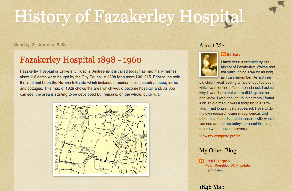
There doesn’t seem to be a website dedicated to Fazakerley history, but this blog (updated until 2008) has a lot of information on the area, though concentrating on the hospital.

Visit the website

The Fazakerley Family

The Fazakerley family were the main landowners in the area, and took their name from the township. They sold a lot of their land to the Liverpool Corporation when the city needed new land for development. Fazakerley Street near Old Hall Street in Liverpool’s city centre is named for the former owners of the land that the road was built on. The Fazakerleys also owned Spellow House (on a site near the modern Spellow Lane).

The home of the Fazakerley family, Fazakerley Hall, stood near Fazakerley Hall Lane, on Fazakerley Brook. Fazakerley House was a three storey farmhouse built in 1749. It stood at the end of a long drive which, after the redevelopment of the area, became Fazakerley Road. By the 20th century the house belonged to one Ms. Evered, a relation of the Fazakerley family by marriage, commemorated by Evered Avenue.

Health Care

These days Fazakerley is known for its modern hospital, but the roots of healthcare in the area go back a long way.

Fazakerley Cottage Homes

One of Fazakerley’s characteristics is as the location for a series of healthcare institutions. This part of the township’s history started in 1889 with the opening of the Fazakerey Cottage Homes by the West Derby Workhouse Union.

The intention was to create a place where orphans and children whose parents were unable to take care of them would gain an education and training (in such areas as carpentry, metalwork or grocering). They would also benefit from on-site health care from resident doctors. Money for the institution came from the sale of Union-owed land to the Liverpool and Yorksire Railway. The company wanted to open up a tunnel which ran under Fazakerley into a cutting.

Each ‘Cottage’ on the site was overseen by a different House-Mother. The children’s experiences of living there varied greatly depending on the approach to “care” favoured by their House-Mother

Along with other Workhouse Union buildings, the Cottage Homes became a hospital with the formation of the NHS in 1948.

Fazakerley Hospital

In 1898, the Liverpool Corporation bought the Harbreck House Estate for one of a series of new hospitals. This one was to be called City Hospital North, and opened in three phases. The first was a set of wooden buildings on the fields of the former Harbreck Farm of Higher Lane (in 1901). The second was brick-built, and opened in 1906 near to the first set of buildings. In 1913 the third phase began on Sparrowhall Farm land. This was known commonly as the ‘Sparrowhall Hospital’, though its official name was the Infection Diseases Hospital.

In 1914, with the outbreak of the First World War, the hospital complex was taken over by the military to treat sick and injured soldiers. In this guise it was known as the 1st Western Military Hospital, and remained in the hands of the armed forces until the end of the conflict.

The familiar tower block section of the hospital was completed in the 1960s, forming the bulk of the familiar hospital landscape of today. Later additions were built in the end decades of the 20th century and the beginning of the 21st.

Education

The first school in Fazakerley stood on Higher Lane, near to Dyson Hall. It was established in 1725 as a gift from Samuel Turner, who also donated £100 to pay the teacher’s wages. The old school building stood on the site until 1890 when a larger building was erected with space for almost 150 children. However, the school closed in the early 20th century, with the Local Education Board deeming it too close to the nearby Infectious Diseases Hospital.

A second school, the Fazakerley Open Air School, opened in 1938 with responsibility for educating children with diseases like TB and asthma. It was built along ‘open air’ lines, which would help the children deal with their conditions, and was affiliated with Margaret Beavan School and Underleigh School, two other open air institutions.

The open air schools (there were 96 in Britain by 1937) had classrooms where the walls could be opened up on up to three sides – summer and winter! The theory was that ventilation and fresh air were beneficial to health, and helped prevent the spread of tuberculosis. The disease was becoming a problem in the years running up to the Second World War. The schools were, naturally, located in rural areas, of which Fazakerley was one at the time.

Fazakerley Open Air School closed in 1994. Numbers were falling as the children were incorporated into mainstream schooling.

Industry

Liverpool needed new industrial investment in the 1920s and 1930s. Following the Wall Street Crash of 1929 the world was suffering the Great Depression, and the city’s Victorian heyday was slipping into history.

Between 1925 and 1928 Liverpool Corporation acquired 300 acres at Long Lane, as well as land at Speke in the south of the city. Leases were offered in the hope that modern industries would settle there, and the Corporation spurred development by laying out the roads and infrastructure in the area, and planning new housing estates around Fazakerley. The housing would become home to those displaced from demolished slums, and provide a work force for the new factories.

In 1941 the estate was another of the armed forces’ acquisitions, and became a Royal Ordnance Factory (ROF) producing small arms for the war effort. The ROF finally ceased production in 1960 as the area transformed into the Aintree Industrial Estate.

Hartley’s Village

One of the most important pieces of ‘architecture’ in Fazakerley is the model village constructed off Long Lane. Built by W.P. Hartley in 1886, it appeared two years after moving his jam works from Bootle. There were just under 70 houses, making the village smaller than other villages like Port Sunlight on the Wirral and Saltaire in Bradford. But like those other places, their patrons built housing of much better quality than was otherwise available to their workers.

The Hartley’s Jam Works was one of the earliest industrial presences in the area, making good use of the transport links. The factory had it’s own rail lines linking up to both the Liverpool & Yorkshire Railway and Cheshire Lines Railway. At the time of its relocation, much of Fazakerley and Aintree were still rural, but the buildings largely remain today. The village is a Conservation area, and so protected from unsympathetic development. While the whole of Long Lane has taken on the characteristics of a major industrial and commercial centre.

Littlewoods

The Littlewoods company was a key player in Fazakerley’s industrial and commercial development. The headquarters were located on Walton Hall Avenue, and remained an important centre even after the building of the large offices on Edge Lane.

The building was also turned over to the war effort, manufacturing aeroplane parts for the Royal Air Force. The Edge Lane building was given over to munitions, like the Royal Ordnance Factory.

Industrial Buildings

As well as the Littlewoods HQ, Fazakerley is home to some other interesting industrial buildings. The Rockliff-Cox printers occupied a characteristically 1930s building on the Industrial Estate, and the Schweppes factory was another example of this style. Many of the buildings still visible on Long Lane today display the Art Deco influence. They have pale brown brick fronts and small-paned white-framed windows in rows near the roof. This is a legacy from Fazakerley’s early 20th century industrial heritage.

Railways

The first railway in the area was operated by the Liverpool & Bury Railway Company. It later incorporated into the Liverpool & Yorkshire Railway, and it carried both cargo and passengers. The line was so successful that congestion was a growing problem before the end of the 19th century. So Aintree Marshalling Yard was laid out, with additional sidings in Fazakerley, in 1885. Further sidings were built at Fazakerley in 1911, the traffic never slowing its increase.

It’s perhaps unsurprising therefore that the Railway Signal Company chose Fazakerley as the location for its factory in 1881. This important company continued to produce equipment for railways across Britain until the 1960s. By then the technology had changed and the company was wound up.

Trams

Fazakerley was served by the Liverpool-wide tram system from the late 19th century. An innovation on this line was the introduction of a trial First Class service. A similar trial had taken place on the route between Garston and the Pier Head. Complaints claimed that some working class passengers put off their wealthier ‘betters’ with their mucky clothes and spitting habits!

The trams travelled from the Cottage Homes in Fazakerley to the Pier Head in the town centre. They also travelled via Dale Street in an attempt to entice the businessmen who worked in the offices there.

One of the major limitations put on the tram system was the existence of much older bridges over the railways. The train companies built these bridges without trams in mind, so were much too narrow to allow trams and road traffic to pass each other easily. Bottlenecks developed, especially when dual carriageways and central reservations kept things moving smoothly in other parts of the city.

A particularly bad spot was the bridge over the railway on the brand new East Lancashire Road. Here an inventive arrangement of snaking tram tracks and a side (not central) reservation worked until 1930. In that year, Pearson & Knowles of Warrington erected a new wider and stronger girder bridge to better deal with the increases in traffic.

Fazakerley in the 21st century

Today the landscape of Fazakerley reflects the roles it took on in the 19th and 20th centuries. Gone are the Halls and Farms which dotted the countryside. A web of railways, vast industrial estates and retail parks has replaced them. There is also new housing, built for those moving out of the town centre between and after the World Wars.

Fazakerley represents Modern Liverpool, and the attempts to rejuvenate its flagging economy once the British Empire began to fade.

54 Comments on “History of Fazakerley: Hartley’s Jam, tram connections and new town”

  • darren Chapman

    says:

    interesting stuff, if possible could you send me any history of croft lane as i grew up there and am very interested in the history of that road especially the two oldest houses. cheers

    Reply

    • Hi Darren,

      Croft Lane looks from the maps to have been laid out gradually from about 1908 until the 1920s, and was on the edge of the built-up areas of Liverpool until much later. The houses at the west end of the street, which I think you’re interested in, were there before the road itself, and were/are called Clifton Villas, and what’s now the car park of the Grey Chaser used to be a bowling green. By 1928 all the buildings seem to have been in place, with the rest of Fazakerley building up around it.

      Regards,
      Martin

      Reply

  • Carla butler

    says:

    Has fazakeley brook ever flooded as I was thinking of buying a house on ashbrook drive. Thanks

    Reply

    • Hi Carla,

      I’ve not heard of Fazakerley Brook ever flooding, though if anyone else here has done then do let us know. If you’re really (and I mean really) interested in knowing, then there’s a Flood Risk Assessment for the wider area on the Knowsley Council website here. That’s a 200 page PDF though, so might be a bit more than you need…

      Regards,
      Martin

      Reply

  • Alan Poole

    says:

    With reference to the Railway section of the article may I refer you to
    http://spellerweb.net/rhindex/UKRH/LNWR/LivBur.html
    for an accurate sequence of events reference the ownership of the railways in Fazakerley.
    I have lived within a few minutes walk of the sorting sidings site all my life.

    Reply

    • That’s an excellent resource, thanks for pointing it out, Alan. I’ll look into it and hope to incorporate the extra detail in a future update of this page.

      There’s plenty on that site for the Industrial Revolution fan!

      Thanks,
      Martin

      Reply

  • David

    says:

    I used to live in a somewhat confusing location as to place names in North Liverpool. The road I was brought up in was Cornett Road off Longmoor Lane in Fazakerley however the other end of this road junctioned with Hall Lane in Walton.
    Many addresses in this area were described as in Aintree for example Aintree Baptist Church. My family and many of our neighbours addressed their letters as Aintree Liverpool 9
    Aintree of course is about three quarters of a mile away along the A59 to the north.

    Reply

    • Hi David,

      I’ve often found north Liverpool areas confusing too! My nan lived in Orrell Park, which was also Walton (and then I found there’s an Orrell outside Liverpool…). And I think someone commented on here that the boundaries seem to have been moved by the Powers That Be!

      Martin

      Reply

  • John Hughes

    says:

    I doing some research on behalf of a friend who completed part of his National Service at RAF Fazakerley. I would like to get hold of some documentary and/or photographic history of the site but haven’t come across anything substantial yet. I’ve had a look at the Balloon Barrage Reunion Club Website and also the official RAF/MOD site but these only have scant details, e.g. the resident units and the dates it opened and closed. Does anyone know where I could get a bit more in-depth information (particularly photographs) about the site? Any help would be most appreciated.

    Reply

  • Claudia

    says:

    Am tracing the history of my Grandfather- believed to work on Cheshire Line Committee railway around Aintree. He was killed in a railway accident on May 21 1927. Is there any record of this accident?

    Reply

  • Linda

    says:

    My father used to have an allotment in Fazakerely back in the 50’s and 60”s we went there all the time as kids, Does anyone know when houses were built there, I think it was off Copplehouse Lane.

    Reply

    • Martin

      says:

      Hi Linda,

      There are allotments marked on the old maps on the north west corner of the junction between Aintree Lane and Long Moor Lane (the A506). This is still largely open land, except for Haven Road. The houses here first appear on the map of 1966-73. However, there were always a handful of buildings on this site, and the allotments never spread this far west. If I’ve got the wrong allotments, let me know and I’ll have another look!

      Martin

      Reply

    • Colin brennan

      says:

      Hawksmoor park had allotments in the 60s ran between lower lane and copper house lane.

      Reply

  • Terry FITZSIMMONS

    says:

    Martin: thank you for your research and kind help. Would you happen to know the precise location of the Royal Ordinance Factory at Fazakerley? My research leads me to believe that the original building has been demolished and, I assume, built over with something “less significant”, probably in the Industrial estate. I was born in Litherland but now live in the USA and am planning a visit next week. Thanks for your help.

    Reply

    • Martin

      says:

      Hi Terry,

      Sorry that I couldn’t get back to you before your trip to Liverpool, but there is a lot of detailed information, including location, of Kirkby Ordnance Factory here: http://www.disused-stations.org.uk/k/kirkby_royal_ordnance_factory/. I’ve got to confess that I’m not sure if this is the same as the Fazakerley one, as it’s not that far away. If I come up with any more certain information I will let you know.

      Regards,
      Martin

      Reply

    • Gordon Williams

      says:

      The ROF site was located on Long Lane opposite Everton Cemetery. The site was bought by Joseph Lucas Ltd c1960 who operated two companies on the site; Lucas Hydraulics who manufactured hydraulic swash pumps for use in vehicle transmissions including agricultural and military applications. CAV Limited also operated on the site and was the larger employer with in excess of 2000 employees and manufactured inline diesel injection pumps for commercial and military applications. Both companies provided hardware for the mainstream military tanks. I was a manufacturing engineer for CAV from June 1969 until its closure was announced in October 1972. My oldest brother Peter worked for Lucas Hydraulics until mid 1990’s. There was also an engineering apprentice training school located on the site. My two younger brothers and myself served fully indentured engineering apprenticeships in this facility. Once CAV closed it became difficult for Lucas Hydraulics to continue with the increased overheads and subsequently also ceased production. The old ROF site eventually morphed into the Industrial Trading estate located there today.

      Reply

  • Keith ruddock

    says:

    With reference to the reme factory in fazakerley this was located between what is now field lane and the M57 motorway and ran parallel with what is now called valley road , I lived on longmoor lane not far from the black bull aintree , and I was also not far from signal works , my father also had allotments , on what is now barlows lane school ., a lot of people think the reme was the munitions factories in what is now called Kirkby
    These allotments were located between seeds lane and barlows lane hope thus helps if any one wants more info about aintree fazakerley or Walton get in touch

    Reply

  • Jeremy Flack

    says:

    I was lloking to see if I could see any surviving remains of the ROF site. I think I may have found a small building in Higher Lane. I also spotted some buildings that probably had some form of military connection in WW2 at Mersey Flooring in Atherton Road which also has an aircraft hangar although this was probably errected post war. Any ideas as to the sites original purpose>

    Reply

    • Martin

      says:

      Hi Jeremy,

      That’s a really interesting find!

      The site of Mersey Flooring looks like it was a timber yard in 1956, and allotments before the War. The maps have a bit of a gap in between, so there may be a use that we’re missing, related to the war (and hence not mapped for security reasons).

      Martin

      Reply

  • Pat Bowditch nee Edmond

    says:

    There was an accident in the ROF in 1942 November 3rd 1942. when Francis Edmond died . Can anyone tell me more abut this please

    Daughter

    Reply

    • Martin

      says:

      Hi Pat,

      Could this be a work-related incident? If so the best course of action would be to contact the National Archives (http://discovery.nationalarchives.gov.uk/details/r/C1083), as they have all the records related to ROFs. It might be something that was only dealt with as an internal affair.

      Regards,
      Martin

      Reply

  • David

    says:

    Hello again Martin,
    There was an ROF factory on Long Lane with its junction with Stopgate Lane.It was almost opposite to the LBA ground, now known as the Geoffrey Humble Sports Ground.My mother worked in this factory during the war. It was a very large site with a special bus bay to serve the many shifts of arriving and homeward bound workers.The factory was supplied from a siding at the rear of the factory on the Cheshire Line Railway (The Walton Triangular Junction)

    Reply

    • Martin

      says:

      Hi David,

      That’s great info – thanks for sharing! Sounds like they went to great lengths to keep production at its maximum. Not surprising really!

      Martin

      Reply

  • Stephen hanway

    says:

    Superb

    Reply

  • Hitch

    says:

    Hi it was on the site of what is now called the Liver Industrial estate. My old lady worked at both Long Lane and Kirkby.the site became Lucas for years.

    Reply

  • garry madge

    says:

    Good morning.

    Came across this site by accident. I am trying to find out some past history.
    All I have is this.
    Mrs Hudson.Higher Lane Fazakerley 1912.
    Any info much appreciated.

    Regards.
    Garry.

    Reply

  • Pat

    says:

    Allotments were located in the area that ran from hawksmoor park up to copplehouse lane along side the brook. They were built on in the 60s by eagledene estate

    Reply

  • Shelley Woodbury Smith

    says:

    My mum lived in Hawthorns Cottage, Barlows Lane Fazakerley, around 1920/30’s. Her maiden name was Fazackerley. I have tried to find more info about this area/family name but dont get very far. Grateful if anyone can shed any light on it. I have done the family tree thing but only get so far & then no more.

    Reply

    • Martin

      says:

      Hi Shelley,

      Are you related to the important Fazakerley family which gave the area its name? There’s a lot of info in the Victoria County History which is available online here, including the family crest: https://www.british-history.ac.uk/vch/lancs/vol3/pp28-31

      Everything I know about the area (that’s relevant to this website, at least!) is on this page already, but if you have any questions I’ll try to find out more.

      Martin

      Reply

    • James kidd

      says:

      There was a mr Fazackerley who lived on the corner house at the junction of Signal works Road /Adlam Road until the mid 80’s

      Reply

  • Shelley Woodbury Smith

    says:

    Hi Martin,
    Thank you so much, will have a look on that website. I have no idea if there is a connection to the wealthy Fazakerleys, I assume not but who knows. Its interesting a Fazackerley being born in Fazakerley!

    Reply

  • Albert

    says:

    I am trying to locate a very nice family who
    lived in fazakerley in the early eighties.
    The name of the street was:
    Field lane

    The Higgins

    Any help would be appreciated.

    Reply

  • Bob Ashcroft

    says:

    I think it was Jeremy Flack who called to my house in Higher Lane last year. I was out but the building was on my property and was an old air raid shelter the R.O.Depo was the other side of the cemetery by the railway lines

    Reply

  • Mark

    says:

    Hi

    Looks like its been a few years since anybody commented. I was born in Fazakerley and grew up on the “Field Lane estate”. I’m moved out when I was 20 and two years ago, at the age of 33, moved back. I now own the house I grew up in. It’s been strange being back and it’s actually got me asking a lot of questions about the area. If I’m correct in thinking, the Sparrow Hall housing state was built in the late 50’s, early 60’s and the Field Lane housing estate (where the streets are all female names) was built in the early 70’s. But on field Lane, Barbara Avenue and Edna Avenue, those houses look like they were built in the late 1920’s. The question is, who lived in those houses? They’re quite big so they wouldn’t have been cheap to buy or even rent – so I don’t think it would have been people moving from slums. Could it have been doctors/nurses from the hospital?

    I find the Field Lane housing estate to be quite unusual. There’s not much info on the net about it, I can’t find any pictures of its construction or its completion. There’s hardly anything on it at all. It’s still called Fazakerley but it’s classed as Knowsley and there’s a sign just before you enter saying “Welcome to Kirkby”. No wonder I’m so confused about my identity 😉

    Reply

  • John Proffitt

    says:

    Hello Mark,
    I was originally born in Walton Village and in early 1946 our family moved to live in Grace Avenue between Copple House Lane and Field Lane. At the time this was the border of Fazakerley and Kirkby. From our house the next property was a Nursery that grew plants spanning to the River Alt. The people that lived in the houses Edna Ave, Grace Ave, Barbara Ave, Field Lane were mostly middle working class. Teachers, Civil Servants, Nurses, Business owners. My parents bought our house from a coal merchant friend who gave them a mortgage loan as he needed a larger place to store his coal trucks. ALL the land from Field Lane heading towards Kirkby was an RAF Military base with several aircraft hangars, air raid shelters and airport landing strip. My father in-law flew an aircraft in and out of there during WWII. The piece of land beyond that to East Lancashire Road was owned by Napiers (now English Electric). It was a munition factory during WWII, as armament equipment was flown out by aircraft during the war. The RAF base closed in the late 1950’s and was sold and became a housing estate that you are now living on. The land beyond that to St. Chads Church Kirkby was all farmland and green fields. St. Chads Church was surrounded by a little Forrest or woods known as Blue Bell Forrest.
    If you can imagine Moor Lane to Edna Avenue, that was all farmland as we would go potatoe picking there as kids in the summer. Most of the land from Copplehouse Lane side to Grieve Road was an open field where the Gypsies Romanies parked their caravans and put on a circus or Fairground. From Hawksmoor Road to Falcon Hey Road all that area was allotment for horticulture or people keeping chickens. My parents had six allotments there as they grew lots of vegetables.
    Hope this helps
    In regards to Sparrow Hall that was open land and trees until they built multi-story Tennament Flats on it. If you can imagine Long Lane to East Lancashire Road through to West Derby Cemetry and to Lower Lane that was the area we knew as Sparrow Hall.

    Reply

    • Steve Gordon

      says:

      You are right on all accounts there John ! The RAF station had air raid bunkers were we would play as kids . Facing the RAF was a small pathway , across what is now Valley Road , that you could walk to into Kirkby. I remember Valley Road being built and the flyover . Across Copplehouse Lane , on the corner of Fazakerley Brook and the River Alt, was a farm which was crossed by a bridge over “ the broller !” Its now the Sewage works /Water treatment. There was a series of jumps over the broller from Lowere Lane to the River Alt, that was a rite of passage and also climbing onto the Pivvy roof before being legged by the local policeman on a scooter !
      Happy memories!

      Reply

      • mike werner

        says:

        High Steve I grew up in Fazakerley in the 50’s and 60’s ,my grandparents were some of the first to move into Manica Crescent in 1928, if you entered Hawksmoor park from Lower Lane there was a Darby and Joan club on the right hand side of the entrance.The houses on Formosa drive backed on to the park and were the pivvy was was central to the park against the gardens I remember to jumping of the roof we had to worry about the cocky watchman seeing us off.I you continued along Manica Crescent to were it bacame Hawksmoor road the was gates to the park there which led to the swings, from the top of the monkey frame you could see both football grounds.Further down to the railings was the broller and I remember the jumps across as well,Following the railings to the left keeping the brook to your right there was a path that led to Field Lane and on the left it was all allotments along the path.I went to Formosa Drive Primary School .the old Balloon Barrage base was a great place to play on as kids which was just along Moor Lane at the back of Moor lane houses was overgrown fields as a kid but then a housing development went up.Hope this information helps others.
        Mike Werner

        Reply

    • Steve

      says:

      That would be Buckels nursery.
      It was still there until just a few years ago.
      It’s now been turned into a housing estate but can still be seen on the google maps timeline feature.
      One thing I remember from my childhood is if you’re walking down Copplehouse lane past Buckels and across Field lane, just on the other side of the brook by the stone bridge, a little way into the trees/bushes was a little concrete square bunker with one square window and a tiny doorway which led to underground tunnels.
      It was just before the wasteland where the gypsies would set up.
      We used to play there as kids but were too scared to explore it much incase we got lost down there.
      Apparantly the RAF base was over by where the golf course is now?
      I always wondered why there would be s bunker so far away from there but can’t think what else it could have been.
      This too has become a housing estate since (some time in the late 80s/early 90s) as we used to play on the building site at the time.
      Any more info on that?

      Reply

      • Jayne

        says:

        I remember that bunker! There was a wire fence but the gap meant you could get through from the bridge and past the stinging nettles! Pitch black and we would go in with matches to try and see.
        Also remember opposite Ronaldsway being wasteland we would build “dens” in

        Reply

  • Steve Parry

    says:

    Hi – I am trying to find exactly where the ROF Fazakerley site was ( not ROF Kirkby or Simonswood). I have seen all sorts of references – Higher Lane, Hansom Road, Lower lane, and even out by Field lane/M57. I would appreciate any help. Thanks- Steve

    Reply

  • roy Turner

    says:

    I was an apprentice at the Railway Telegraph & Signal Co. starting 1942 until called up into the army, I’m now 94. I would be delighted to find any pictures or drawings of the old works. The General manager was a Mr Ollerenshaw and my boss in the toolroom was Jack Macgreavy, machine shop manager was Mr Paris.

    Reply

  • Nigel Ormond

    says:

    Hi, I live in Lincolnshire, and was trying to find out whether the Fazackerly Cottage Homes buildings are still in existance, and if so what are they used for now? I was also wondering where abouts on Longmoor Lane they are/were. Thanks in advance. Nigel Ormond.

    Reply

    • Hi Nigel,

      Yes, the buildings are still there and I believe they are all private dwellings now. Though it looks from maps like there are some small businesses too.

      Street view of Cottages

      Regards,
      Martin

      Reply

  • Hi, do you have or know of any history on Deauville Road? The times they was built and anything else.
    Thank you.

    Reply

    • Hi Natalie,

      I can’t find much specific information on that street, but it first appears on the 1956 Ordnance Survey map. The field in which it was built (bounded by the back entries of those houses) stayed clear of development a little longer than the other areas. Houses to the east and west were built by 1928.

      I hope this brief info is of interest.

      Regards,
      Martin

      Reply

  • Les Quigley

    says:

    Is there anyone surviving who served at RAF Fazackerley during WW2? Oddly this RAF Station does not appear in the Wikipedia List of wartime RAF Stations yet I know it was there – as an RAF balloon base! I visited several times in 1958 as a 14 year old ATC cadet when it was being closed and the Fazackerly ATC Squadron was being moved to a hut off Walton Vale.

    Reply

    • Jacquie Bravery

      says:

      I lived in a RAF married quarter in Fazakerley in 1964 and my daughter was born in Walton Hospital in 1965. I cannot remember where my late husband was based. Wonder what happened to those quarters?

      Reply

  • Steve

    says:

    I grew up on Copplehouse lane in the 1980s and was looking for any old pictures of this area or the pub.
    I remember that the pub had many old b+w pics in frames on the walls including one of a football team consisting of blokes with big moustaches.
    There was also one showing the Copplehouse exterior with a horse and cart on it’s way down Copplehouse lane (all cobblestones) and no sign of any houses.
    Despite all my search attempts, I seem unable to find much.
    Any help appreciated.
    Cheers

    Reply

  • Jim

    says:

    Hi, not sure if this will be seen. Does anyone know about a possible war time use of the Bluebell Woods by Aintree Hospital / Altcourse Prison?

    I know it was formerly home to Harbreck House, however there are some brick ruins in there spaces more of less around Fazakerley Brook, that aren’t modern man holes, one in pertocular looks to be some sort of shelter or fortification, I know the hospital was taken over by the forces in WW1, but I can’t find much on it from around WW2, it seems to have an interesting history, i’ve explored q lot of it and read various things online, if anyone has anymore info it would be most appreciated

    Reply

    • Tony Wardle

      says:

      I lived in married quarters in Slessor Avenue at RAF Fazakerley from mid 1965 to September 1967.My dad worked in Sea Movements in the docks and I travelled daily into Liverpool by bus to work in my first job . Being a steam engine fan and with the north west the last area on BR to use them, Merseyside was a great area to be in .

      Reply

  • Michelle

    says:

    trying to find K Howe who wrote History of Fazakerley 1999.
    anyone know his whereabouts. he had painted some pictures of the area and would love to put them on show at Fazakerley Station.
    or if anybody else would like to paint a few pictures of area please let me know

    Reply

  • Roy Burns

    says:

    I lived on the corner of Higher Lane and Sandy Lane from 1952 until the mid 70’s
    The houses on the west side of the street were very grand compared to others in the area.
    The house was used as a police station before they moved to no. 16
    Does anyone have any history of the houses from Sandy Lane up to Emanuel Church

    Reply

  • Neil

    says:

    Hi, I have been searching for some time now, but have been unable to find any information on the row of houses on moor lane. Opposite the old air plane field / golf course. I was trying to see when they where built or obtain any old photographs- do you have any details – thanks

    Reply

Leave a Comment

Your email address will not be published. Required fields are marked *

To top